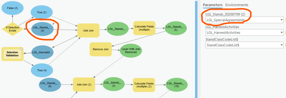
I keep having an intermittent issue with several different models. When I run them from the toolbox, one or more of the original input layers will randomly change to a different layer. This mostly happens when I reopen my project the next day, but not always. Sometimes the underlying layer within the model properties changes, sometimes is does not, but the labels always stay correct.
I found that when I open the tool from the toolbox and before running it in the geoprocessing pane, if I switch to a Layout and then back to the Map view, the tool refreshes and often changes back to the correct layer.
The input layers are hosted feature services and I have them set as parameters. I'm using Pro 2.8.3.
Am I doing something wrong, or is this a bug, or just a refresh issue? PLEASE HELP
See the picture below. The top two parameters are my input layers. You can see that the first one changed to a different layer in the dropdown. But the correct layer is shown in the model, and when I open the tool properties everything is correct this time (sometimes it changes though).