Survey123 Connect 3.12.232 (win64)
I created a survey, pointed the map to a (org) web mercator basemap. I am trying to edit default extents for the map display in the "map" tab of connect.
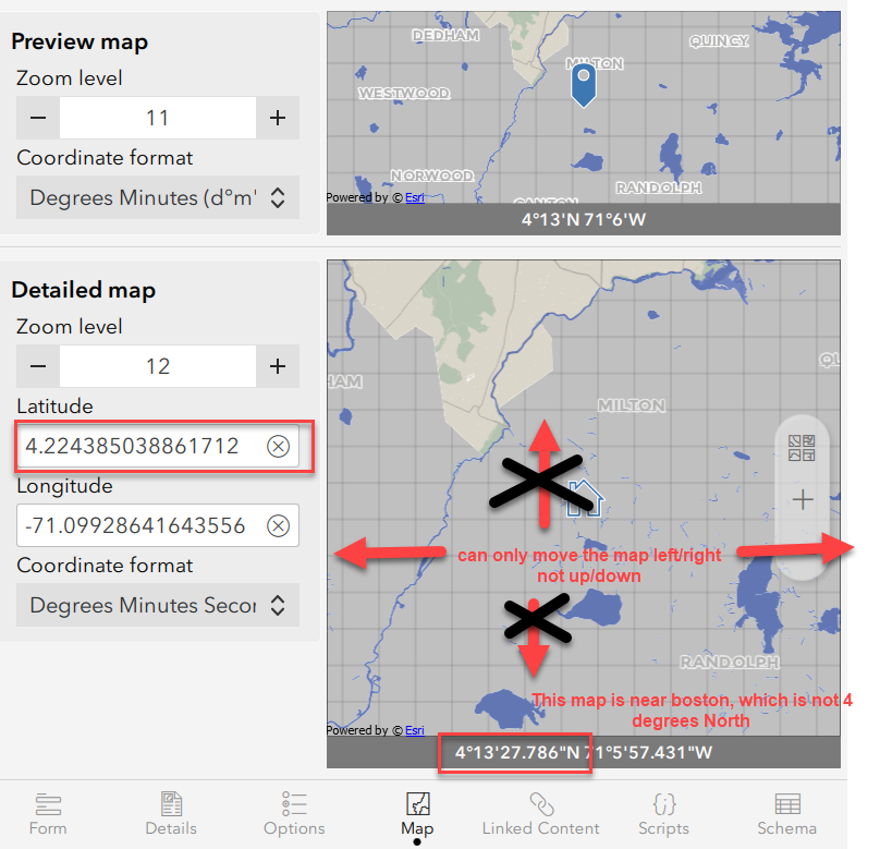
First, it has grabbed the wrong latitude. the pic below shows the latitude text as 4.2xxx, but this is Boston Massachusetts, so really it is 41 or 42 degrees. So the map is sort of right, but the text is wrong.
Second, at times, I can only move the map with my mouse "left and right" and not "up and down". If I jiggle with zoom levels and typing in lat/long I can generally get it to let me move it correctly (I have not figured out how to consistently fix that).
Once I get things corrected here (the map centered in Boston, with reasonable zoom levels) it looks like the pic below. All good.
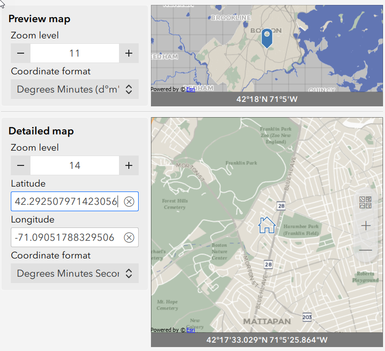
The next problem though is when I publish it and open it in a browser to fill out, the map is zoomed in to the max, which is not what I set in Survey123 Connect.
Here is the browser map (from my windows pc, but looks same on my iphone in a browser):
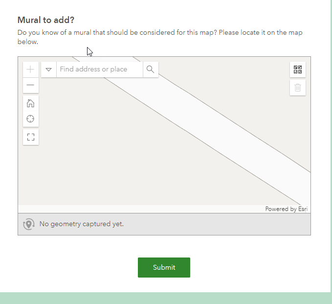
Any idea why it is showing up so zoomed in?
Appreciate any ideas.
Tom S.

