Dear all,
Version 4.17 introduced Time support for WMSLayers which is very welcomed. There are, however, a few quirks, at least for our use case.
Our application utilizes multiple meteorological layers from multiple WMS-servers. The layers have different TimeDimensions (both start/end and intervals) and user is able to mix and match these as he deems fit. The user is also thereafter able to replay the data via a TimeSlider, and view the Time dimensions for the different layers.
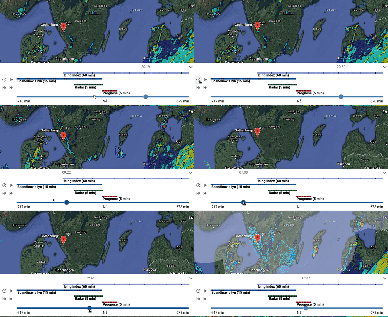
The above is what we are trying to replicate in ArcGIS. It shows the data from 4 layers from three different servers. The layers all have different start/end times (visualized by the colored bars) and different intervals (the number inside the parentheses and the vertical lines across the colored bars)
The ArcGIS WMSLayer docs state that "The timeInfo property is automatically set at layer initialization if the layer has one or more time dimensions." This is true to some extent, no pun intended, however, there's room for improvement.
WMSLayer.timeInfo.fullTimeExtent{start|end} seem to currently be set to the min/max values of ALL the layers available on the provided WMS server, regardless of the fact that only a few layers are selected in WMSLayer.sublayers. This becomes problematic for WMS servers with hundreds of layers available of which one only wants to use a few (whose time dimensions are subsets of the servers min/max).
Furthermore WMSLayer.timeInfo.interval doesn't seem to be set at all, even though the information is present in getCapabilities.
Here's a code-pen describing my problems with the API.
Best Regards,
Emil Aura






