Hi All,
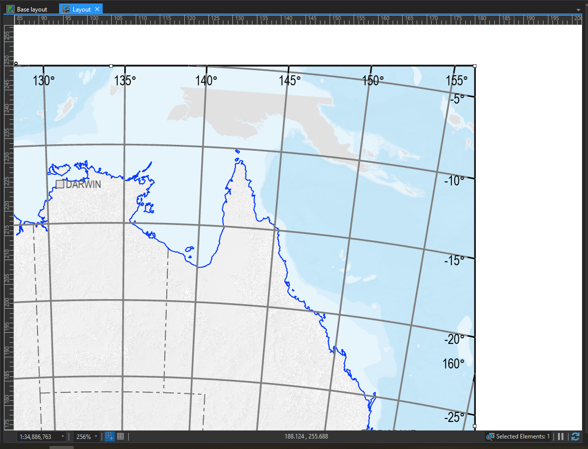
I have an issue, where I am trying to avoid dropping my grid to a graphic element and manually aligning the Lat/Long labels to the grid lines. The projection that we are using means that the grid lines are curved, and across the continent of Australia the angles can be significant in the lower latitudes. I have attached a screen cap of a sample map if anybody is having trouble visualising what I mean.
Is there a way that the labels can be aligned via arcade? (or is there a setting that I'm just not seeing).
We have Pro 2.4 deployed, however I believe that an upgrade is in the works.