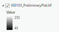
I receive plat maps in pdf format that I then export to tif format. After that I georeference the tif to my parcels. However, sometimes when I add the tif to a Pro session, it will come in as a black an white image:
And other times it comes in as an RGB image:
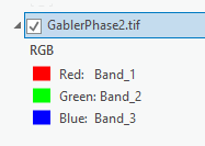
And when it does, I can't see it in Pro to georeference it. I suspect it is in the way it is exported in Adobe, but these two that I show in examples I did today, exactly the same way.
Two questions then:
How do I convince Adobe to export the tif as black and white and/or
How do I convince ArcGIS Pro to 'see' the rgb tif image?
ArcGIS Pro 2.6


