Hi!
I'm working on a exporting a map series for a water utility. Everything exports great except one of my extent map frames that is a local map indicator. I cannot figure out where in ArcPro I have went wrong as the indicator map is displaying a a grey box in my legend on the xported product. I've noticed this if I export as a pdf, jpeg, tiff, or other image file.
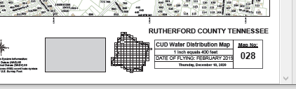
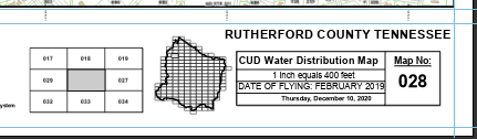
Here's a screen shot of one of the exported pages from my map series as a pdf. The local identifier frame is grey instead of showing the map extent boundaries. There should be three rows of three map indexes in the local identifier frame. The global identifier frame shows the entire county boundary and all 194 map indexes with the current map as the selected.
The local identifiy frame exported as a pdf:
This screen shot is from the same map in ArcGIS Pro before I exported the map series:
Any thought I what I messed up to have my local map indicator frame bomb on export from ArcGIS Pro 2.6.3? I'm all ears as I have almost 1,800 maps to export and arrange in a map book.


