We have loaded an ENC (C-Map) into our ArcGIS Server version 10.7.1 with the Maritime Extension installed. We are having an issue where it looks like one of the North American maps overlaps with the European maps, and can't figure out if it is an issue with the way it was loaded, or if it was an issue with the data that was delivered to us.
This is the North Sea below, and the red area that is circled is actually coming from the North American map - we can see it line up when we pan west to North America.
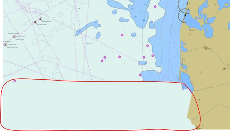
Does anyone understand what might have caused this to happen with our maps - or what we can do to try and resolve it? I was not involved in loading the map and have not used Maritime server extension myself, but I will need to provide our IT team suggestions for how to resolve this.

