- Home
- :
- All Communities
- :
- Industries
- :
- Water Resources
- :
- Water Resources Videos
- :
- Conversations with Jack: GIS and Hydrology
- Subscribe to RSS Feed
- Mark Topic as New
- Mark Topic as Read
- Float this Topic for Current User
- Bookmark
- Subscribe
- Mute
- Printer Friendly Page
Conversations with Jack: GIS and Hydrology
- Mark as New
- Bookmark
- Subscribe
- Mute
- Subscribe to RSS Feed
- Permalink
- Report Inappropriate Content
Jack Dangermond, Esri Founder and President, and David Maidment, University of Texas, discuss water resources and how data and technology have grown to support nationwide flood inundation mapping.
- Mark as New
- Bookmark
- Subscribe
- Mute
- Subscribe to RSS Feed
- Permalink
- Report Inappropriate Content
I would be curious how the NWS responds to this. Also, it would be very important to compare these results to the NWS River Forecast Centers so that there is a cross check on the accuracy of the output. They may be an important partner in developing the accurate local models that work with this.
- Mark as New
- Bookmark
- Subscribe
- Mute
- Subscribe to RSS Feed
- Permalink
- Report Inappropriate Content
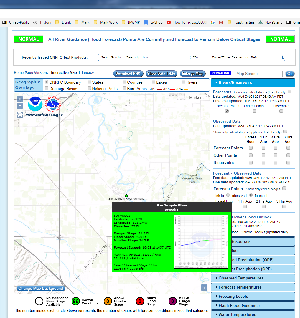
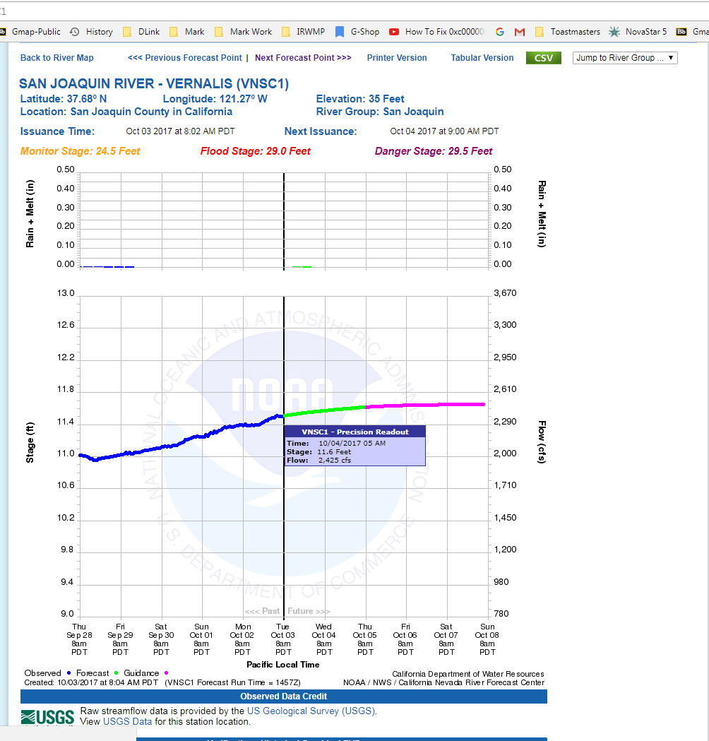
Here is an example. I found this gauge by zooming in on the map at CNRFC site (see first image). The gauge is on the San Joaquin river south of Tracy and Manteca, CA.
The flow at this point at 10/4/17 05AM now is projected to be 2,425 cfs (see second image is for the same station). The data is "current" up to 10/3/17 08AM. (Not sure why the actual gauge readings are not up to date. Could be a summertime practice to only report once a day.) The same location has a flow of 2,168 cfs in the National Water Model (NWM) for 10/4/17, 05 AM (see third image). In once sense these flows are very comparable and I think the NWM is doing pretty good to get this close. In a time of flooding, there would need to be a correlation between the stream gage reading and the NWM. I'm certain that the CNRFC would share the gauge data with anyone. I suspect there is already this kind of collaboration going on.

- Mark as New
- Bookmark
- Subscribe
- Mute
- Subscribe to RSS Feed
- Permalink
- Report Inappropriate Content
I'm a long fun of "Arc Hydro". I hope it will be improved & maintained for decades, not only for ArcMap but also for ArcGIS Pro.