Turn on suggestions
Auto-suggest helps you quickly narrow down your search results by suggesting possible matches as you type.
Cancel
- Home
- :
- All Communities
- :
- Developers
- :
- ArcObjects SDK
- :
- ArcObjects SDK Questions
- :
- Set the extent to features on the table of content...
Options
- Subscribe to RSS Feed
- Mark Topic as New
- Mark Topic as Read
- Float this Topic for Current User
- Bookmark
- Subscribe
- Mute
- Printer Friendly Page
Set the extent to features on the table of content then export it to jpeg/gif
Subscribe
02-03-2012
07:35 AM
- Mark as New
- Bookmark
- Subscribe
- Mute
- Subscribe to RSS Feed
- Permalink
- Report Inappropriate Content
Hi all,
I want to export a multiple feature layer by zoom into it then export it as jpeg/gif file then loop through all feature listed on the table of contents. I need to select the feature then zoom into its extent and then export it as jpeg/gif but all the the feature are NTS sheets so all the other features has to be unselected when exporting one of them as jpeg/gif. And then unselect the one just exported then move to next one, select, zoom, export, unselect, etc for rest of the list.
I found below code online from http://www.cartotalk.com. what it does is that select each record in polygon attribute table, zoom to the extent of that polygon, then export the layout to a jpeg at whatever res you want. Then it moves on the next one.
I dont want to zoom into each features attribute table, I want to zoom into whole feature itself extent.
Please help me about this,
Thank you.
Option Explicit
Private m_pMxDoc As IMxDocument
Private m_pPageLayout As IPageLayout
Private m_pGContainer As IGraphicsContainer
Private Sub AddElement(AnElement As IElement, PagePosition As IGeometry)
Set m_pMxDoc = ThisDocument
Set m_pPageLayout = m_pMxDoc.PageLayout
AnElement.geometry = PagePosition
Set m_pGContainer = m_pPageLayout
m_pGContainer.AddElement AnElement, 0
m_pMxDoc.ActiveView.Refresh
End Sub
Public Sub DeleteElement(AnElement As IElement, PagePosition As IGeometry)
Set m_pMxDoc = ThisDocument
Set m_pPageLayout = m_pMxDoc.PageLayout
AnElement.geometry = PagePosition
Set m_pGContainer = m_pPageLayout
m_pGContainer.DeleteElement AnElement
m_pMxDoc.ActiveView.Refresh
End Sub
Public Sub ExportLayout(Format As String, FileName As String, dpi As Integer)
Dim pMxDoc As IMxDocument
Set pMxDoc = ThisDocument
Dim pLayout As IActiveView
Set pLayout = pMxDoc.PageLayout
Dim rectOut As tagRECT
rectOut = pLayout.exportFrame
Dim pEnv As IEnvelope
Set pEnv = New envelope
pEnv.PutCoords rectOut.Left, rectOut.Top, rectOut.Right, rectOut.bottom
Dim pExporter As IExporter
If Format = "GIF" Then
Set pExporter = New JpegExporter
Else
Set pExporter = New PDFExporter
End If
pExporter.ExportFileName = FileName
pExporter.PixelBounds = pEnv
pExporter.Resolution = dpi
'Recalc the export frame to handle the increased number of pixels
Set pEnv = pExporter.PixelBounds
Dim xMin As Double, yMin As Double
Dim xMax As Double, yMax As Double
pEnv.QueryCoords xMin, yMin, xMax, yMax
rectOut.Left = xMin
rectOut.Top = yMin
rectOut.Right = xMax
rectOut.bottom = yMax
'Do the export
Dim hdc As Long
hdc = pExporter.StartExporting
pLayout.Output hdc, dpi, rectOut, Nothing, Nothing
pExporter.FinishExporting
'MsgBox "Export complete!", vbInformation
End Sub
Public Sub PanZoomTitleExportWatersheds()
Dim pMxDoc As IMxDocument
Set pMxDoc = ThisDocument
Dim strImageName As String
Dim pMap As IMap
Set pMap = pMxDoc.FocusMap
Dim pPageLayout As IPageLayout
Set pPageLayout = pMxDoc.PageLayout
Dim pActiveView As IActiveView
Set pActiveView = pMxDoc.FocusMap ' Set to FocusMap, allows zoom to work in page layout or data view
Dim pFeatureLayer As IFeatureLayer
Set pFeatureLayer = pMap.layer(0) ' First layer in map
Dim pFeatureClass As IFeatureClass
Set pFeatureClass = pFeatureLayer.featureClass
Dim pFeatureCursor As IFeatureCursor
Set pFeatureCursor = pFeatureClass.Search(Nothing, False) ' Set QF to Nothing, get all features
Dim pFeature As IFeature
Dim Counter As Integer
Dim pEnvelope As IEnvelope
Dim pLayer As IFeatureLayer
Set pFeature = pFeatureCursor.NextFeature ' clear it, get the first feature
Do Until pFeature Is Nothing
Counter = Counter + 1
' Create image file name from attributes
strImageName = ReplaceMultiple(pFeature.Value(5), "_", " ", ",", "-", ".") & "_" & pFeature.Value(9) 'ReplaceMultiple gets rid of spaces/special characters in names
' Zoom
pActiveView.Extent = pFeature.Shape.envelope
' Set the extent to that of the active view
Set pEnvelope = pActiveView.Extent
' Expand out a little bit
If (pFeature.Shape.envelope.width / pFeature.Shape.envelope.height) < 0.3 Then
pEnvelope.Expand 2, 2, True
Else
pEnvelope.Expand 1.25, 1.25, True
End If
' Center
pActiveView.Extent = pEnvelope
' Refresh after zoom
pActiveView.Refresh
'MsgBox strImageName
' Call ExportLayout, export the current layout
ExportLayout "GIF", "C:\Users\osaban\Desktop\Datasets-In Process\Canada Land Inventory (150 000) - Land Capability for Agriculture\Alberta\" & strImageName & ".gif", 175
' Refresh after deletion
pActiveView.Refresh
' Go to next
Set pFeature = pFeatureCursor.NextFeature
Loop
End Sub
Public Function ReplaceMultiple(ByVal OrigString As String, _
ByVal ReplaceString As String, ParamArray FindChars()) _
As String
'*********************************************************
'PURPOSE: Replaces multiple substrings in a string with the
'character or string specified by ReplaceString
'PARAMETERS: OrigString -- The string to replace characters in
' ReplaceString -- The replacement string
' FindChars -- comma-delimited list of
' strings to replace with ReplaceString
'
'RETURNS: The String with all instances of all the strings
' in FindChars replaced with Replace String
'EXAMPLE: s= ReplaceMultiple("H;*()ello", "", ";", ",", "*", "(", ")") -
'Returns Hello
'CAUTIONS: 'Overlap Between Characters in ReplaceString and
' FindChars Will cause this function to behave
' incorrectly unless you are careful about the
' order of strings in FindChars
'***************************************************************
Dim lLBound As Long
Dim lUBound As Long
Dim lCtr As Long
Dim sAns As String
lLBound = LBound(FindChars)
lUBound = UBound(FindChars)
sAns = OrigString
For lCtr = lLBound To lUBound
sAns = Replace(sAns, CStr(FindChars(lCtr)), ReplaceString)
Next
ReplaceMultiple = sAns
End Function
Public Function MakeGifFileName(strHucName As String, strHucNumber As String) As String
If Trim(strHucName) = "" Then
MakeGifFileName = Trim(strHucNumber)
Else
MakeGifFileName = Trim(strHucNumber) & "_" & ReplaceMultiple(ReplaceMultiple(strHucName, "_", " ", "-"), "", "'", ".", ",")
End If
End Function
Solved! Go to Solution.
1 Solution
Accepted Solutions
02-13-2012
08:33 AM
- Mark as New
- Bookmark
- Subscribe
- Mute
- Subscribe to RSS Feed
- Permalink
- Report Inappropriate Content
You'd just have to comment out where it checks if the layer is a Feature Layer
Don't forget to mark the answer as correct and/or helpful
Do While Not (pLayer Is Nothing) 'If TypeOf pLayer Is IFeatureLayer Then pLayer.Visible = True pActiveView.extent = pLayer.AreaOfInterest pActiveView.Refresh ExportLayout "GIF", "C:\Users\Desktop\" & pLayer.Name & ".gif", 175 'System.Windows.Forms.MessageBox.Show (pLayer.Name) pLayer.Visible = False 'End If Set pLayer = pEnumLayer.Next Loop
Don't forget to mark the answer as correct and/or helpful
13 Replies
02-03-2012
10:14 AM
- Mark as New
- Bookmark
- Subscribe
- Mute
- Subscribe to RSS Feed
- Permalink
- Report Inappropriate Content
Any reason you're not using Python for this workflow?
02-03-2012
10:31 AM
- Mark as New
- Bookmark
- Subscribe
- Mute
- Subscribe to RSS Feed
- Permalink
- Report Inappropriate Content
i dont have any reason to use python. That's what I found for what I needed. do you have any suggestions?
please help
Thanks
please help
Thanks
02-07-2012
02:55 AM
- Mark as New
- Bookmark
- Subscribe
- Mute
- Subscribe to RSS Feed
- Permalink
- Report Inappropriate Content
Hi all,
Please help me about this
Thank you
Please help me about this
Thank you
02-07-2012
08:18 AM
- Mark as New
- Bookmark
- Subscribe
- Mute
- Subscribe to RSS Feed
- Permalink
- Report Inappropriate Content
Which version of ArcGIS are you using?
02-07-2012
08:21 AM
- Mark as New
- Bookmark
- Subscribe
- Mute
- Subscribe to RSS Feed
- Permalink
- Report Inappropriate Content
Which version of ArcGIS are you using?
I am using ArcGIS 10.
I am using ArcGIS 10.
02-07-2012
09:14 AM
- Mark as New
- Bookmark
- Subscribe
- Mute
- Subscribe to RSS Feed
- Permalink
- Report Inappropriate Content
I'm having difficulty in trying to understand your goals. Can you provide an illustration of what you're trying to achieve?
02-07-2012
09:29 AM
- Mark as New
- Bookmark
- Subscribe
- Mute
- Subscribe to RSS Feed
- Permalink
- Report Inappropriate Content
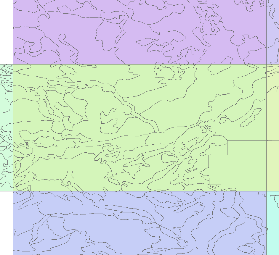
I am sending some images to clear things little bit.
In image NTS Sheet, that is what I have as dataset in the data frame window, each of of them is a different shape file adjacent to each other. I want to go through table of content layers then zoom into first one and export it as jpg or gif while the adjacent nts sheets are turned off.
The final product should look like 083H120_1, not like as in 083H120.
I hope this helps to clear it out.
Thank you
02-07-2012
11:30 AM
- Mark as New
- Bookmark
- Subscribe
- Mute
- Subscribe to RSS Feed
- Permalink
- Report Inappropriate Content
Here is some code written in VB.NET ( so you'll have to do some slight modifications for VBA) that will loop through the table of contents three times. The code first gets the original extent of the activeview. The first loop will turn off all the layers. The second loop will turn on a layer and zoom to its extent, pops up a message box to pause the operation, then turns the layer off. The third loop turns the layers back on once again. Finally, the activeview is set back to the original extent.
            Dim activeView As ESRI.ArcGIS.Carto.IActiveView
            activeView = pMxDoc.ActiveView

            Dim extent As ESRI.ArcGIS.Geometry.IEnvelope
            extent = activeView.Extent

            Dim pMap As ESRI.ArcGIS.Carto.IMap
            pMap = pMxDoc.FocusMap

            Dim enumLayer As ESRI.ArcGIS.Carto.IEnumLayer
            enumLayer = pMap.Layers
            enumLayer.Reset()

            Dim layer As ESRI.ArcGIS.Carto.ILayer
            layer = enumLayer.Next

            Do While Not (layer Is Nothing)
                layer.Visible = False
                layer = enumLayer.Next
            Loop

            enumLayer.Reset()
            layer = enumLayer.Next
            Do While Not (layer Is Nothing)
                If TypeOf layer Is ESRI.ArcGIS.Carto.IFeatureLayer Then
                    layer.Visible = True
                    activeView.Extent = layer.AreaOfInterest
                    activeView.Refresh()
                    System.Windows.Forms.MessageBox.Show(layer.Name)
                    layer.Visible = False
                End If
                layer = enumLayer.Next
            Loop

            enumLayer.Reset()
            layer = enumLayer.Next
            Do While Not (layer Is Nothing)
                layer.Visible = True
                layer = enumLayer.Next
            Loop
            activeView.Extent = extent
            activeView.Refresh()
02-10-2012
10:16 AM
- Mark as New
- Bookmark
- Subscribe
- Mute
- Subscribe to RSS Feed
- Permalink
- Report Inappropriate Content
Thank you Ken, I dont know how to integrate this into VBA but i will try it out.