- Home
- :
- All Communities
- :
- Products
- :
- ArcGIS QuickCapture
- :
- ArcGIS QuickCapture Questions
- :
- Display shape area in QuickCapture App
- Subscribe to RSS Feed
- Mark Topic as New
- Mark Topic as Read
- Float this Topic for Current User
- Bookmark
- Subscribe
- Mute
- Printer Friendly Page
- Mark as New
- Bookmark
- Subscribe
- Mute
- Subscribe to RSS Feed
- Permalink
- Report Inappropriate Content
Hi,
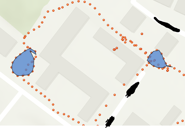
For my project I want to use QuickCapture to capture an area (see blue shapes in attached picture). It would be really useful if the area (in actual numbers, eg in km2) was displayed on the area shape in the app view itself. Is there a way to do this?
Thanks
Natalie
Solved! Go to Solution.
Accepted Solutions
- Mark as New
- Bookmark
- Subscribe
- Mute
- Subscribe to RSS Feed
- Permalink
- Report Inappropriate Content
Hi Natalie. One approach would be to configure your QuickCapture project with a web map:
- Create a web map including the layer with the polygons. Configure this layer with the symbology and labels that you want to show.
- Save the web map and share it with as many groups as you plan to share the QuickCapture project.
- Go into the QuickCapture designer and configure the project to use your web map
- Save and reload in mobile device
In the app, you will see the polygon been added into the map right away, as you capture it. This draft polygon will have a default symbology set and no labels. Once the data is sent to ArcGIS, the polygon will show with the symbology and labels you defined in the web map.
Hope this helps!
- Mark as New
- Bookmark
- Subscribe
- Mute
- Subscribe to RSS Feed
- Permalink
- Report Inappropriate Content
Hi Ismael Chivite,
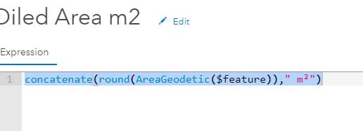
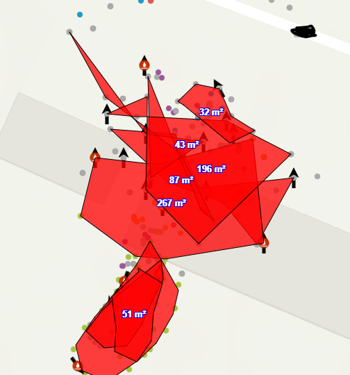
I think Natelie and I have solved this following your good advice. What caught us out for a while was the units of the "Shape_Area" field in the polygon. It wasn't in a unit we could figure out until I read this article.
FAQ: Why are my map, distance and area measurements wrong when using WGS 1984 Web Mercator?
We're guessing this is what is occuring.
Anyway with a bit of Arcade magic we got the labels showing the "correct" area.
It's a shame the labels won't update for new polygons whilst QC is offline. Is that true even if we follow your article about taking maps offline?Offline map for Quick Capture
Thanks
Liam
- Mark as New
- Bookmark
- Subscribe
- Mute
- Subscribe to RSS Feed
- Permalink
- Report Inappropriate Content
Hi. Glad you were able to make some progress!
When working offline, you will not be able to see the area, since the area labels are rendered only in the web map.
We are considering the introduction of new device variables to auto-calculate the area of a polygon (using units of your choice). This is available for testing through the Early Adopter Program. Our thinking is that these new device variables will officially get into the released software in Q3 2020. Once that is in place, we will have the foundation in place to draw the area in the map as a label. I think this could make a good Idea. You may want to post the idea and see if we can get some traction with it.