- Home
- :
- All Communities
- :
- Products
- :
- ArcGIS CityEngine
- :
- ArcGIS CityEngine Questions
- :
- Creating a Road Network/Polygon/Surface from exist...
- Subscribe to RSS Feed
- Mark Topic as New
- Mark Topic as Read
- Float this Topic for Current User
- Bookmark
- Subscribe
- Mute
- Printer Friendly Page
Creating a Road Network/Polygon/Surface from existing Vertexes of an OBJ model
- Mark as New
- Bookmark
- Subscribe
- Mute
- Subscribe to RSS Feed
- Permalink
- Report Inappropriate Content
Hello,
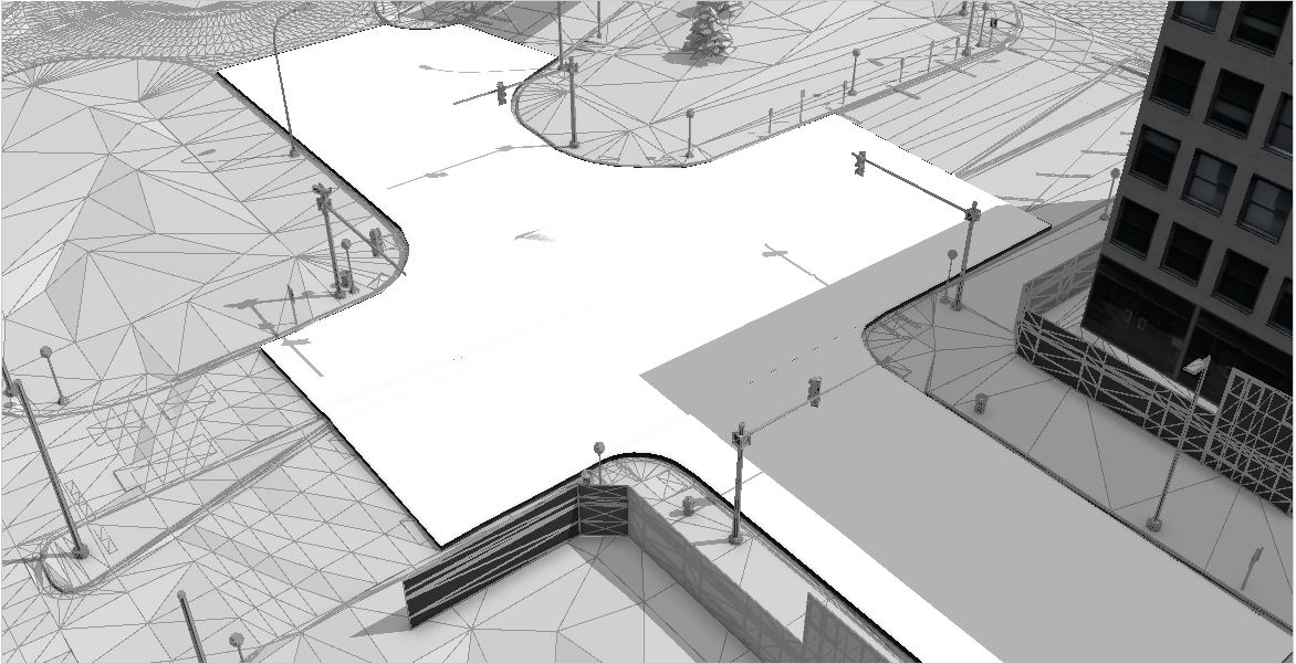
I have a question regarding making road networks from features/vertices of an existing 3d model (.obj file). I was given a .obj file of a couple town block that includes many individual objects. I've attached a sample view of this .obj file. I would like to group the vertices that describe the road surface into a single "road surface" layer that I can then use in visibility analysis.
I have searched through the CityEngine tutorials for making road networks, but I have not found a way to create a road network out of existing vertices/vertexes.
I'd appreciate any information or recommendations you might have.
Thank you,
Chris C
Edit: I forgot to add that I've done a quick, but not very accurate, version of this where I made a polygon defining the road edges, and I then applied a rule file where I made a very short building (.25 meters high) to raise this polygon above the vertexes of the "true" road surface. This is an idea I had and I recognize that it is likely not the best way to do this. Please see additional attached image. Thanks!
- Mark as New
- Bookmark
- Subscribe
- Mute
- Subscribe to RSS Feed
- Permalink
- Report Inappropriate Content
Anyone have any thoughts about this, or performed something similar?
Thanks,
Chris
- Mark as New
- Bookmark
- Subscribe
- Mute
- Subscribe to RSS Feed
- Permalink
- Report Inappropriate Content
Anyone have any thoughts on this?
Thanks,
Chris