- Home
- :
- All Communities
- :
- User Groups
- :
- Coordinate Reference Systems
- :
- Questions
- :
- How to create arbitrary coordinate system in ArcGI...
- Subscribe to RSS Feed
- Mark Topic as New
- Mark Topic as Read
- Float this Topic for Current User
- Bookmark
- Subscribe
- Mute
- Printer Friendly Page
How to create arbitrary coordinate system in ArcGIS Pro?
- Mark as New
- Bookmark
- Subscribe
- Mute
- Subscribe to RSS Feed
- Permalink
- Report Inappropriate Content
I need to georeference a jpeg map of an archaeological excavation with an arbitrary grid system where each square in the grid is 1 m x 1 m. The locations of artifacts within the grid are listed according to Northing and Easting decimal locations relative to a false origin 0,0 and the distance north and east from the origin point in meters. For example, an artifact located 1.5 m north and 2 m east of the origin point is at 1.5 N, 2 E.
How can I create such an arbitrary coordinate system in ArcGIS Pro in order to produce a map of the artifact locations across the excavation grid?
I have never really used ArcGIS before so I'm not sure where to start.
Thank you!
- Mark as New
- Bookmark
- Subscribe
- Mute
- Subscribe to RSS Feed
- Permalink
- Report Inappropriate Content
Great question, after some research I came across this:
Local Cartesian Projection—Help | ArcGIS for Desktop
https://pro.arcgis.com/en/pro-app/help/mapping/properties/local.htm
- Mark as New
- Bookmark
- Subscribe
- Mute
- Subscribe to RSS Feed
- Permalink
- Report Inappropriate Content
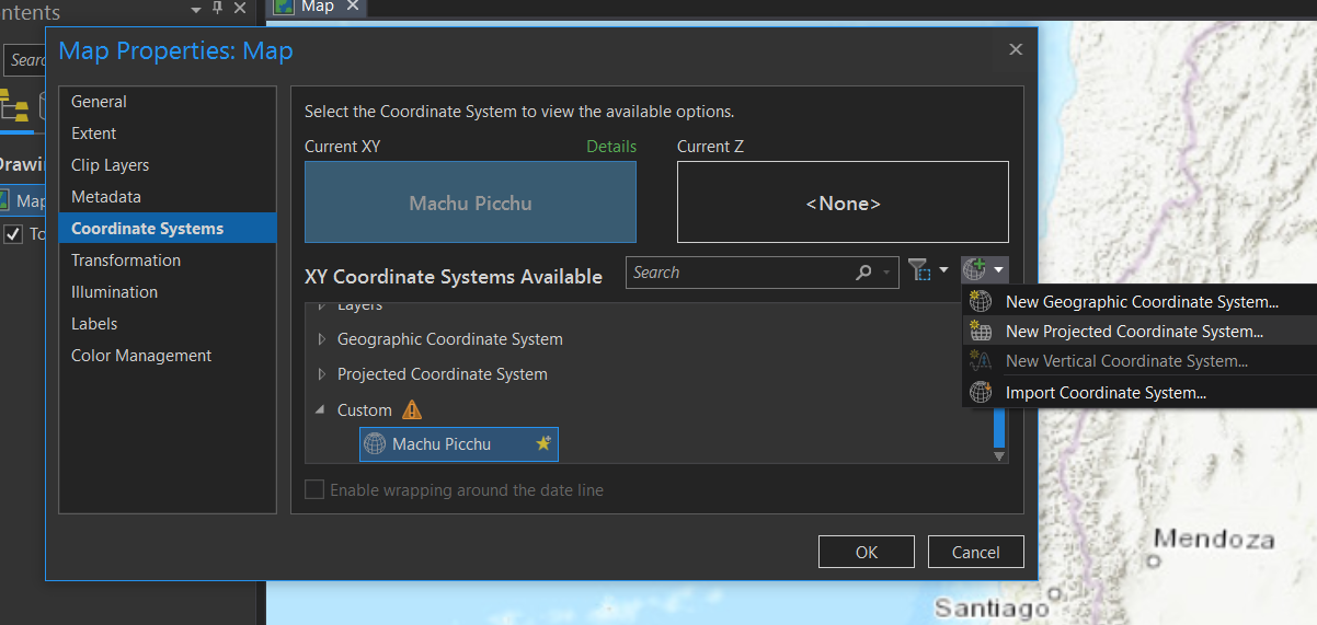
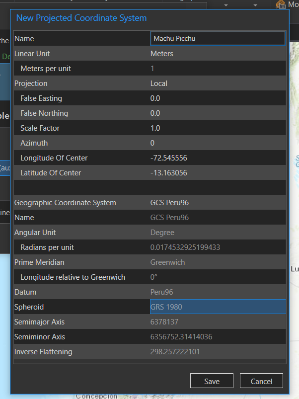
Go to Map Properties, select "Coordinate Systems" and then "New Projected Coordinate System..."
Local projection would work for your application. For Longitude and Latitude of Center use geographic coordinates of the origin point, False Easting, False Northing, and Azimuth are 0, and Scale Factor mark as 1. For the Geographic Coordinate System, select the one of your origin point.