- Home
- :
- All Communities
- :
- Industries
- :
- Education
- :
- Higher Education
- :
- Higher Education Questions
- :
- How do I create a boundary for my raster/polygon l...
- Subscribe to RSS Feed
- Mark Topic as New
- Mark Topic as Read
- Float this Topic for Current User
- Bookmark
- Subscribe
- Mute
- Printer Friendly Page
How do I create a boundary for my raster/polygon layer?
- Mark as New
- Bookmark
- Subscribe
- Mute
- Subscribe to RSS Feed
- Permalink
- Report Inappropriate Content
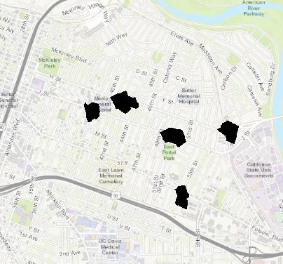
Hi folks, I am trying to perform a walkability analysis for Sacramento, CA. I converted the service area polygon shapefiles for each locations in Sacramento into raster layers. However, I need to have my raster layers within a boundary like the figure on the left, so I can define raw raster values of 0-1. Right now, my polygon shapefiles & raster layers are stand alone so they only have a single value of 1.
Does anyone know how to do this? Am I supposed to create the boundary with the service area polygons before I convert them to raster?
Thank you!

- Mark as New
- Bookmark
- Subscribe
- Mute
- Subscribe to RSS Feed
- Permalink
- Report Inappropriate Content
If you are trying to create a 'boundary" from the raster you can use the "raster to polygon" GP tool found in the conversions tools set->From Raster-> "Raster to Polygon"
If you are trying to Clip them based on a boundary just do a "clip raster" GP tool. found in Raster->Raster Processing->"Clip Raster"
- Mark as New
- Bookmark
- Subscribe
- Mute
- Subscribe to RSS Feed
- Permalink
- Report Inappropriate Content
I figured it out. I had to Reclassify my raster layers and specify the processing extent and raster analysis mask.
Thanks!