- Home
- :
- All Communities
- :
- Products
- :
- ArcGIS Pro
- :
- ArcGIS Pro Questions
- :
- getting Z-information from a raster dataset / mosa...
- Subscribe to RSS Feed
- Mark Topic as New
- Mark Topic as Read
- Float this Topic for Current User
- Bookmark
- Subscribe
- Mute
- Printer Friendly Page
getting Z-information from a raster dataset / mosaic to points
- Mark as New
- Bookmark
- Subscribe
- Mute
- Subscribe to RSS Feed
- Permalink
- Report Inappropriate Content
Hello.
before telling my problem/question here are some information. I am working with ArcGis Pro.
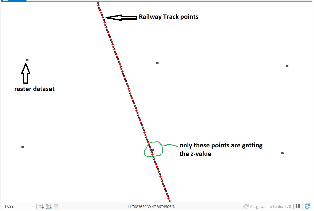
- I transformed many raster datasets into a mosaic (one single raster dataset). The raster includes z information.
- I have a railway track with points every meter along the track.
Now I want to add Z information for these points of my railway track. Every Raster/mosaic point accross the map is about 25 meter apart the other.
The Problem is, when i add the z information to the railway track points, only the points which are very near to the points of the raster are getting the z-information.
How can I get the z-information from the raster to my points of the track? Is there a option to interpolate the altitude inside the raster? Or any other possibility to add a z-value?
I also tried to create a TIN but this doesn't work.
(I will put a picture in the attachement, for a better understanding of my problem)
Thanks a lot for helping me solving this problem.
Solved! Go to Solution.
Accepted Solutions
- Mark as New
- Bookmark
- Subscribe
- Mute
- Subscribe to RSS Feed
- Permalink
- Report Inappropriate Content
Hey Thomas,
Try converting the individual rasters to points. Then use the Interpolate Points tool to create a raster dataset. It should interpolate the empty area between the points.
- Mark as New
- Bookmark
- Subscribe
- Mute
- Subscribe to RSS Feed
- Permalink
- Report Inappropriate Content
Hey Thomas,
Try converting the individual rasters to points. Then use the Interpolate Points tool to create a raster dataset. It should interpolate the empty area between the points.
- Mark as New
- Bookmark
- Subscribe
- Mute
- Subscribe to RSS Feed
- Permalink
- Report Inappropriate Content
Thank you very much!! It worked.