- Home
- :
- All Communities
- :
- Products
- :
- Data Management
- :
- Data Management Questions
- :
- Error adding rasters to mosaic dataset in enterpri...
- Subscribe to RSS Feed
- Mark Topic as New
- Mark Topic as Read
- Float this Topic for Current User
- Bookmark
- Subscribe
- Mute
- Printer Friendly Page
Error adding rasters to mosaic dataset in enterprise geodatabase
- Mark as New
- Bookmark
- Subscribe
- Mute
- Subscribe to RSS Feed
- Permalink
- Report Inappropriate Content
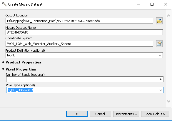
I'm having problems adding raster datasets to a mosaic dataset contained in an Oracle enterprise geodatabase. I create the dataset.
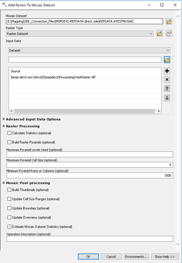
Then add a raster, which at first, seems to work...
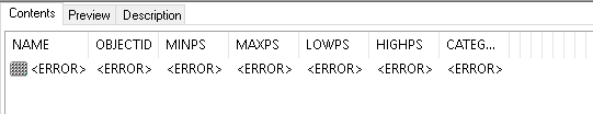
However, attempting to view the contents of the mosaic dataset just shows a bunch of errors...
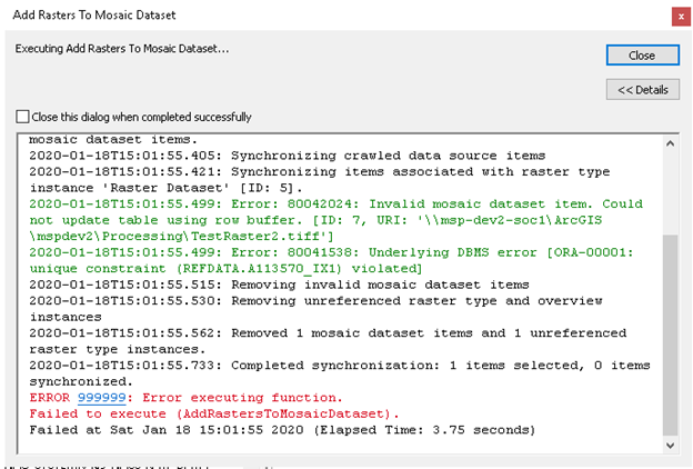
Attempting to add any more rasters to the mosaic dataset causes unique constraint violations...
Any updating of boundaries, or cell calculation causes errors, essentially nothing works. Clearly I'm missing some fundamental step in my process, but I don't know what it is. I can add these same rasters to a mosaic dataset inside a file geodatabase without any issues, but the project I'm working on will be accessed by hundreds of users, and may need to have multiple sets of data being loaded into it at the same time (presumably this can be done when using an enterprise geodatabase).
Any assistance in getting past this very first step would be greatly appreciated!