Turn on suggestions
Auto-suggest helps you quickly narrow down your search results by suggesting possible matches as you type.
Cancel
- Home
- :
- All Communities
- :
- Products
- :
- ArcGIS Pro
- :
- ArcGIS Pro Questions
- :
- Importing images from a Zenmuse XT2 camera (drone ...
Options
- Subscribe to RSS Feed
- Mark Topic as New
- Mark Topic as Read
- Float this Topic for Current User
- Bookmark
- Subscribe
- Mute
- Printer Friendly Page
Importing images from a Zenmuse XT2 camera (drone images)
Subscribe
355
0
01-17-2020 05:44 AM
01-17-2020
05:44 AM
- Mark as New
- Bookmark
- Subscribe
- Mute
- Subscribe to RSS Feed
- Permalink
- Report Inappropriate Content
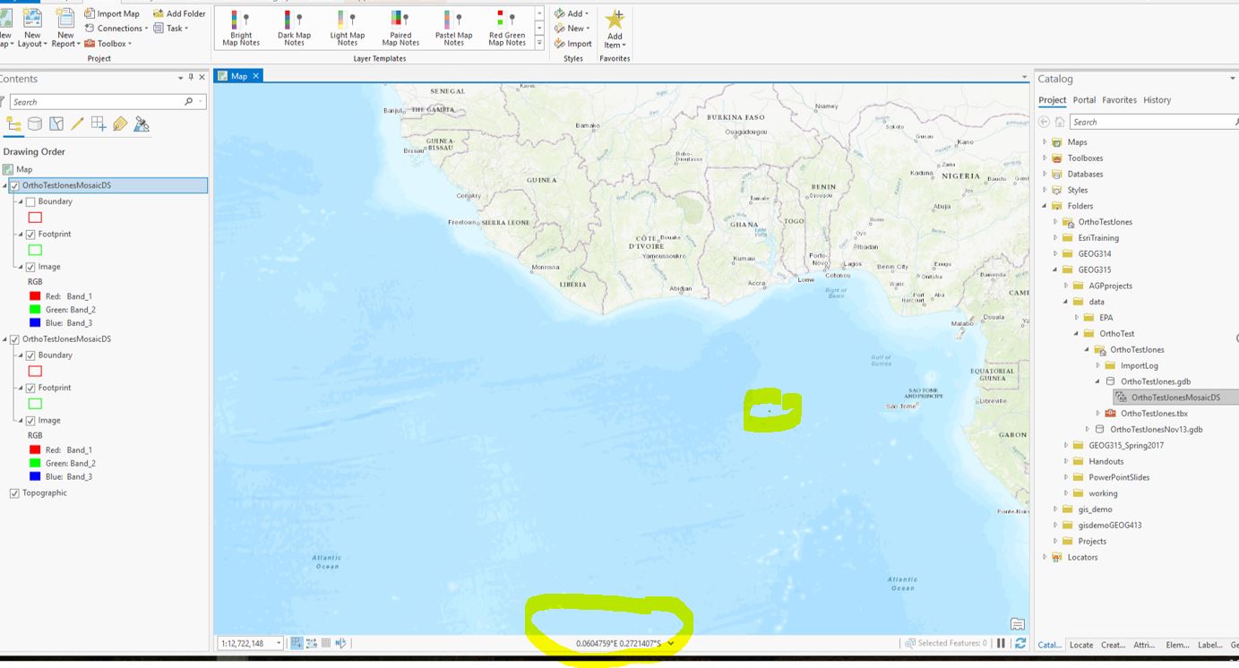
This seems like it should be a simple thing - I'm trying to add my drone images to a ArcGIS Pro map.
They are jpg format. They are not seen by ArcGIS Pro as something I can add to a map.
I tried creating a mosaic dataset and to add them, but all 190 images show up all stacked on top of each other off the west coast of Africa. Should be in eastern Massachusetts.
Does anyone know what I need to do to get the software to recognize the location of these images?
Odd thing is, when I import them into Drone2Map, they are georeferenced properly.
Thank you for any input
0 Replies