- Home
- :
- All Communities
- :
- Products
- :
- ArcGIS Living Atlas of the World
- :
- Living Atlas Questions
- :
- What is the date range for the current ACS data in...
- Subscribe to RSS Feed
- Mark Topic as New
- Mark Topic as Read
- Float this Topic for Current User
- Bookmark
- Subscribe
- Mute
- Printer Friendly Page
What is the date range for the current ACS data in Living Atlas?
- Mark as New
- Bookmark
- Subscribe
- Mute
- Subscribe to RSS Feed
- Permalink
- Report Inappropriate Content
What is the date range for the current ACS data in Living Atlas? This information should be available in the data description within Living Atlas in ArcGIS Pro Catalog. ESRI presses us to create metadata but they never have it available for the data they provide. I want to ensure I'm transparent about the data I'm using.
Solved! Go to Solution.
Accepted Solutions
- Mark as New
- Bookmark
- Subscribe
- Mute
- Subscribe to RSS Feed
- Permalink
- Report Inappropriate Content
Thank you for your question. The vintage as of December 19, 2019 is 2014-2018. Each year the data in these layers is updated as soon as the Census releases their newest estimates.
The ACS layers in ArcGIS Living Atlas are fully documented, including the current vintage. If you visit the item page for a layer from the Living Atlas website, you will see the vintage, the ACS tables being used, along with detailed information about how the data was downloaded and processed. Click here to find all of the ACS layers and their documentation.
The metadata can also be seen in the Pro Catalog View by finding a layer topic such as "ACS Housing Costs Variables - Centroids" in Living Atlas and clicking the layer name.
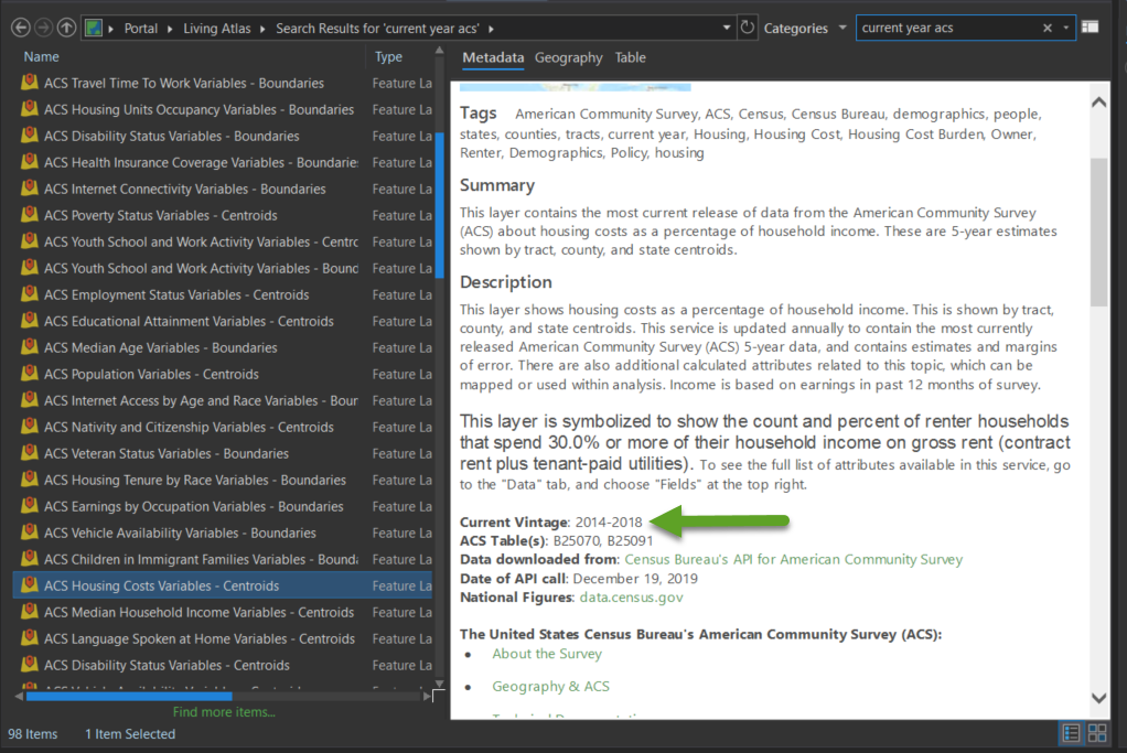
I hope that this helps you in your efforts of transparency.
For more information about these layers, visit some of our blogs or the FAQ.
- Mark as New
- Bookmark
- Subscribe
- Mute
- Subscribe to RSS Feed
- Permalink
- Report Inappropriate Content
Thank you for your question. The vintage as of December 19, 2019 is 2014-2018. Each year the data in these layers is updated as soon as the Census releases their newest estimates.
The ACS layers in ArcGIS Living Atlas are fully documented, including the current vintage. If you visit the item page for a layer from the Living Atlas website, you will see the vintage, the ACS tables being used, along with detailed information about how the data was downloaded and processed. Click here to find all of the ACS layers and their documentation.
The metadata can also be seen in the Pro Catalog View by finding a layer topic such as "ACS Housing Costs Variables - Centroids" in Living Atlas and clicking the layer name.
I hope that this helps you in your efforts of transparency.
For more information about these layers, visit some of our blogs or the FAQ.
- Mark as New
- Bookmark
- Subscribe
- Mute
- Subscribe to RSS Feed
- Permalink
- Report Inappropriate Content
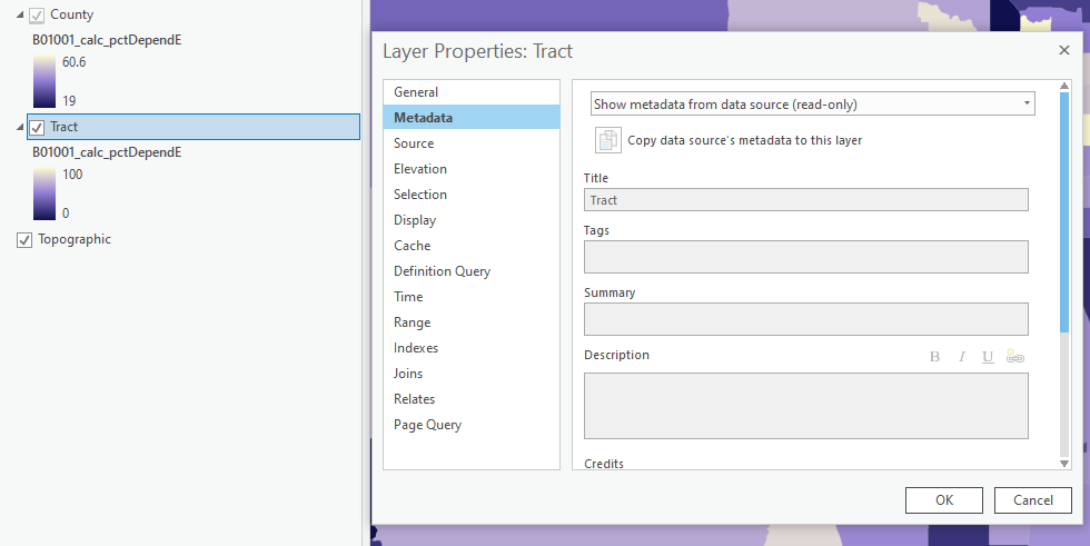
Thanks for the information. How do you get to that view of the metadata? This is the only way I know how to view it and there's nothing here:
- Mark as New
- Bookmark
- Subscribe
- Mute
- Subscribe to RSS Feed
- Permalink
- Report Inappropriate Content
The view in the screenshot is from the Catalog View. However, I'm seeing some weird behavior with the layer you're using, so I will send this over to the dev team to review. In the meantime, here is the ArcGIS Online item page metadata for the ACS Population Variables - Boundaries layer you are using. The metadata for all 78 of the ACS layers can be found here.
- Mark as New
- Bookmark
- Subscribe
- Mute
- Subscribe to RSS Feed
- Permalink
- Report Inappropriate Content
To augment Lisa's answer, the latest ACS data is released by the Census Bureau around the middle of December every year.