- Home
- :
- All Communities
- :
- Industries
- :
- Water Utilities
- :
- Water Utilities Questions
- :
- Finding Sewer Lift Station Flow
- Subscribe to RSS Feed
- Mark Topic as New
- Mark Topic as Read
- Float this Topic for Current User
- Bookmark
- Subscribe
- Mute
- Printer Friendly Page
Finding Sewer Lift Station Flow
- Mark as New
- Bookmark
- Subscribe
- Mute
- Subscribe to RSS Feed
- Permalink
- Report Inappropriate Content
Hello Everyone,
I have been given the task to find the flow of our lift stations, specifically the ones that flow into another lift station. I have attempted several different ways of doing this but none of them seem to get very far. To have a better idea what I am talking about, here is an example of the data:
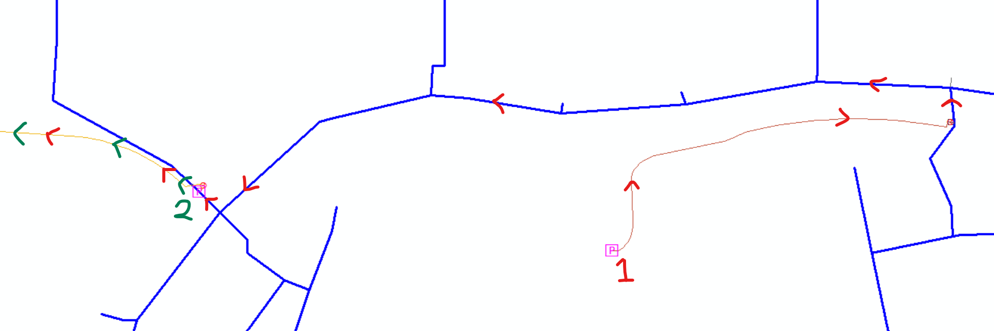
(The data goes to a main on the left side and continues upwards)
I want to insert the name of Lift Station #1 into a field for the linear features with the red arrows and then a combination of #1 and #2 to the linear features after Lift Station #2. I feel like this can be accomplished using Network Analyst, but a large majority of the linear dataset doesn't the correct direction.
If anyone has an idea of how this can be accomplished that would be great!
- Mark as New
- Bookmark
- Subscribe
- Mute
- Subscribe to RSS Feed
- Permalink
- Report Inappropriate Content
Evan,
Wanted to ask - when you mentioned finding the flow of the lift stations, where you looking for a:"flow direction" or b:"volume of flow" or flowrate (i.e. 1 cubic foot/per second). 2 different variables/different answers. Also once knowing a or b, what is the next step, what are they looking to do? Thanks for posting the question, look forward to your response - talk soon!
Respectfully,
Martin
- Mark as New
- Bookmark
- Subscribe
- Mute
- Subscribe to RSS Feed
- Permalink
- Report Inappropriate Content
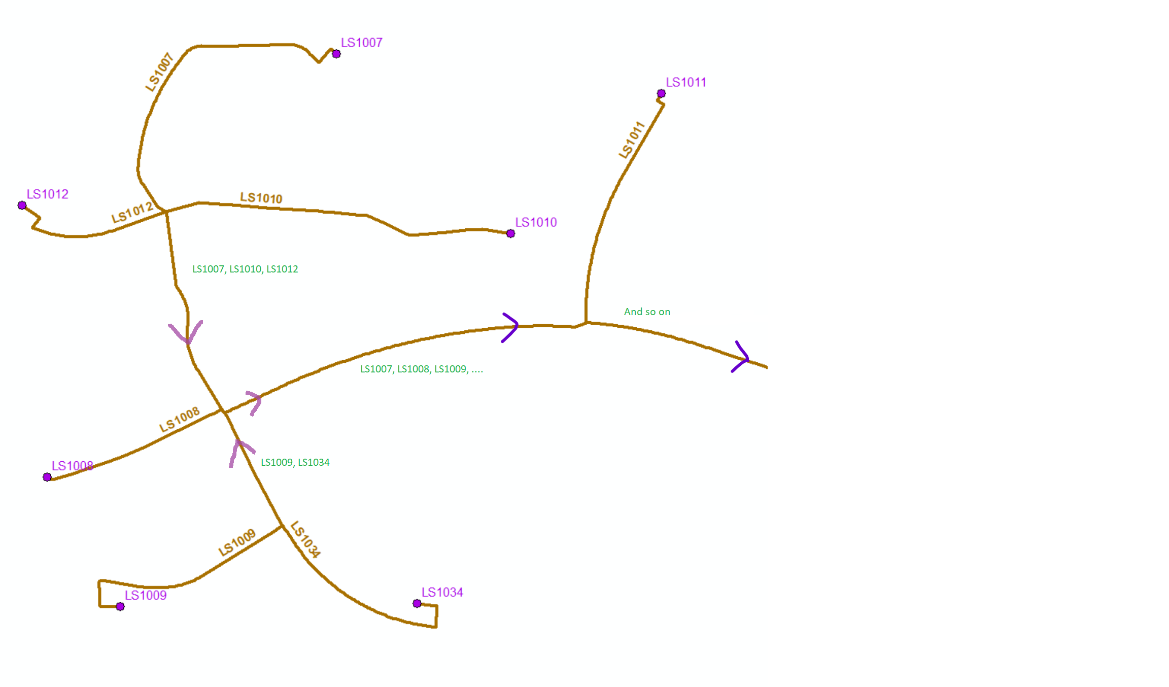
Basically, I would like to transfer the name of a lift station to the connecting Pressure Main but only if the main goes down stream. I've attached a picture of another spot in our service area. I managed to get the name transferred to the 1st main intersecting the lift station using Spatial Join but I don't know how to get the rest of the pipes. The letters in green is what I want to happen. One of the issues I'm running into is pipes getting their named replaced or the wrong name being assigned because of the way Spatial Join works.
- Mark as New
- Bookmark
- Subscribe
- Mute
- Subscribe to RSS Feed
- Permalink
- Report Inappropriate Content
If you are using ArcMap and your data is in a geometric network than you should be able to do this with the attribute assistant in this Solution Template - Water Geometric Network Editing and Analysis | ArcGIS Solutions for Water
- Mark as New
- Bookmark
- Subscribe
- Mute
- Subscribe to RSS Feed
- Permalink
- Report Inappropriate Content
Leaving a quick update how I believe was the best way accomplishing this.
I created a Network Dataset, set up some basic rules, and then, using Pro, I created a Closest Facility layer and made the treatment plants Facilities and the Pump Stations Incidents. This created a single Route line for each lift station with an origin and destination name as well as the proper direction of flow.
My next step is doing a combination of splits and spatial joins on the existing pipes and the Routes to create the desired results.
Thank you all for the help!