- Home
- :
- All Communities
- :
- Products
- :
- Data Management
- :
- Data Management Questions
- :
- Wrong base-map location
- Subscribe to RSS Feed
- Mark Topic as New
- Mark Topic as Read
- Float this Topic for Current User
- Bookmark
- Subscribe
- Mute
- Printer Friendly Page
Wrong base-map location
- Mark as New
- Bookmark
- Subscribe
- Mute
- Subscribe to RSS Feed
- Permalink
- Report Inappropriate Content
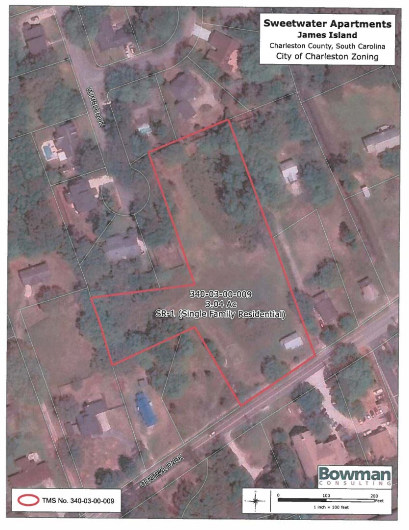
When I go to print one of my maps, or export to PDF, the basemap location changes to as if it was the middle of a dense forest. This has been happening way too often. In the below image, is how the map looks from my computer screen:
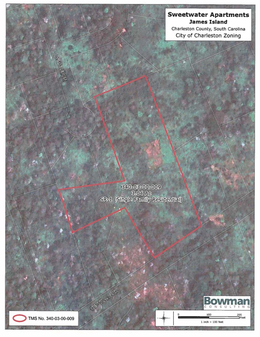
However, when I print or export to pdf, it turns into this.
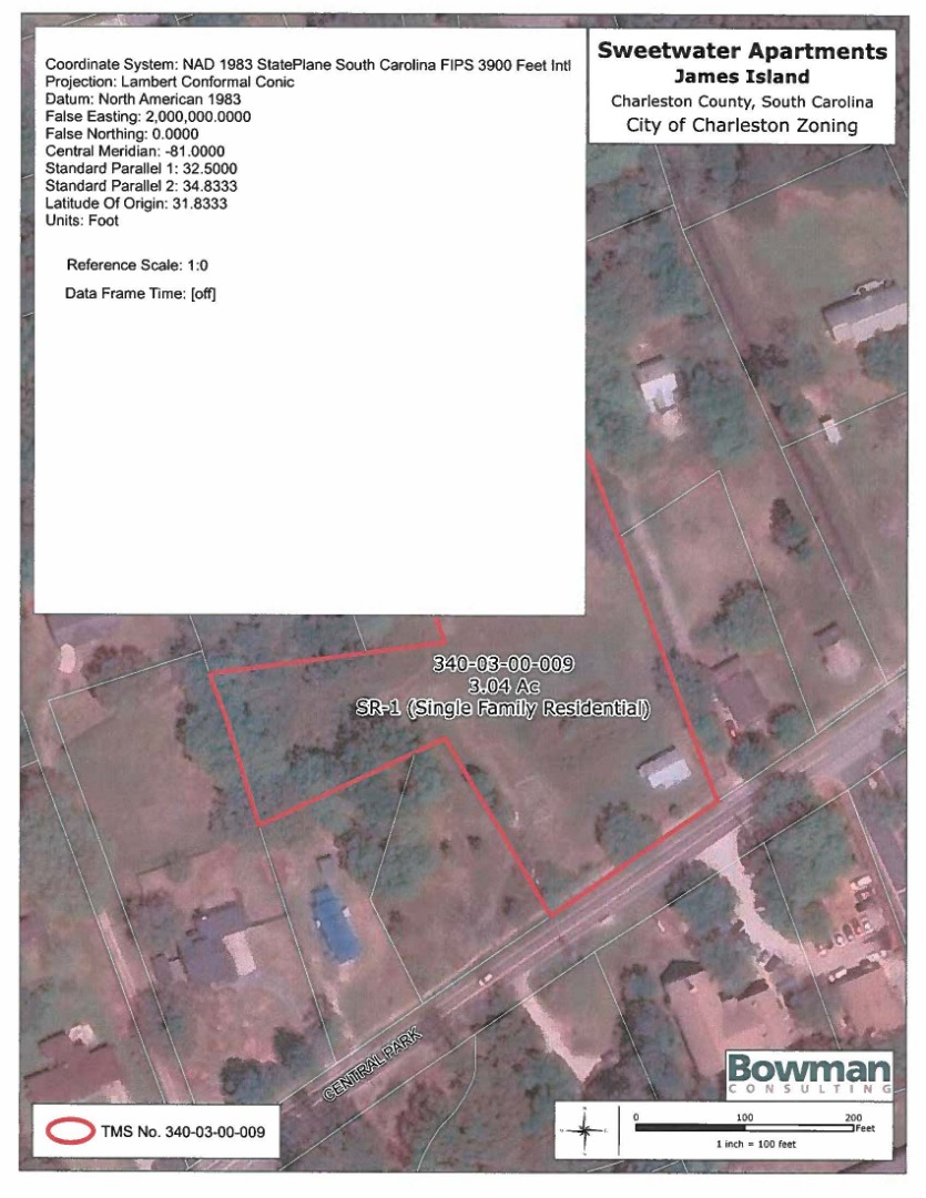
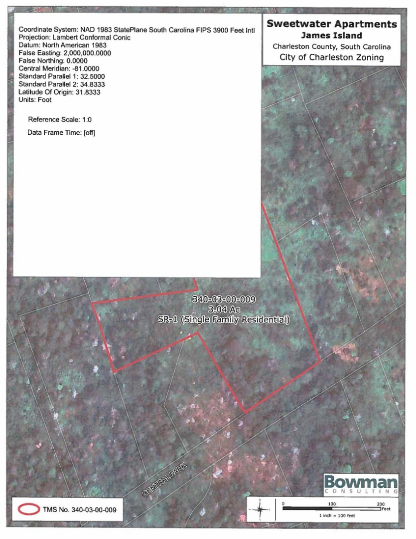
Here are the df stats for both (these are the exact same MXD's. I just had to save as, then re-open).
- Mark as New
- Bookmark
- Subscribe
- Mute
- Subscribe to RSS Feed
- Permalink
- Report Inappropriate Content
I've had this problem as well with the ESRI Topographic basemap. Usually a save, close and re-open does the trick but it's pretty frustrating
- Mark as New
- Bookmark
- Subscribe
- Mute
- Subscribe to RSS Feed
- Permalink
- Report Inappropriate Content
I found if I change the projection to Web Mercator and then back to my preferred projection it fixes it temporarily and then it will mix it up again after a few exports. I made one textual change to a half dozen maps and sent them to a client without opening the PDFs yesterday. It's embarrassing and I know it's ESRI's fault, but like all abusive relationships, I blame myself for not opening the PDFs. How this just starts out of the blue is beyond me and it sets my hair on fire to use this software some days.