- Home
- :
- All Communities
- :
- Products
- :
- ArcGIS Pro
- :
- ArcGIS Pro Questions
- :
- Issue with merging polygons and the shapes complet...
- Subscribe to RSS Feed
- Mark Topic as New
- Mark Topic as Read
- Float this Topic for Current User
- Bookmark
- Subscribe
- Mute
- Printer Friendly Page
Issue with merging polygons and the shapes completely changing?
- Mark as New
- Bookmark
- Subscribe
- Mute
- Subscribe to RSS Feed
- Permalink
- Report Inappropriate Content
I'm working with a polygon layer see image merge1. I selected all the circle polygons show then using the merge tool on the edit menu. The polygons completely loose their original shape see image merge2. I've never seen this happen before. Does anyone have any ideas how to stop this from happening.
- Mark as New
- Bookmark
- Subscribe
- Mute
- Subscribe to RSS Feed
- Permalink
- Report Inappropriate Content
Hi Linda,
I have a few questions:
- What coordinate system is the data in?
- What coordinate system is the Map in?
- I'm assuming those circles are made of curves and not densified with lots of vertices, but can you please show us the vertices of one of the problem circles? (Edit tab > Modify > Reshape group > Vertices > select one of the problem circle features and take a screenshot).
Please let me know.
Thanks!
-Scott
- Mark as New
- Bookmark
- Subscribe
- Mute
- Subscribe to RSS Feed
- Permalink
- Report Inappropriate Content
1 Data is in GCS North American 1983
2. Map is also in GCS North Amercian 1983
3. The circles were made using the Crete Features Circle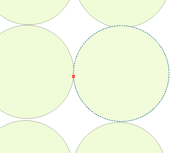
After doing the merge in this area this happens...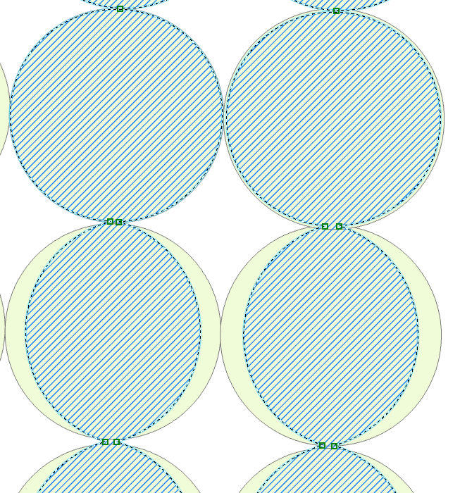
the blue hatched area is what was created after this merge, the green circles are a copy of the original data.
Note I'm using ArcGIS Pro 2.3
- Mark as New
- Bookmark
- Subscribe
- Mute
- Subscribe to RSS Feed
- Permalink
- Report Inappropriate Content
Hi Linda,
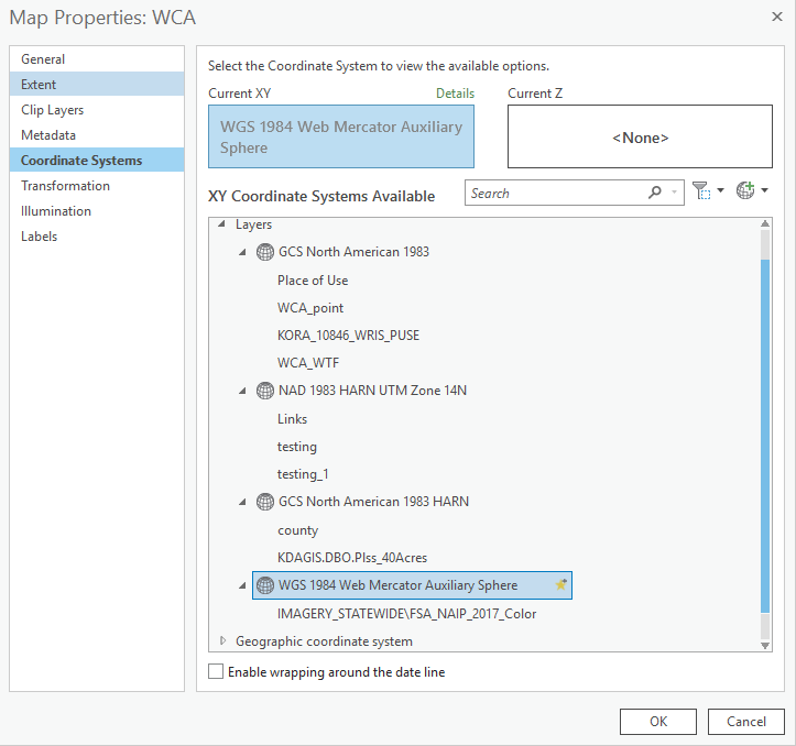
I created similar data in GCS North American 1983 in a Map that is also in GCS North American 1983. I then used the Merge tool (Edit tab), but I'm not reproducing the issue in 2.3 or 2.4. It seems that this could happen if the data was being projected on the fly based on my testing. Can you please send a screenshot of the following:
Map properties > Coordinate Systems section > Expand layers > Expand the current coordinate system to show all layers. I'm assuming the layer name will show up there "WCA_WTF"
Please let me know, thank you!
-Scott
- Mark as New
- Bookmark
- Subscribe
- Mute
- Subscribe to RSS Feed
- Permalink
- Report Inappropriate Content
Yes the layer is WCA_WTF
- Mark as New
- Bookmark
- Subscribe
- Mute
- Subscribe to RSS Feed
- Permalink
- Report Inappropriate Content
Hi Linda,
From the screenshot, I can tell your map is not in GCS North American 1983. It's in WGS 1984 Web Mercator Auxiliary Sphere. Please try setting the Map's coordinate system to match the data you are editing - GCS North American 1983.
Specify a coordinate system—Properties of maps | ArcGIS Desktop