- Home
- :
- All Communities
- :
- User Groups
- :
- LIDAR Resources
- :
- Questions
- :
- Can I load high density point cloud?
- Subscribe to RSS Feed
- Mark Topic as New
- Mark Topic as Read
- Float this Topic for Current User
- Bookmark
- Subscribe
- Mute
- Printer Friendly Page
Can I load high density point cloud?
- Mark as New
- Bookmark
- Subscribe
- Mute
- Subscribe to RSS Feed
- Permalink
- Report Inappropriate Content
Hi, I'm working with information taken by a UAV system, I have obtained high density point cloud, around 75 million points. I'm analizing all my data in ArcGIS Pro but I'm having problems:
- Sometimes the point cloud data loads and it doesn't show in the screen.
- In other time I load the data and the software suddenly closes.
Maybe, it is a limit amount of the data that we can work in ArcGIS Pro or there is another way to do that?
- Mark as New
- Bookmark
- Subscribe
- Mute
- Subscribe to RSS Feed
- Permalink
- Report Inappropriate Content
Hey there, I have pretty much the same problem. I guess there is some kind of point limit for a maximum number of points that can be displayed in ArcGIS Pro?
- Mark as New
- Bookmark
- Subscribe
- Mute
- Subscribe to RSS Feed
- Permalink
- Report Inappropriate Content
No, we've worked with point clouds with billions of points. Can you tell us more information, e.g.
- which version of Pro are you using?
- what is the data source? (If uav/drone, the points may be below ground)
- what is the behavior? display slow? some or all points not visible? software crashes?
- are you using a LAS Dataset?
- Is the data LAS format? Do you know the version of the LAS file?
- Mark as New
- Bookmark
- Subscribe
- Mute
- Subscribe to RSS Feed
- Permalink
- Report Inappropriate Content
I am using Version 2.5.1 and I want to convert a Dense Point Cloud (generated from UAV-images in Agisoft Metashape) from LAS into a Scene Layer Package. ArcGIS Pro only displays a 3D bounding box of some kind (correctly located) but does not display any points. I tried converting to SLPK and it does, but only at a very rough spatial resolution.
- Mark as New
- Bookmark
- Subscribe
- Mute
- Subscribe to RSS Feed
- Permalink
- Report Inappropriate Content
Hello Sebastian,
To get the best rendering your point clouds its important to create a LAS Dataset with it to begin. This can be done using the "Create LAS Dataset" Geoprocessing tool. Once this is done the LAS data will be indexed and should render once you zoom to the extent. Adjusting the number of points rendered in the appearances tab will help also.
Regarding the "rough spatial resolution" what exactly are you referring too. The Create scene layer package tool will transform the data to WGS for rendering in the browser, Earth or Pro. If you need to maintain the local coordinate you need to define it in the preferences. I have covered publishing of Point Cloud scene layers in the following blog article.
Publishing Point Cloud Scene Layers in ArcGIS Pro
Hope this is of assistance.
- Mark as New
- Bookmark
- Subscribe
- Mute
- Subscribe to RSS Feed
- Permalink
- Report Inappropriate Content
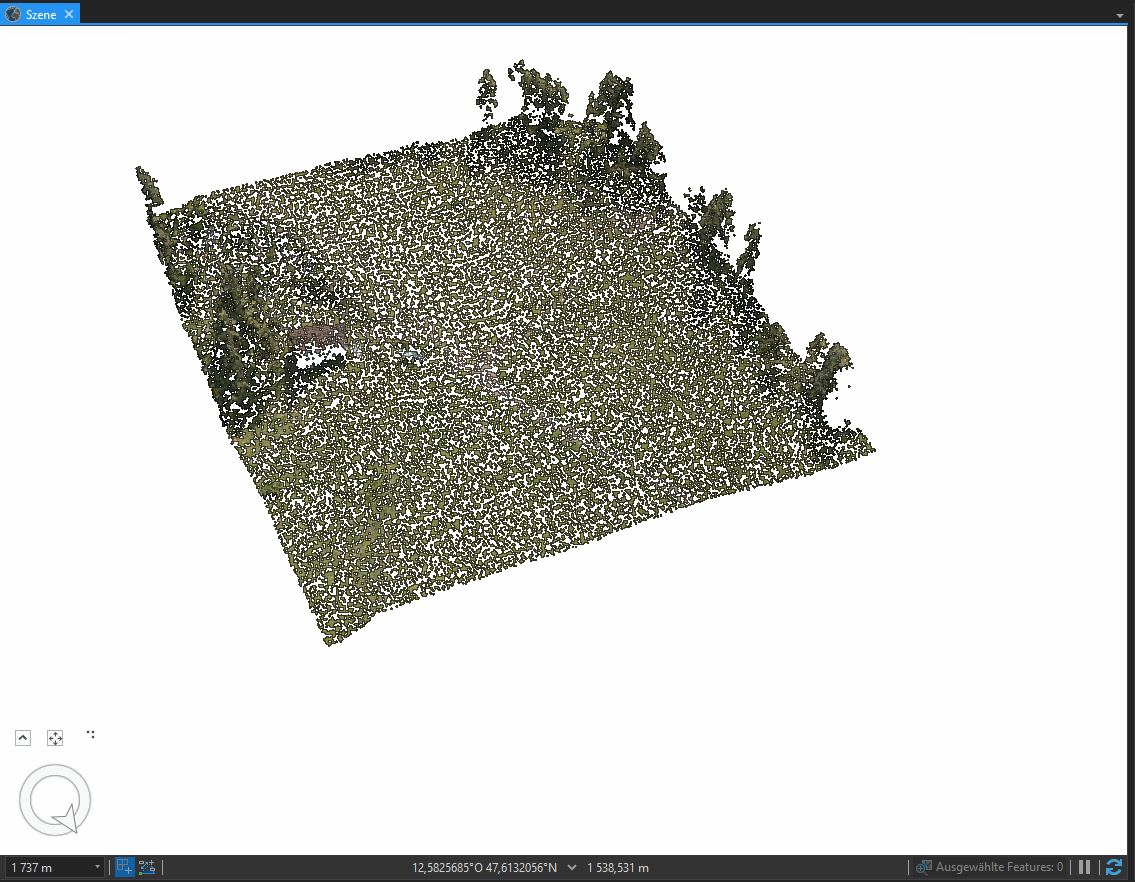
Thanks for the input! I did use the create LAS Dataset tool and it didn't make much of a difference. I'll try to explain the problems in my workflow with more detail and add some screenshots:
After creating a LAS-Dataset for a fairly big dense cloud (800 million points) and adding it to the project I can only see the bounding box:

I can see some points after zooming in and adjusting the number of points rendered in the appearances tab, but it is just a fraction of the points in this dataset:

I tried the same workflow for a smaller dataset (30 million points) and it displays a lot better:

When I convert this smaller subset to SLPK I get the following result, which is what I described earlier as "rough spatial resolution":
I thought SLPK was a file format to produce photorealistic meshes from photogrametric point clouds, but maybe my expectations are just too high right there.
The problem with the rendering of the bigger point cloud could be a performance issue, but it shouldn't be such a problem since I did the photogrammetric processing on the same computer, and visualization of the same point cloud works well in other software products (Agisoft Metashape, CloudCompare).
- Mark as New
- Bookmark
- Subscribe
- Mute
- Subscribe to RSS Feed
- Permalink
- Report Inappropriate Content
I have exactly the same problem, did you find any solution?