- Home
- :
- All Communities
- :
- Industries
- :
- Electric
- :
- Electric Questions
- :
- How does containment work when visualizing in port...
- Subscribe to RSS Feed
- Mark Topic as New
- Mark Topic as Read
- Float this Topic for Current User
- Bookmark
- Subscribe
- Mute
- Printer Friendly Page
How does containment work when visualizing in portal?
- Mark as New
- Bookmark
- Subscribe
- Mute
- Subscribe to RSS Feed
- Permalink
- Report Inappropriate Content
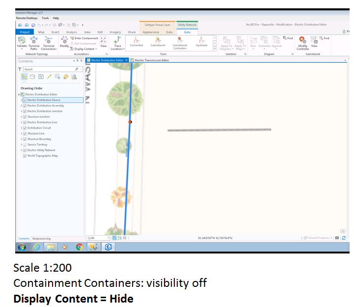
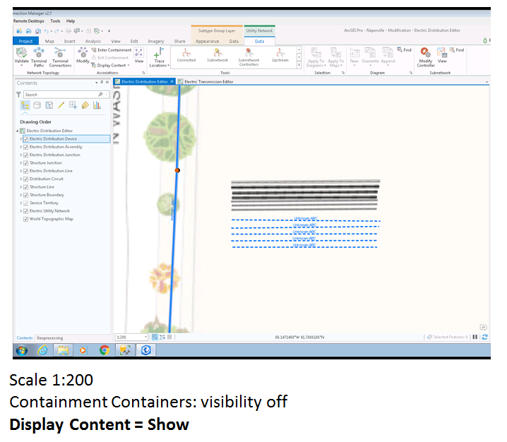
I have been investigating the capability provided by the containment function in UN. This makes a very clean looking map in pro. The first 2 images below are showing ducts, duct banks and electric lines with containment - display content hidden then shown.
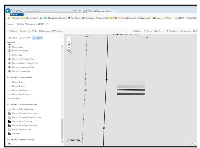
This third image is the same dataset in a portal map. As you can see there is no containment and all the objects are visible.
Is there any configuration we need to set to allow the portal users to utilise containment? Or are the users stuck with the objects always shown?
Solved! Go to Solution.
Accepted Solutions
- Mark as New
- Bookmark
- Subscribe
- Mute
- Subscribe to RSS Feed
- Permalink
- Report Inappropriate Content
If you're using a map service in your web map it should respect display filters. So if you set up your containment display filters to turn off at a specific scale and are using map services you should be good to go. If you want to interactively turn them on / off or want to use features services you will likely need to have a widget that applies / removes filters (using the WAB) or you'll need to make a custom tool to do this. At some point I'm hoping to see a widget for this in the core web app builder.
- Mark as New
- Bookmark
- Subscribe
- Mute
- Subscribe to RSS Feed
- Permalink
- Report Inappropriate Content
Thanks Robert. We have a highly complex underground CBD network that needs to considered on how to visualize and manage this network (one good example is in a single road parcel there are 7 unique trenches, with 87 distinct cables, and over 100 conduits). The use of containment for lines seemed like a good idea, but how to keep it clean yet interactive is the question. The interactive turn on/off and building something ourselves i guess we will need to look into until there is a core web app.