- Home
- :
- All Communities
- :
- Products
- :
- 3D
- :
- 3D Cities / Campuses Questions
- :
- Spatial Join - Identifying the correct polygon to ...
- Subscribe to RSS Feed
- Mark Topic as New
- Mark Topic as Read
- Float this Topic for Current User
- Bookmark
- Subscribe
- Mute
- Printer Friendly Page
Spatial Join - Identifying the correct polygon to merge with (condo buildings)
- Mark as New
- Bookmark
- Subscribe
- Mute
- Subscribe to RSS Feed
- Permalink
- Report Inappropriate Content
Hello,
I have created an address locator where the reference data is a shapefile of county parcel data. I then geocoded utility service addresses using my custom locator, which worked quite well. However, I am having trouble relating the parcel APN (feature in shapefile) to the geocoded utility address attribute table. I have tried to select the APN as the point address ID and as 'additional field' when making an address locator, but this does not work. The reason I cannot do a simple spatial join is that some condo buildings have four parcel APNs in the same area. I need to select which utility address matches each condo.
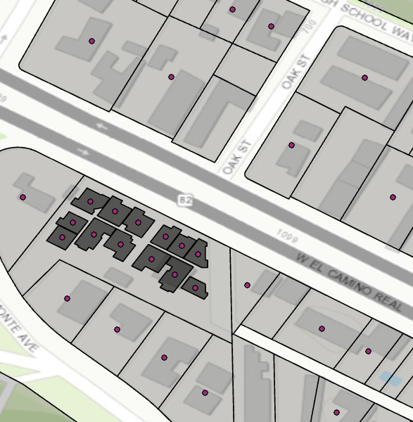
I'm assuming that, since the utility addresses are being geocoded to the centroid of each parcel, that I should be able to extract the parcel APN and place it in the resulting geocode output.
Thank you!
-Robert