- Home
- :
- All Communities
- :
- Products
- :
- Mapping and Charting Solutions
- :
- Mapping and Charting Questions
- :
- How to avoid rasterization cause by transparent la...
- Subscribe to RSS Feed
- Mark Topic as New
- Mark Topic as Read
- Float this Topic for Current User
- Bookmark
- Subscribe
- Mute
- Printer Friendly Page
How to avoid rasterization cause by transparent layers?
- Mark as New
- Bookmark
- Subscribe
- Mute
- Subscribe to RSS Feed
- Permalink
- Report Inappropriate Content
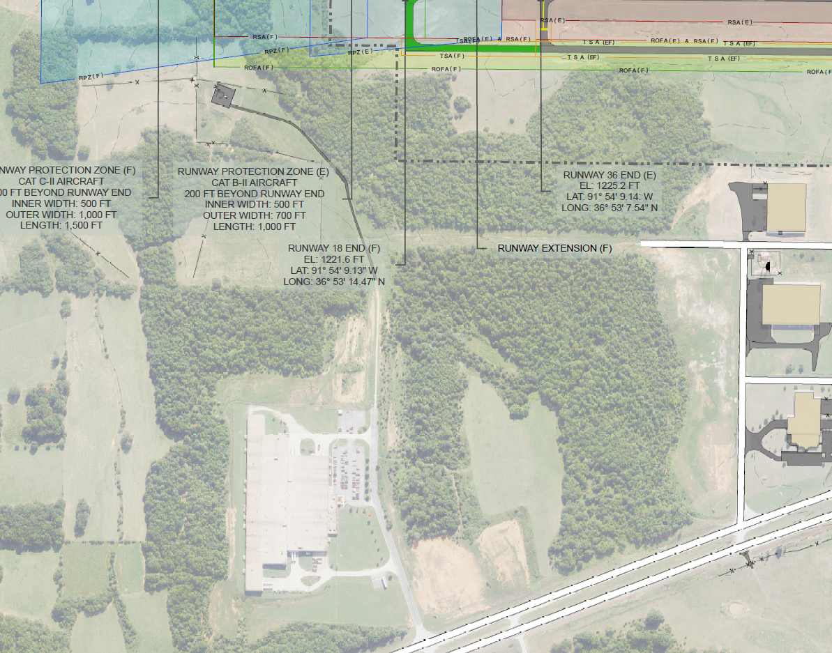
I'm having some extremely irritating issues with layers being rasterized producing really horrible lines on several map exports. You can see a few examples of this in the image I included below. This map contains about 15 layers of varying size, several of which are using transparency and is set to print at 34x22". I snagged this off of a print done to .pdf at 400 dip. I tried one at 1400dpi, and while it took forever to export, it really didn't fix anything.
I know that transparent layers can cause some issues exporting from ArcMap and I've tried a number of the fixes I've found online; including ungrouping layers, removing all unnecessary data, and moving the transparent layers as low down on the draw order as possible. Doing this (especially changing the order of the transparent layers) has fixed most of the issues I was having, but these ugly pavement and road symbols are stubborn and still draw poorly. The ugly grey pavement feature seen in the upper lefthand portion of the image is simply a polygon feature with dark grey outline and med grey file. The road feature at the base is a line feature drawn as 3 lines (central while line and 2 black lines as borders) via cartographic representation.
I'm pretty sure that the root of the remaining problems the feature outline mask layer I'm using as a background for my annotations. I've made it greenish and 50% transparent to increase the readability of the labels, but the trouble is, these transparent layers have to be up in this draw order to give much of a benefit.
I could simple get rid of them and go with text halos or some other option, but its going to look much worse and the client has already seen and commented on how much they like these transparent masks, so I'm not keen on removing them.
From what I can tell looking around online, my best option to keep the transparent layers and get a decent print is going to be to export everything to an .ai file opaque and then use illustrator to manage transparencies before the print. Is this really my only option? It just feels wrong that I need to buy another expensive piece of software to take advantage of the features of an even more expensive piece of software we already own.
If anyone knows a better answer than Illustrator I'd really love to know what it is. This has eaten a good chuck of time already and I'd really appreciate any help I can get. Thanks in advance.

- Mark as New
- Bookmark
- Subscribe
- Mute
- Subscribe to RSS Feed
- Permalink
- Report Inappropriate Content
Hi Kevin,
I think you have it correct that ArcMap is rasterizing all layers found under the transparency on the annotation backgrounds. I don't know of any other method besides what you have tried. If you could just put the anno below the pavement layers showing the aliasing effect... but then your dimension anno may not show well.
There is a remedy if you are using bmp markers/fills. But nothing about transparency. See the Rasterization section in Exporting your map—Help | ArcGIS Desktop
If you are able to import your mxd into ArcGIS Pro, I understand that this is not an issue in Pro for printing and exporting.
I agree with the client that the way you have set it up, looks great!