- Home
- :
- All Communities
- :
- Products
- :
- ArcGIS Pro
- :
- ArcGIS Pro Questions
- :
- State plan coordinates to WGS 1984
- Subscribe to RSS Feed
- Mark Topic as New
- Mark Topic as Read
- Float this Topic for Current User
- Bookmark
- Subscribe
- Mute
- Printer Friendly Page
State plan coordinates to WGS 1984
- Mark as New
- Bookmark
- Subscribe
- Mute
- Subscribe to RSS Feed
- Permalink
- Report Inappropriate Content
Hi,
What is the proper way to project state plan coordinate to WGS 1984?
Using ArcGIS Pro I am utilizing Project tool to convert a feature class that has "NAD 1983 StatePlane Nevada East FIPS 2701 Feet" as a coordinate system to "WGS 1984 Web Mercator Auxiliary Sphere"
for this projection what is the name of the transformation ? Also, I see that NAD 1983 StatePlane is in feet does this affect the transformation process?
The project tool doesn't do anything and the data stays at the same location in the output FC.
Thank you,
Ahmad
- Mark as New
- Bookmark
- Subscribe
- Mute
- Subscribe to RSS Feed
- Permalink
- Report Inappropriate Content
The projected file will stay in the same location as the input because it was projected-on-the-fly back to the coordinate system of the map. Open a new map, add the projected file and examine its properties by right-clicking on the layer and examining its extent. As for the transformation, one is normally offered during the projection process.
A list of supported transformations is in this link... although it is having 'issues' opening this morning
http://desktop.arcgis.com/en/arcmap/latest/map/projections/pdf/geographic_transformations.pdf
- Mark as New
- Bookmark
- Subscribe
- Mute
- Subscribe to RSS Feed
- Permalink
- Report Inappropriate Content
Dan,
Thank you for your answer, I tried creating a new map and adding the projected FC to it with no luck. I also started a new project and tried the same and the features still in the same location!
What should I also look into?
Thank you,
- Mark as New
- Bookmark
- Subscribe
- Mute
- Subscribe to RSS Feed
- Permalink
- Report Inappropriate Content
check the original... it should be in the range -180 to 180 an -90 to 90 if the coordinates were in decimal degrees.
If it was outside that range, perhaps the original was already projected and/or defined incorrectly.
You can only project from a know coordinate system to another know one. If either are incorrect, you get garbage
- Mark as New
- Bookmark
- Subscribe
- Mute
- Subscribe to RSS Feed
- Permalink
- Report Inappropriate Content
- Mark as New
- Bookmark
- Subscribe
- Mute
- Subscribe to RSS Feed
- Permalink
- Report Inappropriate Content
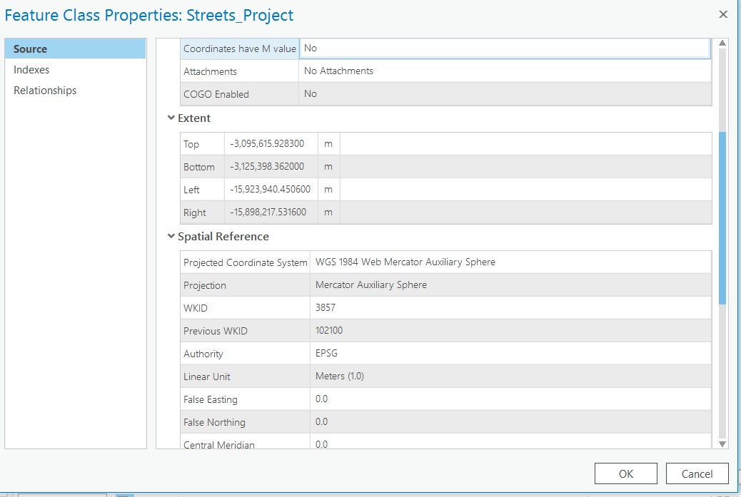
Welll, I have no clue where it is. It was projected from something to something and it keeps ending up in the southern hemisphere in water... I would get the original
- Mark as New
- Bookmark
- Subscribe
- Mute
- Subscribe to RSS Feed
- Permalink
- Report Inappropriate Content
hmm this is what I received and I thought that I am doing something wrong while projecting the data! now I can say its a data issue!!
thank you Dan, very much appreciated!