- Home
- :
- All Communities
- :
- User Groups
- :
- Coordinate Reference Systems
- :
- Questions
- :
- How do you project a new layer from Arc Online tha...
- Subscribe to RSS Feed
- Mark Topic as New
- Mark Topic as Read
- Float this Topic for Current User
- Bookmark
- Subscribe
- Mute
- Printer Friendly Page
How do you project a new layer from Arc Online that in't in Arc Catalog?
- Mark as New
- Bookmark
- Subscribe
- Mute
- Subscribe to RSS Feed
- Permalink
- Report Inappropriate Content
Hello,
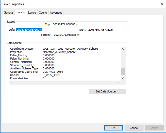
I'm on lab 5 (image attached) on the Maribeth Price "Mastering ArcGIS" book. My problem is that I'm adding a basemap from ArcGIS Online but the coordinate system/projection does not align with the current map.
So, I try to project it, but I can't find the layer in ArcCatalog, it just isn't there because the map I'm using doesn't have a geodatabase it was saved only as a map document that you download from the book.
So, I tried to save the layer so that I can project it using the Project tool. But, I can't seem to save the layer in a way that lets the project tool work.
Also, this is what I posted to my class discussion board:
Hello all,
For lab 5 you're supposed to add the World Terrain basemap from ArcGIS Online. I added it, but it doesn't show up on the map. The coordinate system says its in WGS_1984_Web_Mercator_Auxiliary_Sphere, but the warning when I add it says its in GCS 1984.
So, I try to go and project it to North_America_Equidistant_Conic, the same as the 'Hazards' dataframe, but I can't find the source of the World Terrain layer to project it. So my questions are:
1. How do you save the World Terrain layer so that it shows up in Arc Catalog? (So that I can find it and project it)
2. Is there an easier way to do this such as clicking on the transformations button when the warning appears. If so,
3. How do you know which transformation to use?
Thanks in advanced.
Also, when I try to transform the GCS it only allows a transformation to another GCS. So this doesn't work.
Does this make any sense? Any feedback is appreciated, thank you.
- Mark as New
- Bookmark
- Subscribe
- Mute
- Subscribe to RSS Feed
- Permalink
- Report Inappropriate Content
This question has been resolved. It was fixed by opening a new map, adding the basemap to a counties map, then transforming the basemap from WGS 1983 to NAD 1984 using the first transformation in the list. Then the counties layer was removed. Then, the layers of the original map were dragged and dropped into the new map (using two ArcMap screens). Shout out to Ahmed for resolving the original thread.
- Mark as New
- Bookmark
- Subscribe
- Mute
- Subscribe to RSS Feed
- Permalink
- Report Inappropriate Content
As for projecting data... The tools in ArcToolbox are most useful since those tools exist in ArcMap and in ArcGIS Pro
For instance, you don't need arccatalog at all, you can use
Project—Data Management toolbox | ArcGIS Desktop
which appears in the same location in both in the toolbox.