- Home
- :
- All Communities
- :
- User Groups
- :
- Cartography and Maps
- :
- Questions
- :
- How do I retroactively make a point it snap to the...
- Subscribe to RSS Feed
- Mark Topic as New
- Mark Topic as Read
- Float this Topic for Current User
- Bookmark
- Subscribe
- Mute
- Printer Friendly Page
How do I retroactively make a point it snap to the road?
- Mark as New
- Bookmark
- Subscribe
- Mute
- Subscribe to RSS Feed
- Permalink
- Report Inappropriate Content
I am transferring locations from a paper map to ArcMap so that I can calculate the difference between locations. The locations don't have to be exact because the animal locations I am mapping can cover large distances. What I did to transfer the locations is create a road along the coast and then add points along the road. There seems to be a problem because the points are not quite on the road. Even when I zoom in really far and add points to the road they will end up a little off of it. I selected by location for points intersecting the road and less than 1/3 of my points for each map end up on the road. I am guessing that I should have been using the snapping tool all along. Is there anyway to snap retroactively or a different tool to add the point locations to the road? or do I have to start over? Thank you so much for your help!
- Mark as New
- Bookmark
- Subscribe
- Mute
- Subscribe to RSS Feed
- Permalink
- Report Inappropriate Content
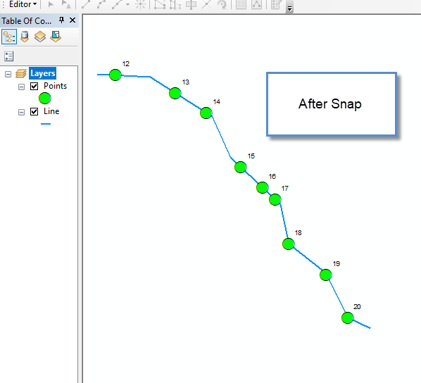
You can use the Geoprocessing Tool Snap.

- Mark as New
- Bookmark
- Subscribe
- Mute
- Subscribe to RSS Feed
- Permalink
- Report Inappropriate Content
Thank you! This was very helpful.