- Home
- :
- All Communities
- :
- Developers
- :
- ArcGIS Pro SDK
- :
- ArcGIS Pro SDK Questions
- :
- Added MapPoints receive a coarser coordinate preci...
- Subscribe to RSS Feed
- Mark Topic as New
- Mark Topic as Read
- Float this Topic for Current User
- Bookmark
- Subscribe
- Mute
- Printer Friendly Page
Added MapPoints receive a coarser coordinate precision than the input
- Mark as New
- Bookmark
- Subscribe
- Mute
- Subscribe to RSS Feed
- Permalink
- Report Inappropriate Content
Hi everyone,
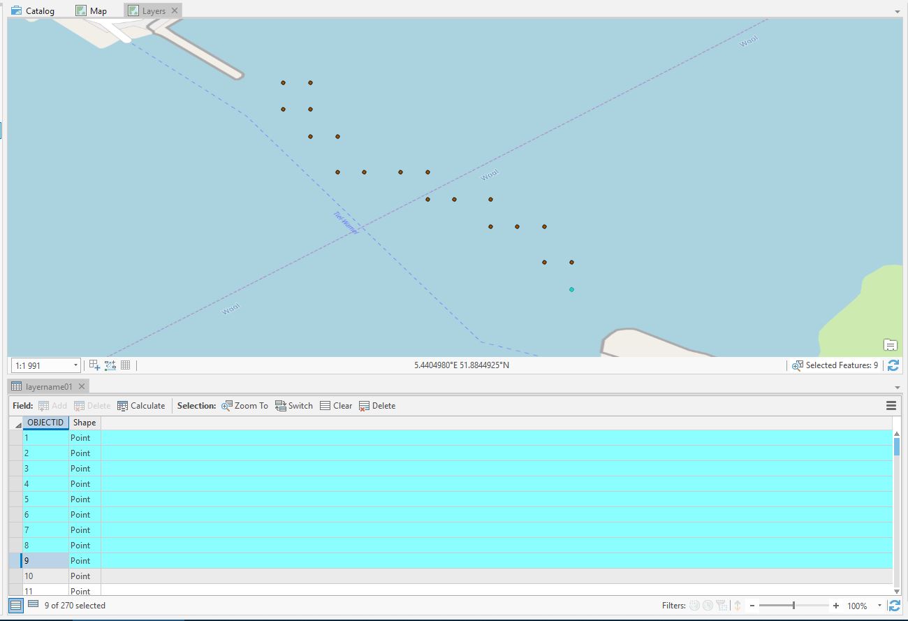
I have a list of mappoints (a total of 270) with lat and lon values. When I add these points to my map they appear only on a few locations, resulting in about 10 points per location (see capture below), even though they should be all in row with small steps in between. This seems to me like some sort of resolution or precision problem (or even unwanted aggregation?). Does anyone know how I can plot the points on the correct locations? Could it be due to the FeatureLayer? I use the following code to get the points in GIS pro:
var mp1 = new MapPointBuilder();
for (int i = 0; i < Longitude.Length; i++)
{
mp1 = new MapPointBuilder(Longitude, Latitude, 0, 0);
MapPoint mPoint = mp1.ToGeometry();
MapPointBuilder.CreateMapPoint(mPoint, SpatialReferences.WGS84);
var createFeatures = new EditOperation();
createFeatures.Create(fLayer, mPoint);
createFeatures.Execute();
}
Thanks in advance!