- Home
- :
- All Communities
- :
- User Groups
- :
- Coordinate Reference Systems
- :
- Questions
- :
- prj-file not Esri readable
- Subscribe to RSS Feed
- Mark Topic as New
- Mark Topic as Read
- Float this Topic for Current User
- Bookmark
- Subscribe
- Mute
- Printer Friendly Page
prj-file not Esri readable
- Mark as New
- Bookmark
- Subscribe
- Mute
- Subscribe to RSS Feed
- Permalink
- Report Inappropriate Content
Hello Esri-community,
I'm testing various transformation tools in order to transform shapefiles and feature classes from gauss krueger (epsg 31468) to utm32 (epsg 25832). No I'm running into the problem that I get not Esri-readable prj files (e.g. when using ogr2ogr). I think the problem is the problem might be the EPSG name and the GEOGCS name ("ETRS898" vs "GCS_ETRS_1989"). As soon as I change this parameters to the Esri-format everything is fine and ArcGIS recognizes the EPSG Code. Spatialreference.org as well as EPSG Geodetic Parameter Registry refer to the epsg code 25832 as "ETRS89 / UTM zone 32N" whereas files which are transformed in ArcGIS refer to "ETRS_1989_UTM_Zone_32N".
http://spatialreference.org/ref/epsg/25832/esriwkt/
PROJCS["ETRS89 / UTM zone 32N",GEOGCS["ETRS89",DATUM["D_ETRS_1989",SPHEROID["GRS_1980",6378137,298.257222101]],PRIMEM["Greenwich",0],UNIT["Degree",0.017453292519943295]],PROJECTION["Transverse_Mercator"],PARAMETER["latitude_of_origin",0],PARAMETER["central_meridian",9],PARAMETER["scale_factor",0.9996],PARAMETER["false_easting",500000],PARAMETER["false_northing",0],UNIT["Meter",1]]esri-prj-file
PROJCS["ETRS_1989_UTM_Zone_32N",GEOGCS["GCS_ETRS_1989",DATUM["D_ETRS_1989",SPHEROID["GRS_1980",6378137.0,298.257222101]],PRIMEM["Greenwich",0.0],UNIT["Degree",0.0174532925199433]],PROJECTION["Transverse_Mercator"],PARAMETER["False_Easting",500000.0],PARAMETER["False_Northing",0.0],PARAMETER["Central_Meridian",9.0],PARAMETER["Scale_Factor",0.9996],PARAMETER["Latitude_Of_Origin",0.0],UNIT["Meter",1.0]]How is that possible or how can I avoid that I have to change my prj files after transforming them?
Thank you a lot for your help,
Carolin
PS: something similar occurs when I use
gdalsrsinfo -o wkt_esri "EPSG:25832"- Mark as New
- Bookmark
- Subscribe
- Mute
- Subscribe to RSS Feed
- Permalink
- Report Inappropriate Content
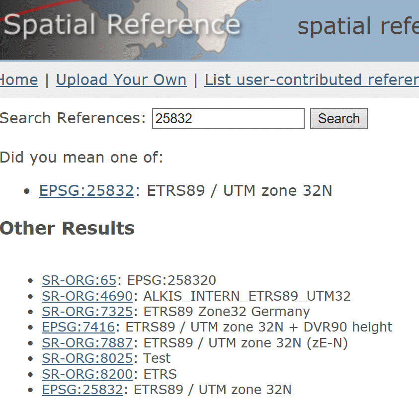
Yet, when you go to the spatial ref site and query by 25832.
you get a number of other options... Do any match esri's?
- Mark as New
- Bookmark
- Subscribe
- Mute
- Subscribe to RSS Feed
- Permalink
- Report Inappropriate Content
It seems that ETRS: SR-ORG Projection -- Spatial Reference matches the Esri WKT style. But I can't address this url directly while transforming with e.g. ogr2ogr (at least not when I want to transfrom with an additional NTv2 grid). As far as I understand it I have to transform in 2 steps in order to get an esri readable prj file.