- Home
- :
- All Communities
- :
- Products
- :
- ArcGIS Pro
- :
- ArcGIS Pro Questions
- :
- Tool to create grid with referenced points
- Subscribe to RSS Feed
- Mark Topic as New
- Mark Topic as Read
- Float this Topic for Current User
- Bookmark
- Subscribe
- Mute
- Printer Friendly Page
Tool to create grid with referenced points
- Mark as New
- Bookmark
- Subscribe
- Mute
- Subscribe to RSS Feed
- Permalink
- Report Inappropriate Content
Hello,
Pardon me if I don't describe my question with correct terminology, I'm still quite new at GIS work.
I'll describe what I'm trying to accomplish and then hopefully someone can point me in the right direction to get started.
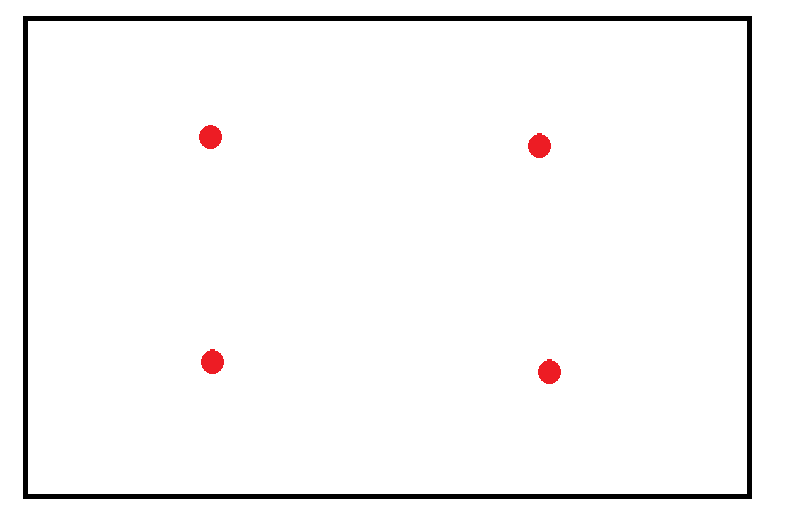
I'm looking to create a grid (I think a grid) over some polygons that represent the borders of agricultural fields. The grid should place a point at 1 acre spacing across the field. Then in the field, personnel will navigate to those points to collect a sample.
The picture I've attached demonstrates rougly what I'm going for. With the red dots in the field being the collection points. Now, not all the fields will be perfect rectangles. Is what I'm hoping to accomplish possible in ArcGIS Pro?
Thanks!
- Mark as New
- Bookmark
- Subscribe
- Mute
- Subscribe to RSS Feed
- Permalink
- Report Inappropriate Content
quick and dirty solution.
do a negative buffer of your fields by some offset distance that is appropriate for your fields (ie 30 m or 100 ft)
convert he buffer to points
That would be perfect if your buffers are rectangular.
You can also do this using the Fishnet tool... converting to points and removing duplicates... or just use an appropriate fishnet size and use the label points.
I wrote Point tools for Pro … mesh points option
but if you want a fancy offset from the border... sorry, that has a low market appeal
- Mark as New
- Bookmark
- Subscribe
- Mute
- Subscribe to RSS Feed
- Permalink
- Report Inappropriate Content
Thanks Dan,
The buffer and fishnet tools seem like they would work well for rectangular areas. However many of the areas I'm working with are irregular, like in the attached pic.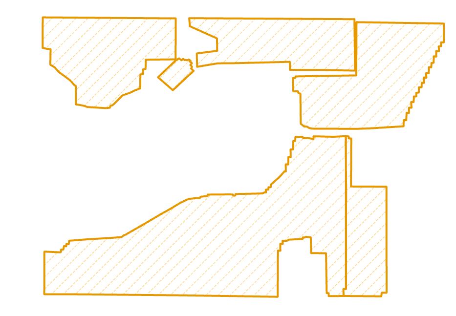
Lets say that the above area encompasses 100 acres. Ideally I can create 100 different sampling points evenly (as much as possibled) spaced within the above polygons. Perhaps this could be accomplished by converting the polygons to raster datasets and then using the center of the raster cells as my sampling locations?
- Mark as New
- Bookmark
- Subscribe
- Mute
- Subscribe to RSS Feed
- Permalink
- Report Inappropriate Content
or just create a fishnet over the area (like a raster cell), and get the label points for the ones you want to keep... a little bit manual, but if you are looking for the one-button-solves-all solution, it may take more time to find it or write it than to put some quasi-automation-human-selection into it