Turn on suggestions
Auto-suggest helps you quickly narrow down your search results by suggesting possible matches as you type.
Cancel
- Home
- :
- All Communities
- :
- Products
- :
- Geoprocessing
- :
- Geoprocessing Questions
- :
- GeoTagged Photos to Points; -9999 in Direction fie...
Options
- Subscribe to RSS Feed
- Mark Topic as New
- Mark Topic as Read
- Float this Topic for Current User
- Bookmark
- Subscribe
- Mute
- Printer Friendly Page
GeoTagged Photos to Points; -9999 in Direction field
Subscribe
637
2
06-22-2018 06:50 AM
06-22-2018
06:50 AM
- Mark as New
- Bookmark
- Subscribe
- Mute
- Subscribe to RSS Feed
- Permalink
- Report Inappropriate Content
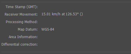
The output of my GeoTagged Photos to Points tool gives a "-9999" in the direction field. Examining the EXIF data of the photos, I can see that they do, in fact, have a bearing embedded. I'm wondering why this information isn't captured in the output feature class?
2 Replies
12-18-2018
05:45 AM
- Mark as New
- Bookmark
- Subscribe
- Mute
- Subscribe to RSS Feed
- Permalink
- Report Inappropriate Content
Hey Brian,
What device is being used to capture the images? Based on the syntax of exif_data.png file, I am wondering if the Geoprocessing tool is having a hard time parsing the EXIF data into a readable format that it can write to the attribute table?
Are you able to provide a txt file output of the EXIF information? I would like to compare it to some images that I have on my end.
Danny
12-18-2018
05:54 AM
- Mark as New
- Bookmark
- Subscribe
- Mute
- Subscribe to RSS Feed
- Permalink
- Report Inappropriate Content