- Home
- :
- All Communities
- :
- Products
- :
- ArcGIS Pro
- :
- ArcGIS Pro Questions
- :
- Geoprocessing Tools Hang After Finishing
- Subscribe to RSS Feed
- Mark Topic as New
- Mark Topic as Read
- Float this Topic for Current User
- Bookmark
- Subscribe
- Mute
- Printer Friendly Page
Geoprocessing Tools Hang After Finishing
- Mark as New
- Bookmark
- Subscribe
- Mute
- Subscribe to RSS Feed
- Permalink
- Report Inappropriate Content
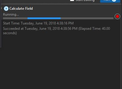
I've found another odd behavior in Pro that's cropped up recently. When running geoprocessing tools, they will occasionally sit there with a status of "Running..." after it reports "Succeeded at Tuesday, June 19...", with the progress bar just scrolling through like it's still working.
The ArcGIS Pro GUI becomes incredibly slow, and Resource Monitor reports higher than normal usage (at least 25% on a quad-core machine, when normally it only uses 5-10% just sitting there). There does not appear to be any abnormal disk, memory, or network activity. The ArcGIS Pro Diagnostic Monitor doesn't report anything out of the ordinary.
The system will sit here as long as you let it. Most of the time I can clear it out by switching from the map tab to the Catalog tab in the main window, but sometimes a hard Resource Monitor => End Process is required to break it out of its slumber.
I've experienced this when working on local datasets in a project saved locally. I'm not aware of anything that would be relying on the network (as that's been a problem for us in the past with our setup). I am also not writing the results to XML, as per Dan's answer here. I'm running ArcGIS Pro 2.1.3 on Windows 10 Pro, Version 1803 (the April Update)
Anyone got any ideas?
- Mark as New
- Bookmark
- Subscribe
- Mute
- Subscribe to RSS Feed
- Permalink
- Report Inappropriate Content
Five months later, and after switching organizations, I've come up against hangups that exhibit very similar behavior to what I first reported. It seems like something isn't releasing the UI after certain tasks are completed.
Environment
ArcGIS Pro 2.2.3
Windows 7 SP 1
Xeon E3-1275 v2, 24 GB Ram, Quadro K200D
MS Active Directory network
Dataset
Utah Road Centerlines feature class from the state GIS clearinghouse: Roads and Highway System
I've confirmed that subsetting the data to Salt Lake County via DefQuery/Export, and then subsetting further to major roads via DefQuery/Export, does not change the behavior (it is a large feature class, but the major road subset only has ~7000 features).
Behavior
Certain actions cause the interface to go unresponsive or extremely slow when working with the centerlines:
- Opening the project for the first time.
- Making any symbology change that would update the map (clicking Apply Symbology, changing from Single Symbol to Unique Values, dragging layers around in Symbol Layer Drawing).
- Running the Import Symbology tool to apply symbology to the centerlines feature class.
- Running field calculator on a field in the attribute table (same behavior as originally reported).
After these actions, the interface goes unresponsive for a split second as normally happens. The map pane will refresh to display the updated symbology as expected. However, the icons in the ribbon stay grayed out, as do the icons at the very top (Save/Open/New, Undo/Redo). The cursor displays the spinning progress circle when I move it anywhere around the interface EXCEPT for the map pane, where it displays the Explore finger. Navigating around the map pane at this time is extremely slow, as are any identify operations. Sometimes an inadvertent click to identify an area not covered by the feature class causes a full hang while the Identifying progress bar appears indefinitely, requiring a full End Process to recover (and subsequent loss of any unsaved work).
As the interface is hung, Task Manager reports ~25% CPU usage while the ArcGIS Performance Monitor does not report any hangs or any real activity (as noted before).
Pausing the map pane does not change the behavior. Without pausing, the map pane updates as it should so it doesn't seem to be related to the actual drawing of the data.
Workaround
Once the interface hangs, if I switch the map pane over to the catalog and then back to the map pane (using the tabs at the top of the map pane) it "releases" the full interface and everything goes back to normal. This works for small one-time changes, but doing this every time I move a layer in the Drawing Order is just painful (and frustrating when doing it five times, then having it hard hang and lose all that work because I didn't save after every layer move).
Troubleshooting
I've tried the following different scenarios with no changes:
- Project saved on a network drive, feature class saved in GDB saved on a network drive.
- Project saved on a network drive, feature class saved in GDB saved on a local drive.
- Project saved on a local drive, feature class saved in GDB saved on a network drive.
- Project saved on a local drive, feature class saved in GDB saved on a local drive.
With the project saved on a local drive, I've tried it against a copy of the feature class I downloaded two weeks ago, subsetted to Salt Lake County, and put in a network-based GDB; exporting this copy to a local GDB; re-extracting the downloaded GDB from the zip folder into a local folder; and downloading the GDB anew and extracting it into a local folder. None of these variations showed any difference either.
Other feature classes in the network-based GDB rarely exhibit the same behavior.
I don't remember what dataset I was running into problems with on my original post, but there is a better-than-not chance it was a download of the same feature class.
I have the project packaged in a small (<2mb) package that I can send by e-mail if anyone wants to try reproducing the problem.
- Mark as New
- Bookmark
- Subscribe
- Mute
- Subscribe to RSS Feed
- Permalink
- Report Inappropriate Content
Having this same issue. It's a shame that this posting has been ignored. great detail in your breakdown.
In my case, geometry and attachments look ok in the GDB, and I can also access and test the data. Even though the geoprocessing window is still acting like it is doing something after 24 hours. I am going to try performing this same process in Desktop catalog. I feel like it provides a better idea of actual progress/status. Hopefully someone at esri can answer this one. I would hate if I ended my process and lost the wor