- Home
- :
- All Communities
- :
- Products
- :
- Geoprocessing
- :
- Geoprocessing Questions
- :
- Hi guys. I am a total beginner in ArcGIS, and I ha...
- Subscribe to RSS Feed
- Mark Topic as New
- Mark Topic as Read
- Float this Topic for Current User
- Bookmark
- Subscribe
- Mute
- Printer Friendly Page
Hi guys. I am a total beginner in ArcGIS, and I have a question on how to proceed step by step to complete an easy project.
- Mark as New
- Bookmark
- Subscribe
- Mute
- Subscribe to RSS Feed
- Permalink
- Report Inappropriate Content
I have:
- a big map of my country
- a shapefile with a "reference area"
- several coordinates to identify some points
I should:
- put the points on the map
- draw the minimum convex polygon for the points
- find the percentage of the MCP included into the reference area.
Could someone help me explaining step-by-step how to proceed?
I guess it's really easy but I never used ArcGIS before.
Thank you in advance
Nebbiolo
- Mark as New
- Bookmark
- Subscribe
- Mute
- Subscribe to RSS Feed
- Permalink
- Report Inappropriate Content
To start, some additional questions:
- what format is the data in (the country map, the reference area and the list of coordinates)?
- what coordinate systems are used for the data sets? If they are different you will probably need to project the data into a common projection.
- what software are you using and when version (ArcMap, ArcGIS Pro, ArcGIS Online)?
- what license level do you have? (this defines which tools are available to you)
In general, you will probably need to plot the points on the map. This can be done with XY events: Make XY Event Layer—Help | ArcGIS Desktop
To create a convex hull polygon you can use the tool Minimum Bounding Geometry—Help | ArcGIS Desktop . This will require an Advanced license of Desktop, but can be achieved with some minor scripting and a Basic license.
With the area derived from the MCP you can use the Intersect—Help | ArcGIS Desktop tool to determine the overlapping area and calculate the percentage.
- Mark as New
- Bookmark
- Subscribe
- Mute
- Subscribe to RSS Feed
- Permalink
- Report Inappropriate Content
Hi Xander,
thanks a lot for your reply 
I attach you a screenshot to be clearer. This is the situation: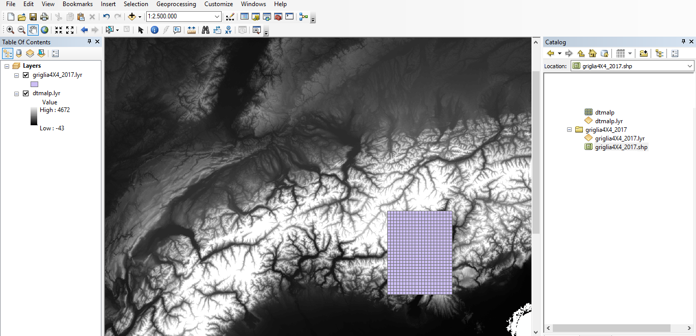
in short, I have a .shp and a dtm.
Coordinates are X_UTM and Y_UTM, they are in a normal excel file at the moment. I am using ArcMap in ArcGIS Desktop 10.6. I got the student edition ArcGIS Desktop Advanced (Single Use).
- Mark as New
- Bookmark
- Subscribe
- Mute
- Subscribe to RSS Feed
- Permalink
- Report Inappropriate Content
In you screenshot I notice a raster layer with the terrain model of the Alps. I assume that this layer is not used in the process you described, right?
Have you tried to create the XY events layer using the tool I mentioned? You license will have access to the Convex Hull tool, so that is not a problem. It would be good to load the shapefile "gringlia4X4_2017.shp" into a File Geodatabase and write the Convex Hull also to a FGDB. This way the area will be managed by ArcGIS and are directly available to you.