- Home
- :
- All Communities
- :
- Products
- :
- ArcGIS Pro
- :
- ArcGIS Pro Questions
- :
- Create Mobile Map Package failed at 72%
- Subscribe to RSS Feed
- Mark Topic as New
- Mark Topic as Read
- Float this Topic for Current User
- Bookmark
- Subscribe
- Mute
- Printer Friendly Page
Create Mobile Map Package failed at 72%
- Mark as New
- Bookmark
- Subscribe
- Mute
- Subscribe to RSS Feed
- Permalink
- Report Inappropriate Content
I am making an attempt to create a mobile map package in ArcGIS Pro which incorporates parcels , roads and a network dataset . I'm continuously obtaining this error once running the tool virtually at seventy two percent.
here is my parameters.

Then I attempted to run the dissolve network just in case it should facilitate, conjointly I got this error.

Thanks
- Mark as New
- Bookmark
- Subscribe
- Mute
- Subscribe to RSS Feed
- Permalink
- Report Inappropriate Content
Are you running this Pro instance on a VM or Physical machine?
Where is the data located that the MMPK is being created from?
- Mark as New
- Bookmark
- Subscribe
- Mute
- Subscribe to RSS Feed
- Permalink
- Report Inappropriate Content
Thanks, I am running it on Physical machine.
My Data is in a network, but I made a local copy and getting the same error.
- Mark as New
- Bookmark
- Subscribe
- Mute
- Subscribe to RSS Feed
- Permalink
- Report Inappropriate Content
What are the machine specs that ArcGIS Pro is being run on?
How much free space is located on the hard drive(s)?
I have seen in the past where creating these MMPK's can take a lot of machine resources to complete the process.
- Mark as New
- Bookmark
- Subscribe
- Mute
- Subscribe to RSS Feed
- Permalink
- Report Inappropriate Content
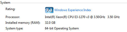
75GB Free Space,
Thank you
- Mark as New
- Bookmark
- Subscribe
- Mute
- Subscribe to RSS Feed
- Permalink
- Report Inappropriate Content
I had 32 GB of memory last year, and it was not unusual to wait several hours and see similar messages. Sometimes you just have to try again, and there is no logical reason why one mobile map package is successful. I have had to do that as many as seven times, usually just once.
Your MMPK might cover too large of an area, or have too much data. The data is being compressed by a factor of 10, and that is why it takes so long. I had to keep parsing my dataset down from a few states, to counties, down to smaller areas as I tried to make map packages for a railroad operating in 26 states.
Remember that MMPK is stored within system memory on a phone or tablet, and that the SD card cannot be used. That may change in a new release of Navigator.
Since I have never had more memory, I cannot say whether it might help. You do have a very fast processor, probably the fastest a company would want to buy.
- Mark as New
- Bookmark
- Subscribe
- Mute
- Subscribe to RSS Feed
- Permalink
- Report Inappropriate Content
Yes I am in my 5th attempt now.
- Mark as New
- Bookmark
- Subscribe
- Mute
- Subscribe to RSS Feed
- Permalink
- Report Inappropriate Content
Try turning on clip features, or using a clipped subset of parcels as your area of interest. The area of interest can just be a uncomplicated boundary shapefile, if that is appropriate to your task. In some states, I would dissolve a statewide county outline into separate, individual county boundaries. If you are in Texas: Political Boundaries | TNRIS - Texas Natural Resources Information System
- Mark as New
- Bookmark
- Subscribe
- Mute
- Subscribe to RSS Feed
- Permalink
- Report Inappropriate Content
Thank you, Will try that and let you know.
- Mark as New
- Bookmark
- Subscribe
- Mute
- Subscribe to RSS Feed
- Permalink
- Report Inappropriate Content
NO Luck still same error of the network dataset has not been dissolved.