- Home
- :
- All Communities
- :
- Industries
- :
- Natural Resources
- :
- Renewable Energy
- :
- Renewable Energy Questions
- :
- River Shapefiles
- Subscribe to RSS Feed
- Mark Topic as New
- Mark Topic as Read
- Float this Topic for Current User
- Bookmark
- Subscribe
- Mute
- Printer Friendly Page
- Mark as New
- Bookmark
- Subscribe
- Mute
- Subscribe to RSS Feed
- Permalink
- Report Inappropriate Content
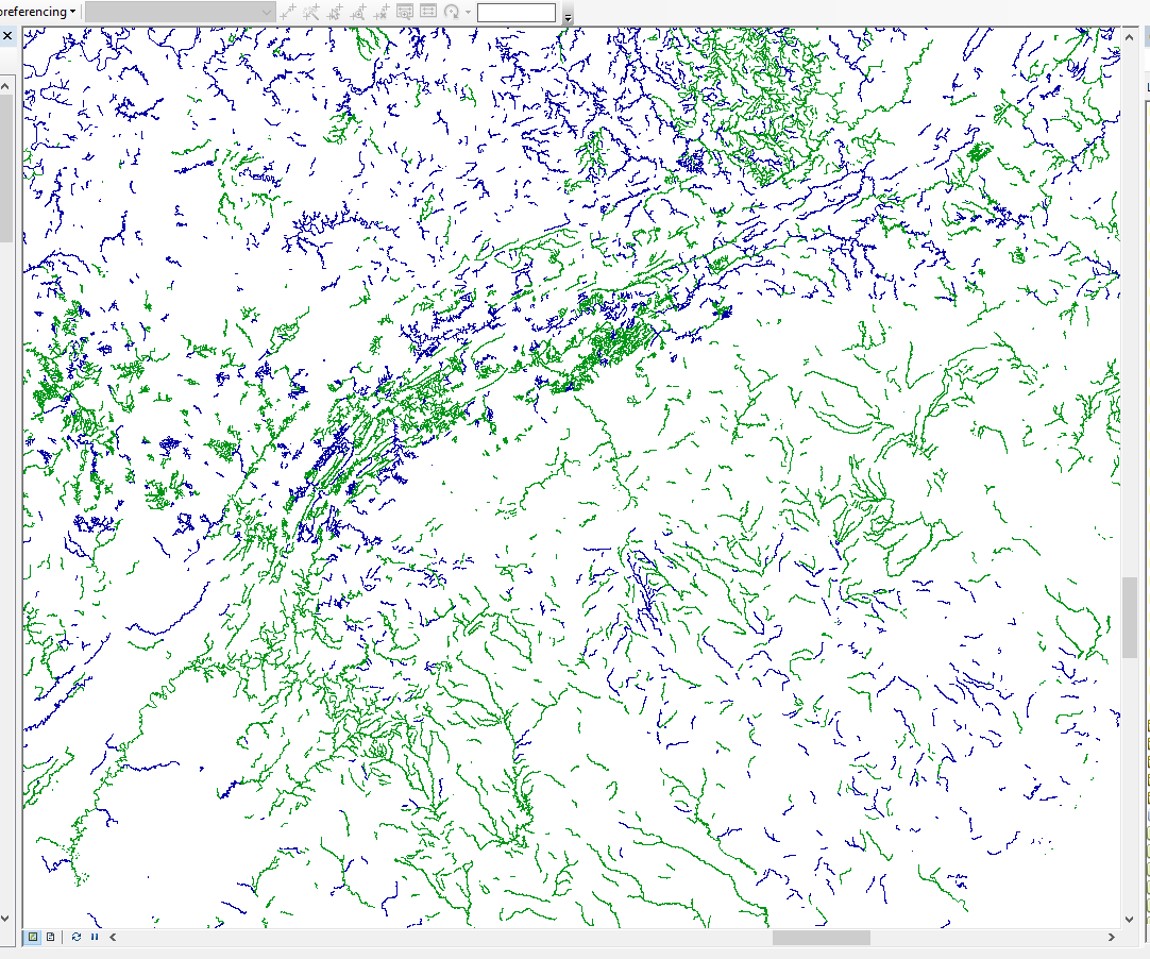
I have two polyline shapefiles of rivers, each of which displays segments that have some level of pollution. The first shapefile displays polluted segments as green and the second displays polluted segments as blue in the image below. There are two shapefiles because each displays different type of pollution, but for my purposes, the type of pollution isn't of concern. I am only concerned with whether a river is 'polluted' or 'not polluted'.
As can be seen, some river segments are coincident, while others are not. I would like to create a single shapefile from these two that displays only 'polluted' segments of river, regardless of type of pollution. I ultimately want to calculate 'total length of polluted rivers' within a given area without regard to type of pollution, but I am especially concerned with avoiding 'double counting' for those segments of rivers that are coincident (i.e., segments that are shown as 'polluted' in both shapefiles).
Can someone suggest the best method in ArcGIS to create this single shapefile of 'polluted rivers' while avoiding double counting? I am using v. 10.3.
Thanks a lot - I really appreciate any advice here.
- Mark as New
- Bookmark
- Subscribe
- Mute
- Subscribe to RSS Feed
- Permalink
- Report Inappropriate Content
One workflow would be this:
1. Run Merge on the two shapefiles. Merge—Help | ArcGIS Desktop
2. Run Dissolve on the result of the Merge. Dissolve—Help | ArcGIS for Desktop
3. Then field calculate the lengths (Calculate Geometry) to update them (as you are using shapefiles, which don't auto-update like feature classes in a geodatabase).
Assumptions:
1. The shapefiles are coincident in that the river segments that do overlap are in the same location. If they are not, for example say they were collected at different accuracy's and are off by a foot from each other, this process will not work. However, If they are off, there are processes to try to fix that. If so, post that and we can suggest a few.
2. The shapefiles only are of polluted features - ie they do not contain segments of unpolluted features. If they do contain unpolluted segments, a pre-processing step will be needed to thin down the shapefiles to just the polluted segments before running this process.
Chris Donohue, GISP