- Home
- :
- All Communities
- :
- Products
- :
- ArcGIS Insights
- :
- ArcGIS Insights Questions
- :
- Does Insight for ArcGIS support Polyline geometry ...
- Subscribe to RSS Feed
- Mark Topic as New
- Mark Topic as Read
- Float this Topic for Current User
- Bookmark
- Subscribe
- Mute
- Printer Friendly Page
Does Insight for ArcGIS support Polyline geometry type?
- Mark as New
- Bookmark
- Subscribe
- Mute
- Subscribe to RSS Feed
- Permalink
- Report Inappropriate Content
Does Insight for ArcGIS support Polyline geometry type? I would like to enable location for the dataset using this shape field, but it looks like that could not do this.
Thanks.
Thao
- Mark as New
- Bookmark
- Subscribe
- Mute
- Subscribe to RSS Feed
- Permalink
- Report Inappropriate Content
I have worked with polyline geometry in Insights without any problems, calculating additional fields and creating different charts:
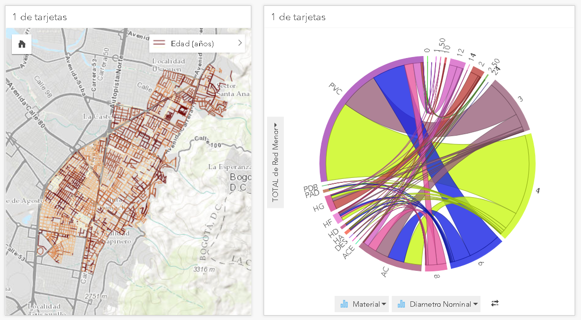
and

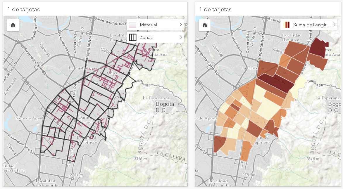
In addition I have also done aggregation of lines inside polygons, which worked like a charm:
So what is your specific use case and how is your data stored? I used hosted feature services published to my portal.
This months Insights 2.3 was released: Insights for ArcGIS 2.3 released! Model data connections and make predictions which allows you to create link maps from Link analysis—Analyze data in Insights | ArcGIS . This will create polylines from 2 point locations (like migration data).
- Mark as New
- Bookmark
- Subscribe
- Mute
- Subscribe to RSS Feed
- Permalink
- Report Inappropriate Content
What is the data source? Hosted feature layer in Portal/AGOL or enterprise geodatabase in DBMS such as Oracle, SQL Server, etc.? Insights should automatically pick up the shape field so no need to enable location, and yes polylines are supported. There might be an issue with your spatial reference or geometry storage type.
- Mark as New
- Bookmark
- Subscribe
- Mute
- Subscribe to RSS Feed
- Permalink
- Report Inappropriate Content
When you say it could be an issue with your spatial reference or geometry storage type what do you mean?
Do you mean that a certain storage type is not supported? or are you talking about some kind of corruption issue with the storage .
I am having the exact same problem where I am using data from enterprise geodatabase (Oracle) and insight does not pick up the shape field .
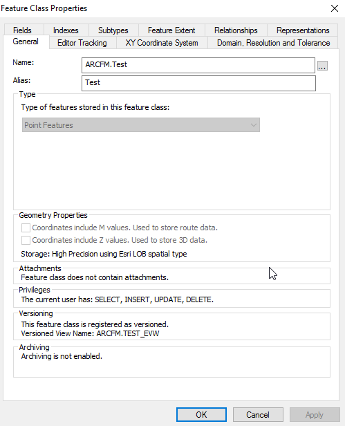
The Storage type on the feature class i am trying to use with Insight is as shown ESRI LOB Spatial type. Any suggestion
or help is appreciated.
- Mark as New
- Bookmark
- Subscribe
- Mute
- Subscribe to RSS Feed
- Permalink
- Report Inappropriate Content
Sorry, But I have already done with the feature layer (from the registered database). I am now connecting data directly to an enterprise geodatabase in Oracle DBMS. So I'm not sure with a polyline feature class, we need to enable location or not. If needed, how can we enable? If not, what should I do without publishing as a service?. Here is a sample feature class for your reference.
Thank you!
- Mark as New
- Bookmark
- Subscribe
- Mute
- Subscribe to RSS Feed
- Permalink
- Report Inappropriate Content
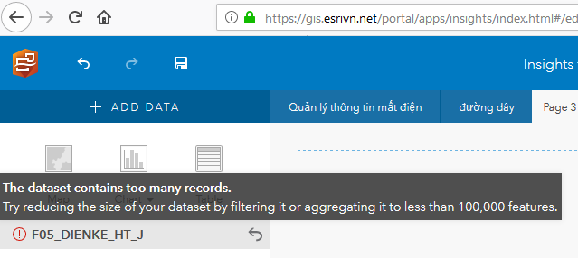
By the way, in case my feature class had more than 100,000 features, can they be fully displayed on a map by adding data directly from a database connection (not a feature layer)? I saw this error after adding the data (about 162,000 records contained):
Thanks.