Turn on suggestions
Auto-suggest helps you quickly narrow down your search results by suggesting possible matches as you type.
Cancel
- Home
- :
- All Communities
- :
- Products
- :
- ArcGIS Pro
- :
- ArcGIS Pro Questions
- :
- Shapefile for the Unincorporated Area of a County
Options
- Subscribe to RSS Feed
- Mark Topic as New
- Mark Topic as Read
- Float this Topic for Current User
- Bookmark
- Subscribe
- Mute
- Printer Friendly Page
Shapefile for the Unincorporated Area of a County
Subscribe
899
1
04-26-2018 09:04 AM
04-26-2018
09:04 AM
- Mark as New
- Bookmark
- Subscribe
- Mute
- Subscribe to RSS Feed
- Permalink
- Report Inappropriate Content
Hello,
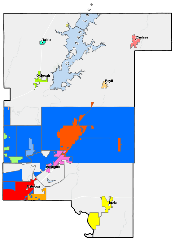
I recently downloaded a shapefile that shows the individual city and towns within a specific county. I noticed that part of the unincorporated portion of this county has polygons but there are parts of the unincorporated area that does not have a polygon. Does anyone know of a tool within ArcGIS Pro that could add a polygon for the unincorporated areas to the shapefile? I've attached an example of Rogers County, OK which has all the municipal boundaries. Part of the unincorporated area has a polygon but there is a large area that doesn't.
1 Reply
04-26-2018
03:54 PM
- Mark as New
- Bookmark
- Subscribe
- Mute
- Subscribe to RSS Feed
- Permalink
- Report Inappropriate Content
Is the data in the shapefile incorrect? What is the data source (from where was it downloaded)?