- Home
- :
- All Communities
- :
- Products
- :
- Mapping and Charting Solutions
- :
- Mapping and Charting Questions
- :
- Help: Drawing straight lines using the polygon too...
- Subscribe to RSS Feed
- Mark Topic as New
- Mark Topic as Read
- Float this Topic for Current User
- Bookmark
- Subscribe
- Mute
- Printer Friendly Page
Help: Drawing straight lines using the polygon tool
- Mark as New
- Bookmark
- Subscribe
- Mute
- Subscribe to RSS Feed
- Permalink
- Report Inappropriate Content
Hi,
I'm currently using Arcmap 10.3.1. and I am trying to manually outline glacier extent on Landsat imagery at 30 m resolution. I wan to draw a straight line around each pixel edge to create a polygon of glacier area. When I am drawing the line they often have angle changes in them so that they do not appear straight (see image below).
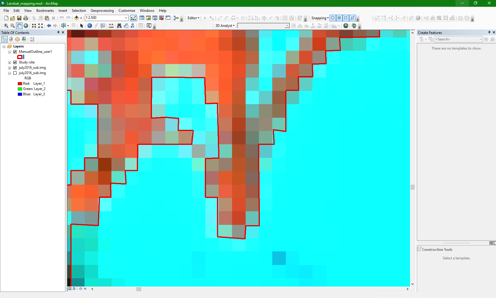
Is there a way to efficiently draw perfectly straight lines? - e.g. shift and drag as in Adobe Illustrator to get a perfectly straight line
Thanks in advance.
- Mark as New
- Bookmark
- Subscribe
- Mute
- Subscribe to RSS Feed
- Permalink
- Report Inappropriate Content
Hi, Josh. Your best bet is the GOGO toolbar.
Good luck!,
Joe
- Mark as New
- Bookmark
- Subscribe
- Mute
- Subscribe to RSS Feed
- Permalink
- Report Inappropriate Content
Thank you, I will have a read up on how to use this tool.
- Mark as New
- Bookmark
- Subscribe
- Mute
- Subscribe to RSS Feed
- Permalink
- Report Inappropriate Content
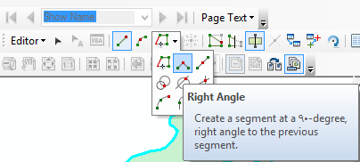
I notice that you are to digitize the pixels of raster that have the four primary direction ( 0 - 90 - 180 - 270 )
so the Right angle tool will be appropriate or this purpose
- Mark as New
- Bookmark
- Subscribe
- Mute
- Subscribe to RSS Feed
- Permalink
- Report Inappropriate Content
Thank you for suggesting this. I have just tried this method out and it performs the task in a much quicker and more accurate way than I had managed previously.
- Mark as New
- Bookmark
- Subscribe
- Mute
- Subscribe to RSS Feed
- Permalink
- Report Inappropriate Content
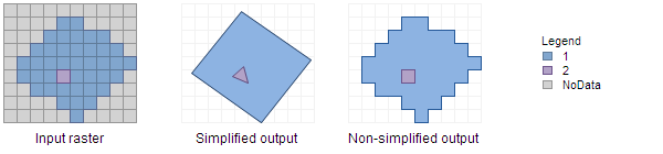
Maybe it's more complicated than this, but have you ruled out choosing some raster value threshold, setting values above to 1, below to 0, and creating a polygon from that mask? At the very least, I'd try to use this as a starting point - digitizing raster cells looks torturous.
- Mark as New
- Bookmark
- Subscribe
- Mute
- Subscribe to RSS Feed
- Permalink
- Report Inappropriate Content
Thank you for your suggestion. I am currently trying to assess how accurately a automated thresholding process generates glacier outlines and compare this to a manual digitisation. Hence the need for a quick and reliable way to digitise in straight lines.
- Mark as New
- Bookmark
- Subscribe
- Mute
- Subscribe to RSS Feed
- Permalink
- Report Inappropriate Content
Okay, counter-proposal: digitize freehand identifying the raster cells to be considered the "manual digitization", convert to raster and back out to line/polygon to get the straight lines.
