- Home
- :
- All Communities
- :
- Developers
- :
- JavaScript Maps SDK
- :
- JavaScript Maps SDK Questions
- :
- Extent and map rotation
- Subscribe to RSS Feed
- Mark Topic as New
- Mark Topic as Read
- Float this Topic for Current User
- Bookmark
- Subscribe
- Mute
- Printer Friendly Page
Extent and map rotation
- Mark as New
- Bookmark
- Subscribe
- Mute
- Subscribe to RSS Feed
- Permalink
- Report Inappropriate Content
I learned something late last night that I thought some might find helpful. My client really liked the Attribute Table view widget I created for them, they just wanted one more thing. Filter by Extent. No problem I said at 4:00 pm, done that several times, 30 min tops. I code it up and all looks good until I notice that things on the screen are not on my list and things that are not on my screen are. 2 hours later I think to place a graphic on the screen where the bounding box is. And it was not at all where I thought it should be.
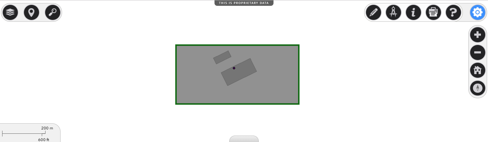
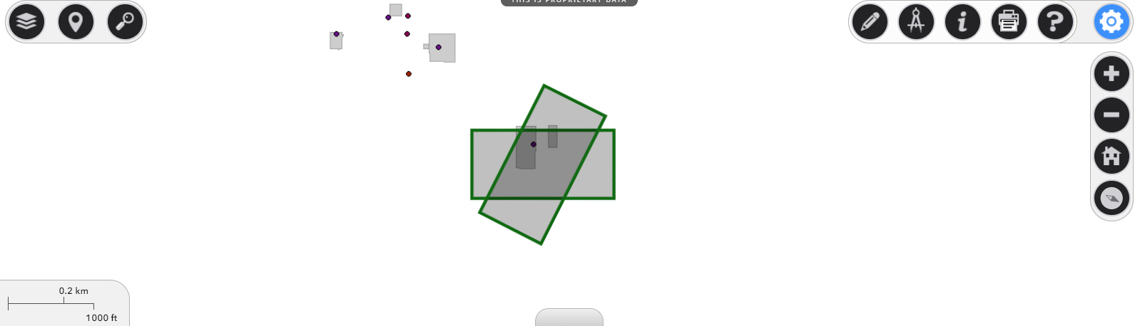
The images below are two polygons, the first is the bounding box of the Views.Extent, the second is a bounding box created by using the ScreenToMap util. The first image is with roation=0, the second is with roation=120.
Rotation = 0
Rotation = 120
My Solution:
if (m.isFilterByExtentOn) {
let xmin = 0;
let ymin = 0;
let xmax = $('#viewDiv').width();
let ymax = $('#viewDiv').height() ;
let pt1 = mainMapView.toMap(xmin,ymin);
let pt2 = mainMapView.toMap(xmax,ymin);
let pt3 = mainMapView.toMap(xmax,ymax);
let pt4 = mainMapView.toMap(xmin,ymax);
let geom = new EsriPolygon({
hasZ: false,
hasM: false,
spatialReference: pt1.spatialReference,
rings: [[[pt1.x, pt1.y], [pt2.x, pt2.y], [pt3.x, pt3.y], [pt4.x, pt4.y], [pt1.x, pt1.y]]]
});
query.geometry = geom;
query.geometryType = "polygon";
query.spatialRelationship = 'intersects';
}