- Home
- :
- All Communities
- :
- Products
- :
- ArcGIS CityEngine
- :
- ArcGIS CityEngine Questions
- :
- sand dunes
- Subscribe to RSS Feed
- Mark Topic as New
- Mark Topic as Read
- Float this Topic for Current User
- Bookmark
- Subscribe
- Mute
- Printer Friendly Page
sand dunes
- Mark as New
- Bookmark
- Subscribe
- Mute
- Subscribe to RSS Feed
- Permalink
- Report Inappropriate Content
How can sand dunes be represented in cityengine ?
- Mark as New
- Bookmark
- Subscribe
- Mute
- Subscribe to RSS Feed
- Permalink
- Report Inappropriate Content
Using CGA?
Or maybe you will need a good terrain and texture(satellite imagery) like https://www.arcgis.com/home/item.html?id=34077131bff7470e892951862df655fd
- Mark as New
- Bookmark
- Subscribe
- Mute
- Subscribe to RSS Feed
- Permalink
- Report Inappropriate Content
Where do I get clear terrain and how do I apply it to my city?
- Mark as New
- Bookmark
- Subscribe
- Mute
- Subscribe to RSS Feed
- Permalink
- Report Inappropriate Content
Like L R suggested creating DEM is good way to start. There is plethora of applications for height map generation so something like Height Map Editor may be good for one off job.
- Mark as New
- Bookmark
- Subscribe
- Mute
- Subscribe to RSS Feed
- Permalink
- Report Inappropriate Content
Are you using CE 2017?
There´s a option called Get Map Data, then it´s possible to import a good terrain+texture from ArcGIS Online.
Another option SRTM it´´s a Free Digital Elevation Model(DEM) provided by NASA.
- Mark as New
- Bookmark
- Subscribe
- Mute
- Subscribe to RSS Feed
- Permalink
- Report Inappropriate Content
how can I make video from CE PLz?
- Mark as New
- Bookmark
- Subscribe
- Mute
- Subscribe to RSS Feed
- Permalink
- Report Inappropriate Content
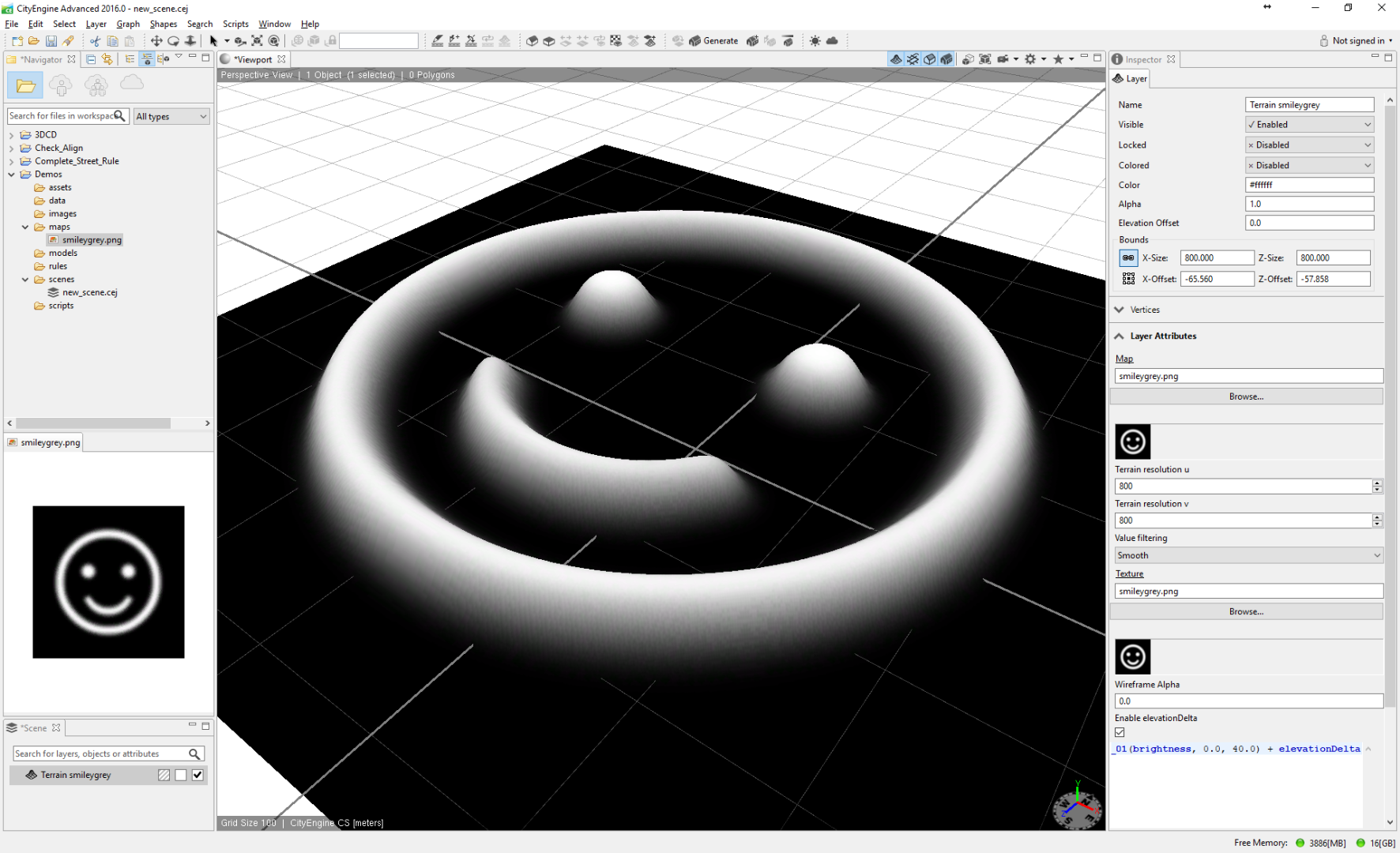
The easiest solution would be to just draw the height layer with an image editor (like Photoshop). Create a greyscale image, paint it black and draw with a soft white brush on a layer on top of it. The brighter, the taller the terrain.
- Mark as New
- Bookmark
- Subscribe
- Mute
- Subscribe to RSS Feed
- Permalink
- Report Inappropriate Content
i can't understand can you explain, or any video explain this step plz?
- Mark as New
- Bookmark
- Subscribe
- Mute
- Subscribe to RSS Feed
- Permalink
- Report Inappropriate Content
There isn't much to explain. Make a new image, go Image > Mode > Greyscale. Then paint whatever you want with a white brush, save the image and open it in CE: