- Home
- :
- All Communities
- :
- Products
- :
- Mapping and Charting Solutions
- :
- Mapping and Charting Questions
- :
- I'm trying to convert a raster reclass to a polygo...
- Subscribe to RSS Feed
- Mark Topic as New
- Mark Topic as Read
- Float this Topic for Current User
- Bookmark
- Subscribe
- Mute
- Printer Friendly Page
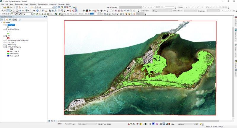
I'm trying to convert a raster reclass to a polygon and can't figure out why the conversion won't work. When I try using the "Raster to Polygon" tool I get bogus results (see images below). Any ideas?
- Mark as New
- Bookmark
- Subscribe
- Mute
- Subscribe to RSS Feed
- Permalink
- Report Inappropriate Content
The area in bright green is the vegetation that I'm trying to convert from raster to polygon (Value = 1 for green area, Value = 0 for no color area). I performed a simple unsupervised classification, reclassified into binary format based on a 1 = what I want, 0 = not what I want, then attempted to convert the resulting raster to polygon.
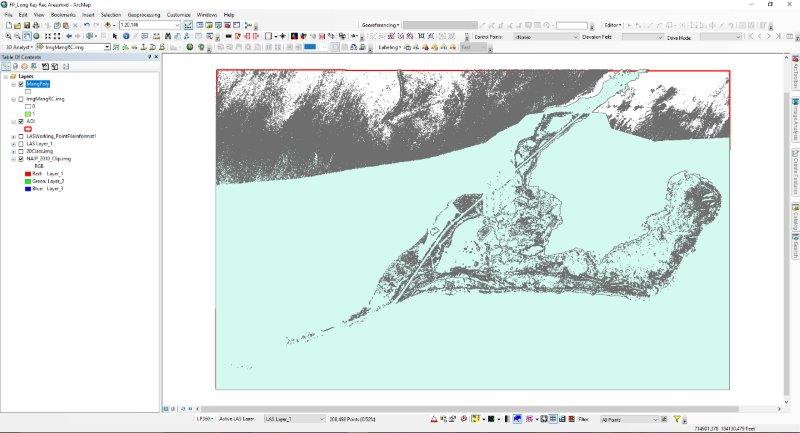
Below is the result I get in polygon format, which doesn't even come close to resembling the green area in the image above.
Solved! Go to Solution.
Accepted Solutions
- Mark as New
- Bookmark
- Subscribe
- Mute
- Subscribe to RSS Feed
- Permalink
- Report Inappropriate Content
It is a little difficult to see from the screenshots you attached (next time just paste the original size, it will show small but allows access to the detailed image), but if yo uhave 0 and 1 values, both will be converted to polygons. If you are only interested in the 1's (vegetation) first use Set Null—Help | ArcGIS Desktop to set the 0 value to NoData.
- Mark as New
- Bookmark
- Subscribe
- Mute
- Subscribe to RSS Feed
- Permalink
- Report Inappropriate Content
Yo may also want to read this help topic to generalize the data before converting to polygons: Generalizing zones with Nibble, Shrink, and Expand—Help | ArcGIS Desktop
- Mark as New
- Bookmark
- Subscribe
- Mute
- Subscribe to RSS Feed
- Permalink
- Report Inappropriate Content
RasterToPolygon only uses the first band from a multiband raster. It looks like you have a 3 band raster.
- Mark as New
- Bookmark
- Subscribe
- Mute
- Subscribe to RSS Feed
- Permalink
- Report Inappropriate Content
This worked like a charm. Thanks Xander!
- Mark as New
- Bookmark
- Subscribe
- Mute
- Subscribe to RSS Feed
- Permalink
- Report Inappropriate Content
Glad it worked!