- Home
- :
- All Communities
- :
- Products
- :
- ArcGIS Pro
- :
- ArcGIS Pro Questions
- :
- Catalog of ArcGIS Pro doesn’t show the coordinate ...
- Subscribe to RSS Feed
- Mark Topic as New
- Mark Topic as Read
- Float this Topic for Current User
- Bookmark
- Subscribe
- Mute
- Printer Friendly Page
Catalog of ArcGIS Pro doesn’t show the coordinate system of the feature class,
- Mark as New
- Bookmark
- Subscribe
- Mute
- Subscribe to RSS Feed
- Permalink
- Report Inappropriate Content
Catalog of ArcGIS Pro doesn’t show the coordinate system of the feature class,
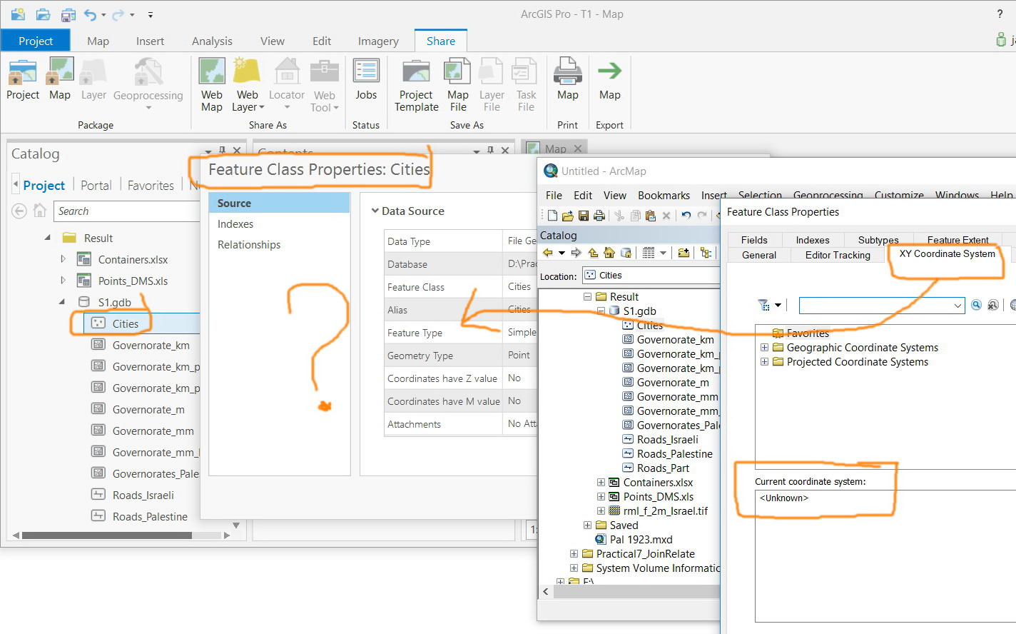
Considering the fact that the Catalog of ArcGIS Pro doesn’t show the coordinate system of the feature class, does this mean that we need to add the feature class to a map in order to recognize its coordinate system?

Jamal Numan
Geomolg Geoportal for Spatial Information
Ramallah, West Bank, Palestine
Solved! Go to Solution.
Accepted Solutions
- Mark as New
- Bookmark
- Subscribe
- Mute
- Subscribe to RSS Feed
- Permalink
- Report Inappropriate Content
Looks like this has been addressed for ArcGIS Pro 2.2...ArcGIS Pro: Include/Add Extent and Spatial Reference to Feature Class Source Tab
- Mark as New
- Bookmark
- Subscribe
- Mute
- Subscribe to RSS Feed
- Permalink
- Report Inappropriate Content
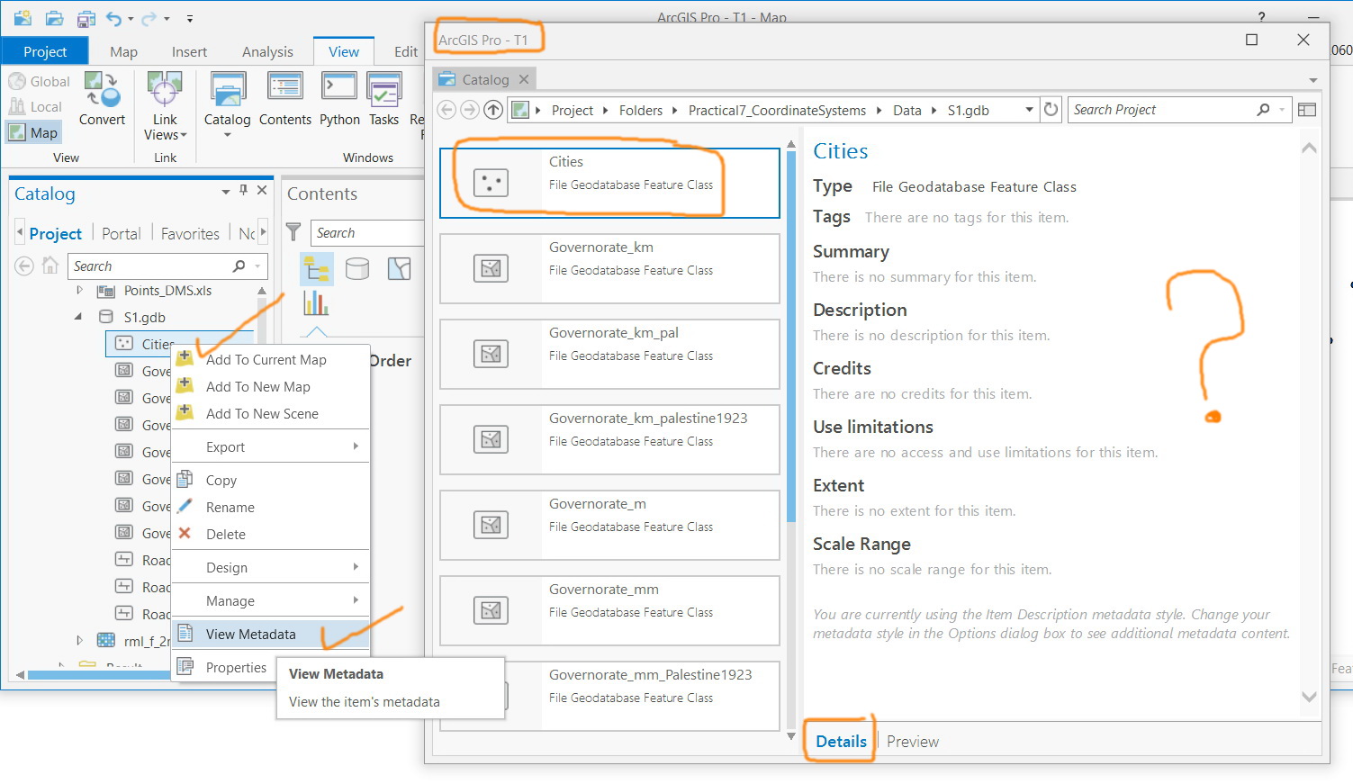
You could right click on the feature class in the Catalog Pane and select "View Metadata" Inside the Metadata, go to the Spatial Reference section and there you will see it without adding it to a new Map View.
- Mark as New
- Bookmark
- Subscribe
- Mute
- Subscribe to RSS Feed
- Permalink
- Report Inappropriate Content
Thanks Robert.
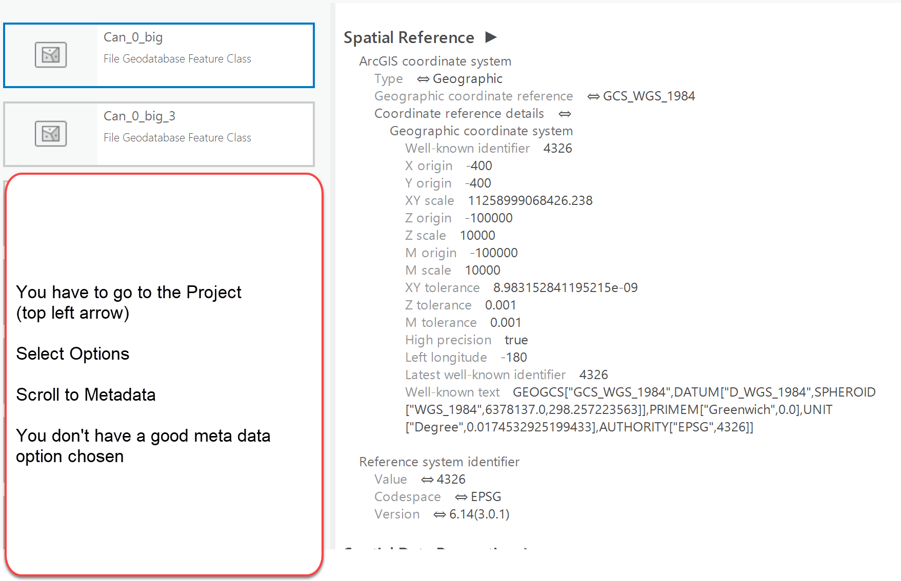
Not sure but I found nothing related to spatial reference in the metadata as shown in the screenshot below
Jamal Numan
Geomolg Geoportal for Spatial Information
Ramallah, West Bank, Palestine
- Mark as New
- Bookmark
- Subscribe
- Mute
- Subscribe to RSS Feed
- Permalink
- Report Inappropriate Content
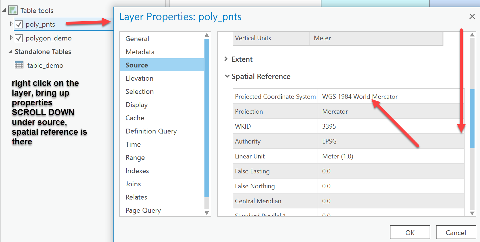
you have to scroll a bit
- Mark as New
- Bookmark
- Subscribe
- Mute
- Subscribe to RSS Feed
- Permalink
- Report Inappropriate Content
Thanks Dan,
My issue here is how to recognize the coordinate system of a feature class from the Catalog Pane but not while we are working in the Content Pane.
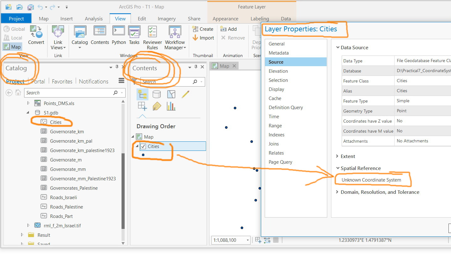
Correct, the Content pane does show the coordinate system but this means that I need to add the feature class to Map just to check its coordinate system
Jamal Numan
Geomolg Geoportal for Spatial Information
Ramallah, West Bank, Palestine
- Mark as New
- Bookmark
- Subscribe
- Mute
- Subscribe to RSS Feed
- Permalink
- Report Inappropriate Content
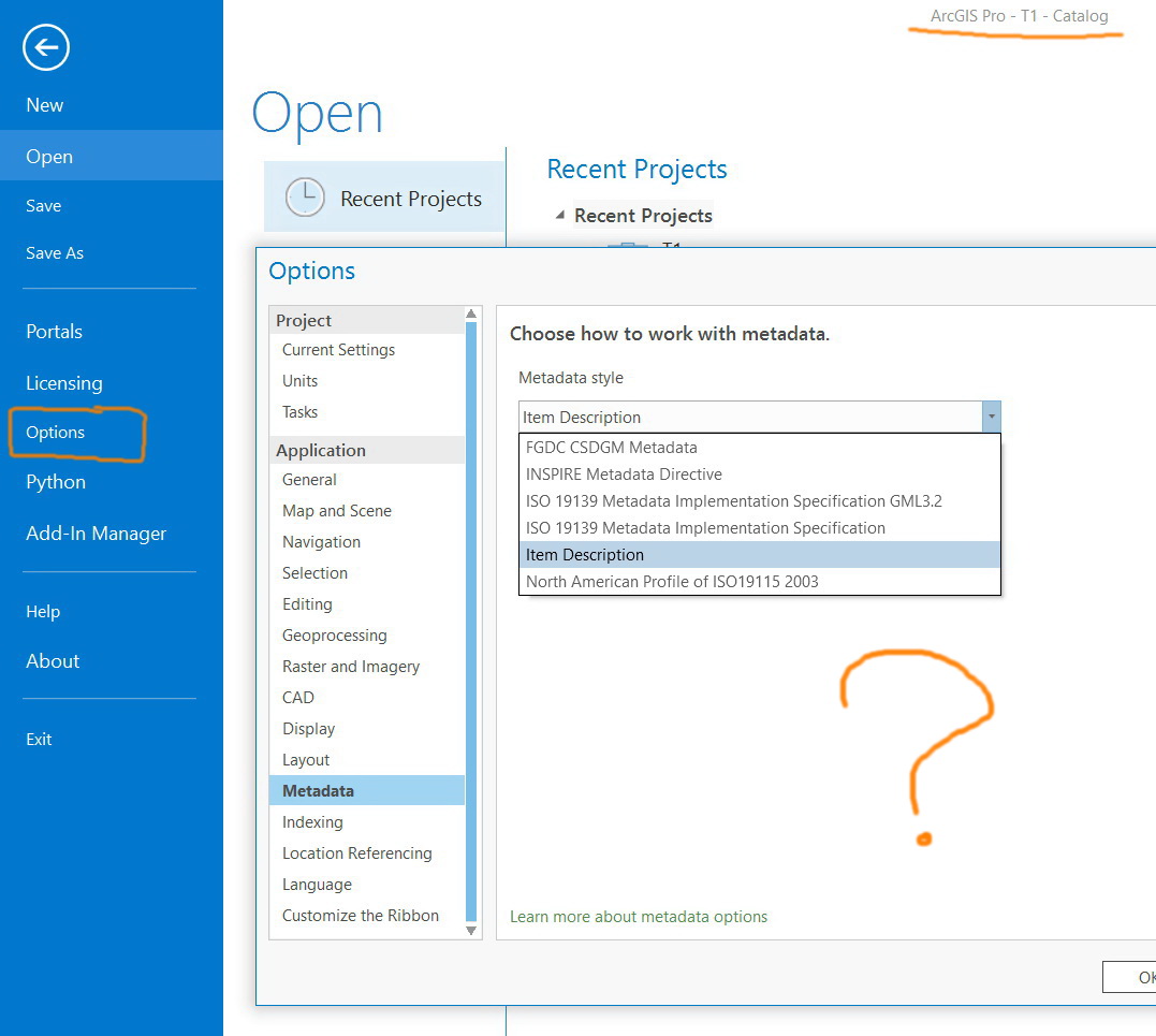
You have a weak metadata setup
go to the Options pane and set one, so when you explore 'Metadata' in catalog all will be revealed.
- Mark as New
- Bookmark
- Subscribe
- Mute
- Subscribe to RSS Feed
- Permalink
- Report Inappropriate Content
If you want to explore the coordinate systems of the layer in your map you should use the Map properties windo, select "Coordinate Systems" and expand "Layers" to see what coordinate systems are in use by which layers.
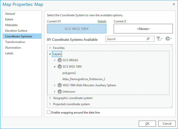
(just like you are probably used to do with the data frame properties window in ArcMap)
- Mark as New
- Bookmark
- Subscribe
- Mute
- Subscribe to RSS Feed
- Permalink
- Report Inappropriate Content
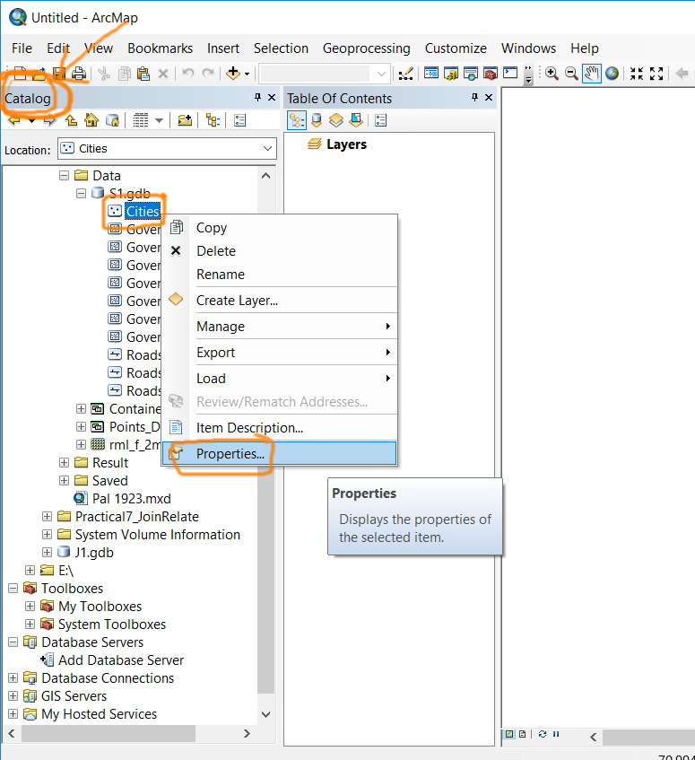
It appears that there is no simple way to approach to recognize the coordinate system of a particular layer straightaway from the Catalog in Pro as it is available in ArcMap (all can be found by right clicking the layer)

Jamal Numan
Geomolg Geoportal for Spatial Information
Ramallah, West Bank, Palestine
- Mark as New
- Bookmark
- Subscribe
- Mute
- Subscribe to RSS Feed
- Permalink
- Report Inappropriate Content
Choose the FGDC metadata option... your option selection is not very good, nor is having a file with an unknown coordinate system
- Mark as New
- Bookmark
- Subscribe
- Mute
- Subscribe to RSS Feed
- Permalink
- Report Inappropriate Content
Not sure why should I experience all of this just to recognize the coordinate system of a feature class. I think this should be made straightforward as in ArcMap
Jamal Numan
Geomolg Geoportal for Spatial Information
Ramallah, West Bank, Palestine