- Home
- :
- All Communities
- :
- Products
- :
- ArcGIS Pro
- :
- ArcGIS Pro Questions
- :
- A georeferenced image (with one control point) fai...
- Subscribe to RSS Feed
- Mark Topic as New
- Mark Topic as Read
- Float this Topic for Current User
- Bookmark
- Subscribe
- Mute
- Printer Friendly Page
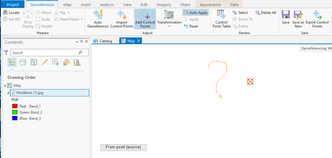
A georeferenced image (with one control point) fails to appear as “zoom to layer” tool is applied,
- Mark as New
- Bookmark
- Subscribe
- Mute
- Subscribe to RSS Feed
- Permalink
- Report Inappropriate Content
A georeferenced image (with one control point) fails to appear as “zoom to layer” tool is applied,
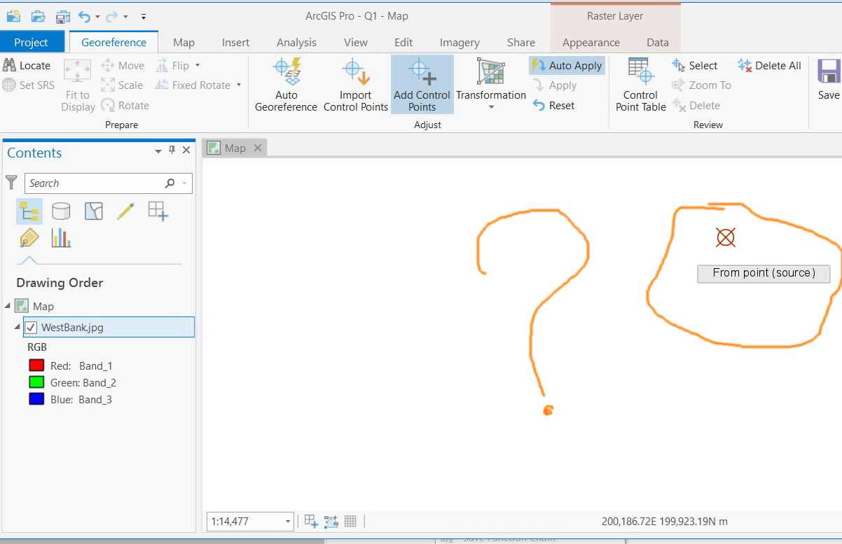
In the screenshots below, the image is georeferenced with one control point. However, as the “zoom to layer” tool is applied, the image fails to appear.
What might be the issue here?


Jamal Numan
Geomolg Geoportal for Spatial Information
Ramallah, West Bank, Palestine
- Mark as New
- Bookmark
- Subscribe
- Mute
- Subscribe to RSS Feed
- Permalink
- Report Inappropriate Content
What is the coordinate system of the image?
This issue may arise if the image is of a low quality (check the number of Rows/Columns).
Alternatively, you could Turn Off Auto Apply tool in the Adjust Group, so that the image doesn't move while adding the GCPs.
Think Location
- Mark as New
- Bookmark
- Subscribe
- Mute
- Subscribe to RSS Feed
- Permalink
- Report Inappropriate Content
Thanks Jayanta
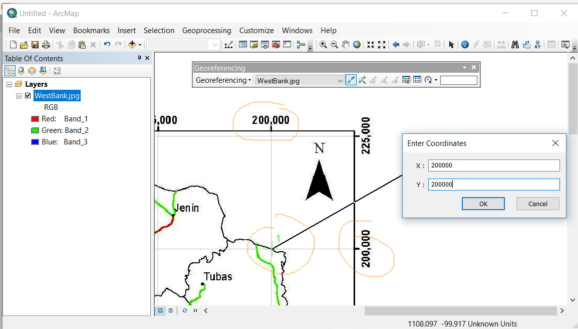
The same image is georeferenced in ArcMap without any issue.
The coordinate system of the data frame (Map) is “Palestine 1923 Palestine Grid”. The image is attached

Jamal Numan
Geomolg Geoportal for Spatial Information
Ramallah, West Bank, Palestine
- Mark as New
- Bookmark
- Subscribe
- Mute
- Subscribe to RSS Feed
- Permalink
- Report Inappropriate Content
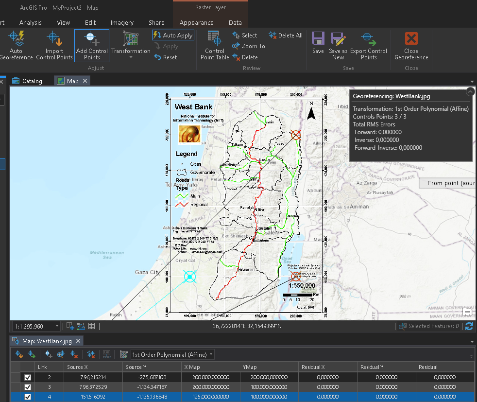
You should always provide multiple points. With 1 point a zero-order polynomial shift is applied. Keep in minder that the jpg has no cell size and the result will not be in any way precise. It will use the cellsize of 1 unit and not apply transformation towards the appropriate cell size. You will need at least 3 control points to aplpy a first-order or affine transformation to shift, scale, and rotate a raster dataset. This will keep straight lines straight. Choose the 3 control points well spread of the image to get a decent result.
- Mark as New
- Bookmark
- Subscribe
- Mute
- Subscribe to RSS Feed
- Permalink
- Report Inappropriate Content
Thanks Xander.
My issue here is not how I should do the georeferencing. The issue here is that the Pro fails to zoom as the first control point is applied. How can I proceed to take the second point while the image is not displayed (this is despite the fact that this is done decently with no issues in ArcMap).


Jamal Numan
Geomolg Geoportal for Spatial Information
Ramallah, West Bank, Palestine
- Mark as New
- Bookmark
- Subscribe
- Mute
- Subscribe to RSS Feed
- Permalink
- Report Inappropriate Content
I would never leave the Auto Apply on when I start to define the control points when the original raster does not have a valid (logical) cell size. I would define my 3 control points and then switch on the Auto Apply:
The fact that the image does not draw after doing a zoom to layer is something for which you create a support case and have it registered as bug, since it doesn't feel like something a user would want to happen.
- Mark as New
- Bookmark
- Subscribe
- Mute
- Subscribe to RSS Feed
- Permalink
- Report Inappropriate Content
For me, I do prefer having “auto apply” on so that I’m aware of the effect of each entered control point.
I hope that esri experts can confirm if this is a bug.
Jamal Numan
Geomolg Geoportal for Spatial Information
Ramallah, West Bank, Palestine
- Mark as New
- Bookmark
- Subscribe
- Mute
- Subscribe to RSS Feed
- Permalink
- Report Inappropriate Content
If you have the appropriate privileges, you can register a case directly in My Esri or contact your local distributor.
- Mark as New
- Bookmark
- Subscribe
- Mute
- Subscribe to RSS Feed
- Permalink
- Report Inappropriate Content
Sure. We are under maintenance contract. I’ll approach them and see if they can fix it
Jamal Numan
Geomolg Geoportal for Spatial Information
Ramallah, West Bank, Palestine
- Mark as New
- Bookmark
- Subscribe
- Mute
- Subscribe to RSS Feed
- Permalink
- Report Inappropriate Content
I faced this issue when I tried to georefrence the imagery too.