- Home
- :
- All Communities
- :
- User Groups
- :
- Elevation Data
- :
- Questions
- :
- How to process a .bil raster file into a 3d model ...
- Subscribe to RSS Feed
- Mark Topic as New
- Mark Topic as Read
- Float this Topic for Current User
- Bookmark
- Subscribe
- Mute
- Printer Friendly Page
How to process a .bil raster file into a 3d model which CityEngine and ArcPro could read?
- Mark as New
- Bookmark
- Subscribe
- Mute
- Subscribe to RSS Feed
- Permalink
- Report Inappropriate Content
I am currently working with a .bil raster Digital elevation model (DEM) which I am wondering if ArcMap could process in order to produce a 3D model. I am not sure if ArcMap is able to process the z values of the DEM with the .bil format. I wanted to know if I should be using ArcMap to process the raster or is there another software I should be using in order to process the .bil raster into 3D? Are there any tutorials available which might give us step by step instructions on how to process the .bil raster?
- Mark as New
- Bookmark
- Subscribe
- Mute
- Subscribe to RSS Feed
- Permalink
- Report Inappropriate Content
supported raster formats (spatial analyst).....
Then there are variety of links to conversion to and from various file formats, working with raster data in the spatial analyst and 3d analyst.
Perhaps if you have a specific problem you have encountered, or are trying to transition from *Map to *Pro, then that can be addressed as well
- Mark as New
- Bookmark
- Subscribe
- Mute
- Subscribe to RSS Feed
- Permalink
- Report Inappropriate Content
Sorry for not making my question clear Dan, here is what I am trying to do. I am trying to construct a 3D model of the ancient city of Hesban (or Hisban) in Jordan using ESRI CityEngine. To start the project, I purchased a 10 meter DEM from Harris which came in a .bil file format, .hdr and .prj. I am aware that CityEngine will not accept a .bil format in to the 3D viewer without formatting it first into an acceptable format. Therefore, I used the Raster To Other Format Conversion tool in ArcMap to reformat the DEM. But I knew reformatting the DEM would not render DEM into 3D, nevertheless, I imported the new formatted (Tiff) DEM into my Map folder in CityEngine and click and dragged it into the 3D Viewer. Just as I suspected, CityEngine was not able to render the raster into 3D correctly (see the image below).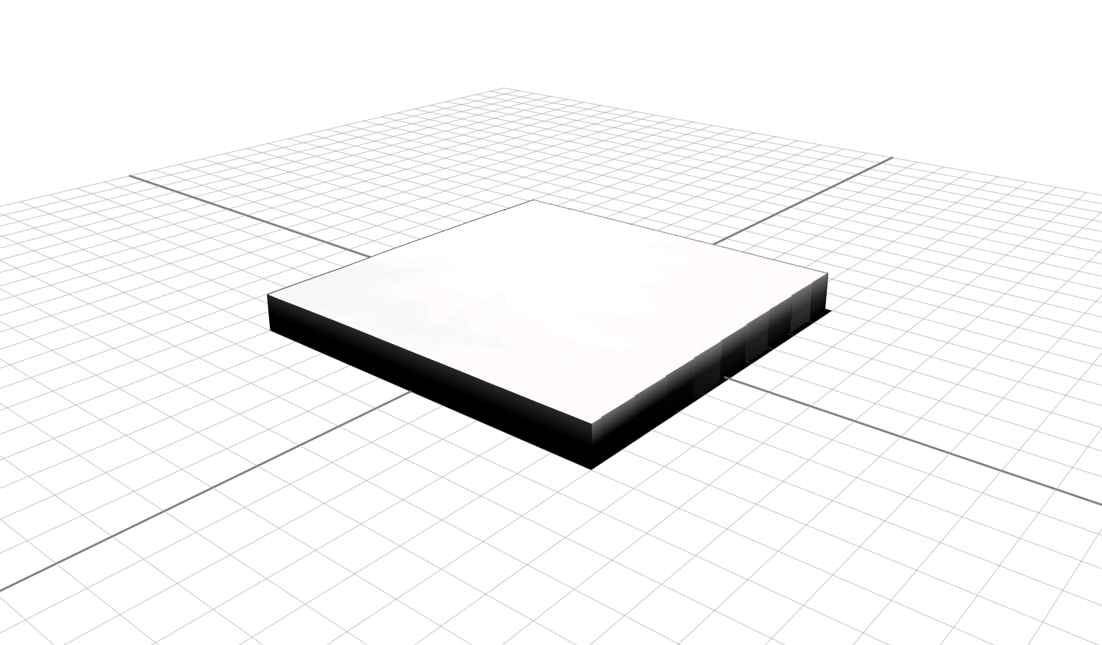
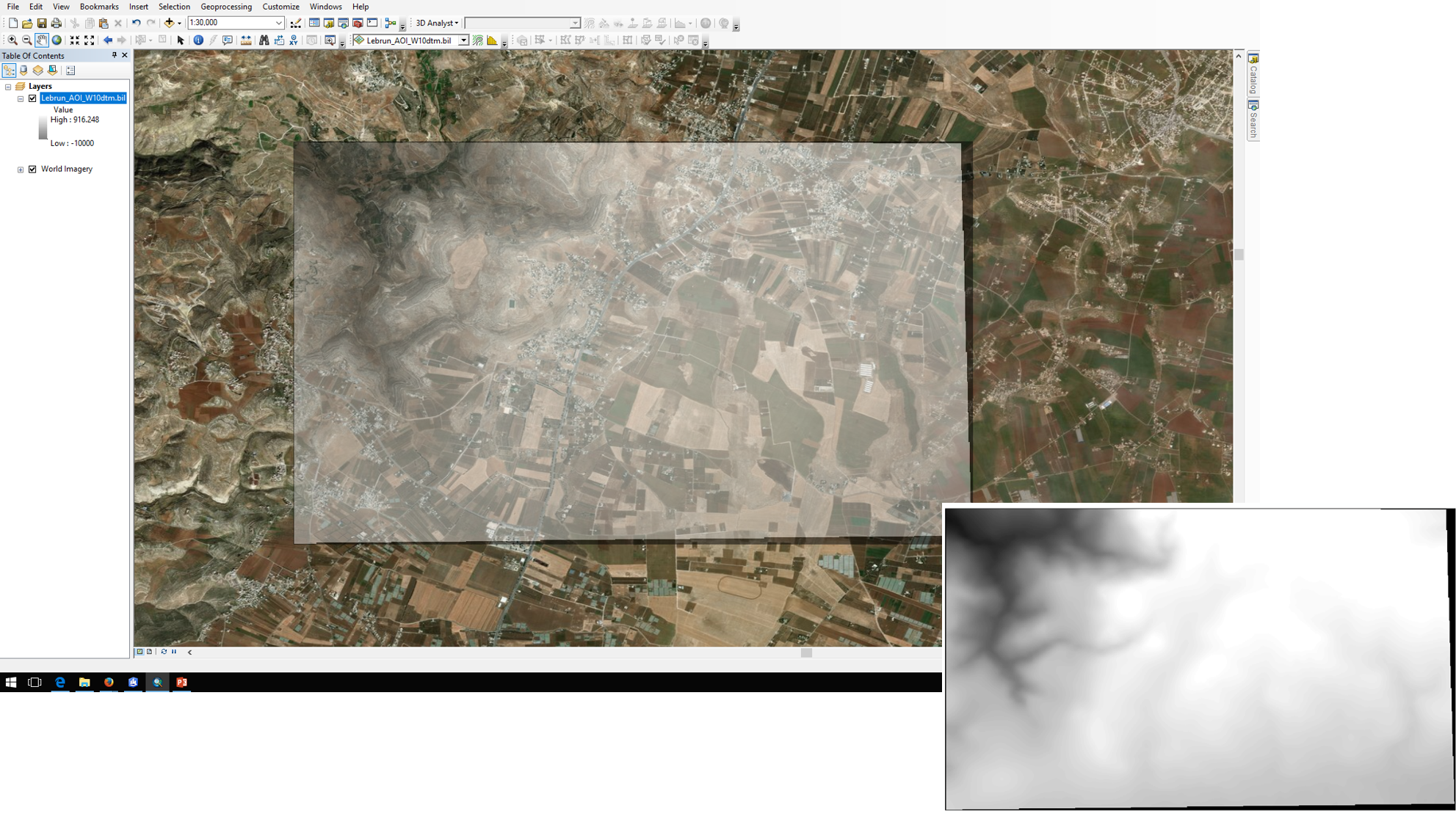
The .bil DEM and the location which it references could be seen in the image below.
Basically, I am trying to find out how to process the DEM in order to have the z values be rendered in 3D. I am assuming I need to have that done first before I could bring it into CityEngine, please correct me if I am wrong. Does ArcMap or ArcGIS Pro have the capability to help process the DEM into 3D and if so How? I really appreciate the help.
- Mark as New
- Bookmark
- Subscribe
- Mute
- Subscribe to RSS Feed
- Permalink
- Report Inappropriate Content
All dem's can be viewed in 3d since the z value is inherently elevation.
I shared this thread to the https://community.esri.com/community/gis/3d/cityengine?sr=search&searchId=28d3d578-2e1c-46e3-91d5-16... Space in the hopes that you might get some better exposure... traffic in the Elevation place is... errr .... flat