- Home
- :
- All Communities
- :
- Developers
- :
- Python
- :
- Python Questions
- :
- How can I access the bands of a raster layer?
- Subscribe to RSS Feed
- Mark Topic as New
- Mark Topic as Read
- Float this Topic for Current User
- Bookmark
- Subscribe
- Mute
- Printer Friendly Page
How can I access the bands of a raster layer?
- Mark as New
- Bookmark
- Subscribe
- Mute
- Subscribe to RSS Feed
- Permalink
- Report Inappropriate Content
I've used MakeNetcdfRasterLayer to create a raster layer. That raster layer has 365 individual bands.
Now I need to apply zonal statistics to each of those bands. The normal way I would do this is to pass rastername/Band_1 to the zonal statistics function, then rastername/Band_2 and so forth. However when I do that here it says that the specified input doesn't exist. Am I going about this the wrong way?
- Mark as New
- Bookmark
- Subscribe
- Mute
- Subscribe to RSS Feed
- Permalink
- Report Inappropriate Content
does it use band names or index numbers?
- Mark as New
- Bookmark
- Subscribe
- Mute
- Subscribe to RSS Feed
- Permalink
- Report Inappropriate Content
Can you share your code and if possible a part of your data? Possibly it is not the "Band_#" part that is causing the problem.
What if you navigate to your data using the catalog window and copy the path of a selected band, does that correspond to the path you are using in your code?
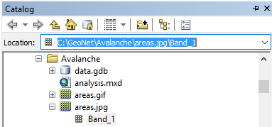
(not a good a example, but it explains what I mean)
- Mark as New
- Bookmark
- Subscribe
- Mute
- Subscribe to RSS Feed
- Permalink
- Report Inappropriate Content
Hi Justin,
I've come across situations when the names of bands were Layer_1, Layer_2, etc., it does not always have to be Band_1, Band_2, etc.
Perhaps try to list the individual bands programmatically as shown here:
The main idea is to set your main raster dataset as a workspace and then use arcpy.ListRasters() function.
Filip.