Turn on suggestions
Auto-suggest helps you quickly narrow down your search results by suggesting possible matches as you type.
Cancel
- Home
- :
- All Communities
- :
- Products
- :
- ArcGIS Online
- :
- ArcGIS Online Questions
- :
- ArcGIS Online drive-time analysis [walk distance]
Options
- Subscribe to RSS Feed
- Mark Topic as New
- Mark Topic as Read
- Float this Topic for Current User
- Bookmark
- Subscribe
- Mute
- Printer Friendly Page
ArcGIS Online drive-time analysis [walk distance]
Subscribe
944
0
08-29-2017 06:41 AM
08-29-2017
06:41 AM
- Mark as New
- Bookmark
- Subscribe
- Mute
- Subscribe to RSS Feed
- Permalink
- Report Inappropriate Content
Hello,
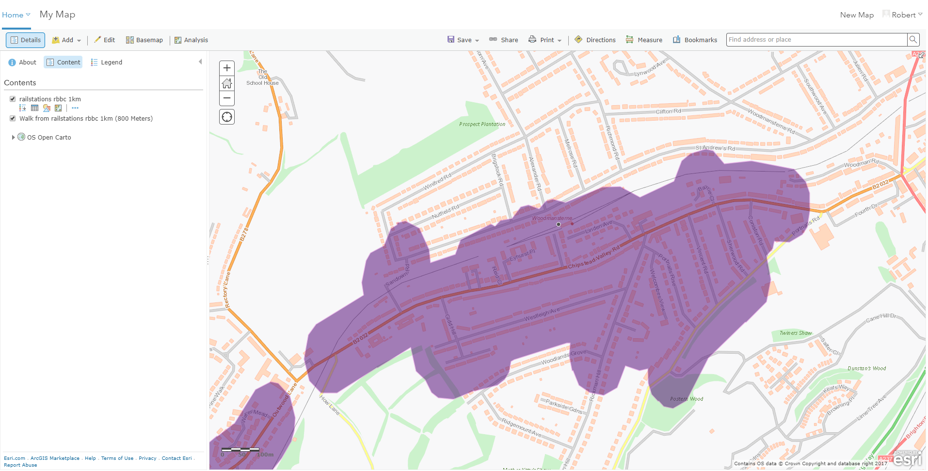
Im using the walk-time analysis tool in ArcGIS Online. This is producing walking distance maps (800m) from railway station points. However, it would appear not to be using a network that includes paths, or pedestrian bridges (see attached example that fails to consider walkers using the pedestrian bridge over the railway).

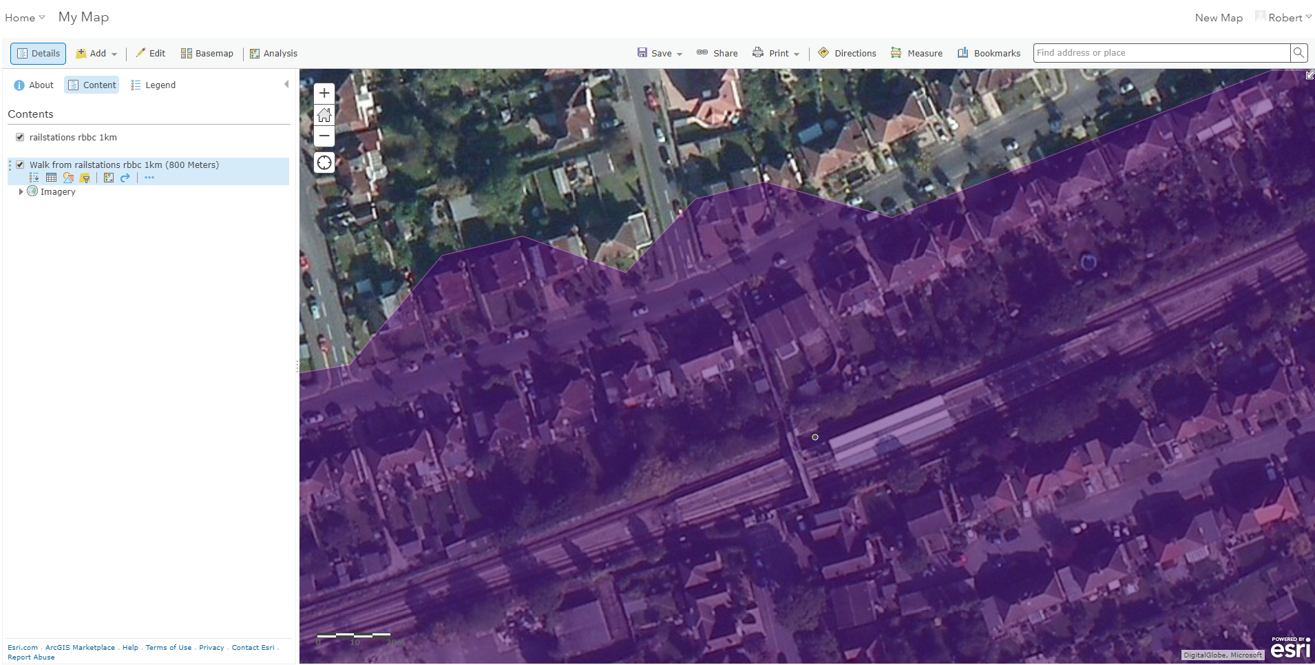
Please can anyone confirm the network being used, or suggest how i can view it, modify it or speak to its administrator? It would appear as though only the road network is being used, not a dedicated path+road network.
Any advice on producing something more reliable in arcgis online?
Thanks, Robert
0 Replies