- Home
- :
- All Communities
- :
- Products
- :
- ArcGIS Pro
- :
- ArcGIS Pro Questions
- :
- Georeference the Satellite Imagery for a three ban...
- Subscribe to RSS Feed
- Mark Topic as New
- Mark Topic as Read
- Float this Topic for Current User
- Bookmark
- Subscribe
- Mute
- Printer Friendly Page
Georeference the Satellite Imagery for a three band raster imagery to get less than one meter accuracy
- Mark as New
- Bookmark
- Subscribe
- Mute
- Subscribe to RSS Feed
- Permalink
- Report Inappropriate Content
Dear Esri,
Is it possible to get one meter or less than one meter accuracy for the data when I Georeference the Satellite Imagery for a three band raster imagery?
What is the best recommended method to do Georeferencing to achieve one meter or less than one meter accuracy for the data.
How can the Auto Georeference Tool work for a three band raster imagery - In which I would like to get one meter or less than one meter accuracy for the data.
Note: Cell size is 1mt.
- Mark as New
- Bookmark
- Subscribe
- Mute
- Subscribe to RSS Feed
- Permalink
- Report Inappropriate Content
Does your imagery have sub-meter cell size?
Do you have sub-meter control points to reference the image to?
What type of image? has anything be done to it in terms of pre-processing?
- Mark as New
- Bookmark
- Subscribe
- Mute
- Subscribe to RSS Feed
- Permalink
- Report Inappropriate Content
Hello Patterson,
I didnt understand regarding the sub-meter cell size for my Imagery.
We dont have sub-meter control points to reference the image. Instead we are using Esri BaseMap-World Imagery for Georeferencing the Satellite Image. And more over our image is a ortho rectified product.
We have taken Indian Satellite Imagery - Cartosat-2 with 1m resolution.....
Pre-Processing is not required for our Imagery.
- Mark as New
- Bookmark
- Subscribe
- Mute
- Subscribe to RSS Feed
- Permalink
- Report Inappropriate Content
Your imagery will only be referenced, at best, to the accuracy of what you are trying to tie it to. Given your images are 1m cell size, then you can probably expect to get a resolution in the order of a couple of meters. The more accurate your control points the better your final product will be
- Mark as New
- Bookmark
- Subscribe
- Mute
- Subscribe to RSS Feed
- Permalink
- Report Inappropriate Content
Hi Janaki,
I guess Cartosat-2 PAN image is your reference image based on which you want to georeference the Multispectral image.
What is the Multispectral Image that you have? Ideally, the best resolution you can get is "Half the pixel size (spatial resolution)" of the Multispectral image. But Practically, it might not be that accurate.
e.g.: If you use LISS IV MSS data (Resolution=5.8 meters), the best accuracy would be 3 meters (approx.).
Think Location
- Mark as New
- Bookmark
- Subscribe
- Mute
- Subscribe to RSS Feed
- Permalink
- Report Inappropriate Content
Hi Jayant Poddar,
I have both Cartosat-2 PAN image and LISS IV MSS data (Resolution=5.8 meters).
I am trying to Georeference the Cartosat-2 PAN image as it has a deviation from Esri World Imagery Base Map. We are using Esri World Imagery Base Map as a reference.
With the help of Cartosat-2 PAN image, I would like to georefernce LISS IV MSS data.
As Cartosat-2 PAN image is of 1mt resolution, We are expecting to get an accuracy of 1mt for the same.
- Mark as New
- Bookmark
- Subscribe
- Mute
- Subscribe to RSS Feed
- Permalink
- Report Inappropriate Content
A Digitalglobe Image used in the World Imagery Basemap has a spatial resolution of 0.46 m. What do you think would be accuracy of that image? Have a look at the details of a point in a metropolitan city in India. In other remote areas, the resolution would be coarser.

You cannot expect to get the accuracy of < 1 meters, when the accuracy of your reference imagery is 4.23 meters. Even the projection System is different.
I believe the ortho-rectified images of both Cartosat PAN and LISS IV MSS (as provided by NRSC) are far more accurate than we can do manually using Georeferencing.
Think Location
- Mark as New
- Bookmark
- Subscribe
- Mute
- Subscribe to RSS Feed
- Permalink
- Report Inappropriate Content
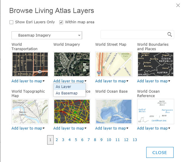
One can get the date, resolution and accuracy of the DigitalGlobe imagery in ArcGIS Online. Just add the world imagery as a layer (not basemap), then click on map and popup will provide date and accuracy details of the tiled basemap imagery.

