- Home
- :
- All Communities
- :
- Products
- :
- ArcGIS Survey123
- :
- ArcGIS Survey123 Questions
- :
- Passing location data to Survey123
- Subscribe to RSS Feed
- Mark Topic as New
- Mark Topic as Read
- Float this Topic for Current User
- Bookmark
- Subscribe
- Mute
- Printer Friendly Page
- Mark as New
- Bookmark
- Subscribe
- Mute
- Subscribe to RSS Feed
- Permalink
- Report Inappropriate Content
We are planning a workflow for the collection of attribute information for assets, and we are looking at using Collector and Survey123, along with a point feature class of known locations for these assets.
We need our assets to have exact coordinates, so we are collecting them with a sub-centimeter GPS system. We want to then send someone out with an iPad with Collector and Survey123 to collect all the attributes for these assets.
Is it possible to just update attribute fields for these feature classes, without creating a new point?
Or, will I have to pass a unique ID, and join it up with the existing points after the fact, and delete the points generated by Survey123?
Solved! Go to Solution.
Accepted Solutions
- Mark as New
- Bookmark
- Subscribe
- Mute
- Subscribe to RSS Feed
- Permalink
- Report Inappropriate Content
I guess there would be the need to know a few things about the schema of the database you are attempting to update?
Will the schema contain related table or repeats as they are known with Survey123?
How many attributes do you want to update?
How large is the Unique ID for each of the points that you want to update the attributes of?
If you do not have related tables, then you might be able to to do the following and keep in mind this is a composite of some of the posts that I have read over the past couple of weeks and that you will need a LIVE connection?
- publish your previously collected data to ArcGIS Online and make sure the item (table or feature class) is the first one listed,
- then open Survey123 Connect, Sign into your account through Survey123 connect,
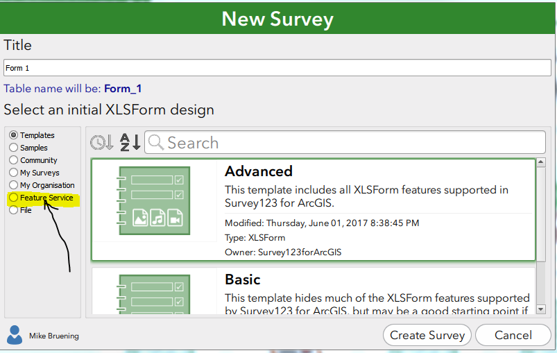
- then select the "Create from Feature Class" (see first screenshot),
- select the Hosted Feature Service that contains your data,
- allow the form to be created and make sure that everything has come across as the questions you want your users to see,
- then go into the "settings" tab of the excel form that was created and create an instance name that contains the "Unique ID" field,
- save the excel spreadsheet and wait for your form to update
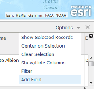
- within Survey123 Connect, click on the "Setting" button, then click on the "Inbox", then change the "Disabled" to "Enabled" and apply a spatial filter which should allow you to set an area of the data you want returned (second screenshot).
- you should be able to repost your survey with the updated settings
- Then have your field crews open up Survey123, download the new form,
- They will have to go into the "Inbox" and attempt to query the asset that is within their area with the spatial filter and then look for the Correct Unique ID within the report headings that are retruned
- Open that survey to edit
- Edit the attributes
- Close and submit the form.
This is all theory based on the blog postings and Survey123 help that I have read over the past couple of weeks. I have not implemented this, but I do think this would be the correct manner in which to accomplish what you are attempting to do.
JTedrick-esristaff do you agree with this. I do not want to lead Eric down the wrong path. Thanks!
first screenshot
second screenshot

- Mark as New
- Bookmark
- Subscribe
- Mute
- Subscribe to RSS Feed
- Permalink
- Report Inappropriate Content
I would take a look at what I posted within the follow blog site. If you have not collected your assets previously and are creating them from scratch, then you'll be able to apply this directly as your workflow. Just keep in mind after reading the blog, that the data from the collector app setup will not be used, but instead the location data from the survey123 hosted feature service will.
If you have already collected some of your assets, then you could complete a search within the Survey123 blog site for a topic of working with existing feature services to learn how to connect to an existing feature service and use this blog site.
You may need to add fields; high accuracy data fields from the blog, to the existing assets point layer from within the ArcGIS Online Map viewer table viewer
We are currently using this setup to collect sub-centimeter to sub-meter GPS data depending on the project needs.
Good luck!
Mike
- Mark as New
- Bookmark
- Subscribe
- Mute
- Subscribe to RSS Feed
- Permalink
- Report Inappropriate Content
Hi Mike,
Thanks for your response!
I think I might have worded my post a little bit ambiguously. We have captured all the location data on a completely separate system (a Leica GNSS receiver and controller), and we won't be using Collector, Survey123, or our iPad to capture any location data.
What I want to do is update attributes using Survey123, so that people doing inspections can pull up the point in Collector, open the form in Survey123, and update the attributes.
Do you know if something like this is possible?
- Mark as New
- Bookmark
- Subscribe
- Mute
- Subscribe to RSS Feed
- Permalink
- Report Inappropriate Content
I guess there would be the need to know a few things about the schema of the database you are attempting to update?
Will the schema contain related table or repeats as they are known with Survey123?
How many attributes do you want to update?
How large is the Unique ID for each of the points that you want to update the attributes of?
If you do not have related tables, then you might be able to to do the following and keep in mind this is a composite of some of the posts that I have read over the past couple of weeks and that you will need a LIVE connection?
- publish your previously collected data to ArcGIS Online and make sure the item (table or feature class) is the first one listed,
- then open Survey123 Connect, Sign into your account through Survey123 connect,
- then select the "Create from Feature Class" (see first screenshot),
- select the Hosted Feature Service that contains your data,
- allow the form to be created and make sure that everything has come across as the questions you want your users to see,
- then go into the "settings" tab of the excel form that was created and create an instance name that contains the "Unique ID" field,
- save the excel spreadsheet and wait for your form to update
- within Survey123 Connect, click on the "Setting" button, then click on the "Inbox", then change the "Disabled" to "Enabled" and apply a spatial filter which should allow you to set an area of the data you want returned (second screenshot).
- you should be able to repost your survey with the updated settings
- Then have your field crews open up Survey123, download the new form,
- They will have to go into the "Inbox" and attempt to query the asset that is within their area with the spatial filter and then look for the Correct Unique ID within the report headings that are retruned
- Open that survey to edit
- Edit the attributes
- Close and submit the form.
This is all theory based on the blog postings and Survey123 help that I have read over the past couple of weeks. I have not implemented this, but I do think this would be the correct manner in which to accomplish what you are attempting to do.
JTedrick-esristaff do you agree with this. I do not want to lead Eric down the wrong path. Thanks!
first screenshot
second screenshot
- Mark as New
- Bookmark
- Subscribe
- Mute
- Subscribe to RSS Feed
- Permalink
- Report Inappropriate Content
This looks like it's working on my end. Thanks for your help!
One last thing... Do you know if there is a way to call the Inbox survey form directly from the Collector app?
- Mark as New
- Bookmark
- Subscribe
- Mute
- Subscribe to RSS Feed
- Permalink
- Report Inappropriate Content
Hi Eric,
Currently we don't have a way to call the Inbox using the app url parameters.
- Mark as New
- Bookmark
- Subscribe
- Mute
- Subscribe to RSS Feed
- Permalink
- Report Inappropriate Content
James Tedrick "Currently we don't have a way to call the Inbox using the app url parameters." --> is this still the case currently? thank you so much!
- Mark as New
- Bookmark
- Subscribe
- Mute
- Subscribe to RSS Feed
- Permalink
- Report Inappropriate Content
Hi Jenny,
Yes, this is still the case, currently it is not possible to use app url parameters with the Inbox to edit an existing feature. This is something we are working on and hope to support in the future.
Phil.
- Mark as New
- Bookmark
- Subscribe
- Mute
- Subscribe to RSS Feed
- Permalink
- Report Inappropriate Content
much appreciated Phil!
- Mark as New
- Bookmark
- Subscribe
- Mute
- Subscribe to RSS Feed
- Permalink
- Report Inappropriate Content
Hi Eric, Mike,
I believe that Mike has the general procedure correct- if Survey123 is going to edit the feature class that already has captured points, it can be done through the Inbox functionality. One aspect I would mention is that you should include the geopoint question but set it read-only so that the point location is preserved (if omitted, Survey123 will attempt to capture a point automatically based on the phone's location).