- Home
- :
- All Communities
- :
- Industries
- :
- Gas and Pipeline
- :
- Gas and Pipeline Questions
- :
- My features do not draw at 1:10 and lower
- Subscribe to RSS Feed
- Mark Topic as New
- Mark Topic as Read
- Float this Topic for Current User
- Bookmark
- Subscribe
- Mute
- Printer Friendly Page
My features do not draw at 1:10 and lower
- Mark as New
- Bookmark
- Subscribe
- Mute
- Subscribe to RSS Feed
- Permalink
- Report Inappropriate Content
I recently transitioned to 10.5, and now when I zoom in beyond 1:12.5, my features do not display. I'm trying to pinpoint minor gaps in my polyline feature class that have somehow made their way into my features, despite using snapping.
- Mark as New
- Bookmark
- Subscribe
- Mute
- Subscribe to RSS Feed
- Permalink
- Report Inappropriate Content
I'm not sure why your features are disappearing at large scales, but you might want to look at the sticky move tolerance in the editor options. It keeps things from moving around when selecting features.
Summit County, Utah
- Mark as New
- Bookmark
- Subscribe
- Mute
- Subscribe to RSS Feed
- Permalink
- Report Inappropriate Content
You may have already considered this, but just wanted to suggest using Topology as a way to find the gaps instead of manual viewing, as Topology will rapidly find the issues. I would suggest using the Topology Line Rule "Must Not Have Dangles (scroll down in the link to see line rules):
Geodatabase topology rules and topology error fixes—Help | ArcGIS Desktop
Also, when one zooms in to around 1:1 when looking for gaps manually there can be visual artifacts that can make it appear that there is an gap when there is not, which makes reviewing difficult. This is a known limitation of the software. ESRI Customer support did say last year that future versions of ArcGIS might end up with a built-in limit to how far in one could zoom so people wouldn't go past the limit for the software. I don't know if this might be where they put that limit into place?
Chris Donohue, GISP
- Mark as New
- Bookmark
- Subscribe
- Mute
- Subscribe to RSS Feed
- Permalink
- Report Inappropriate Content
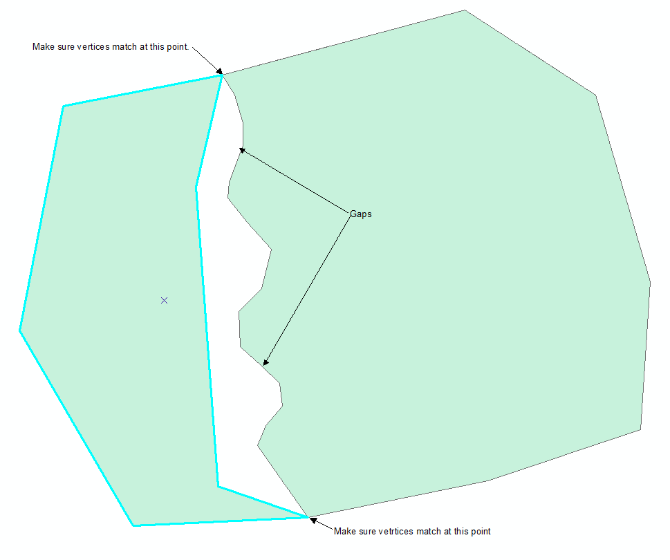
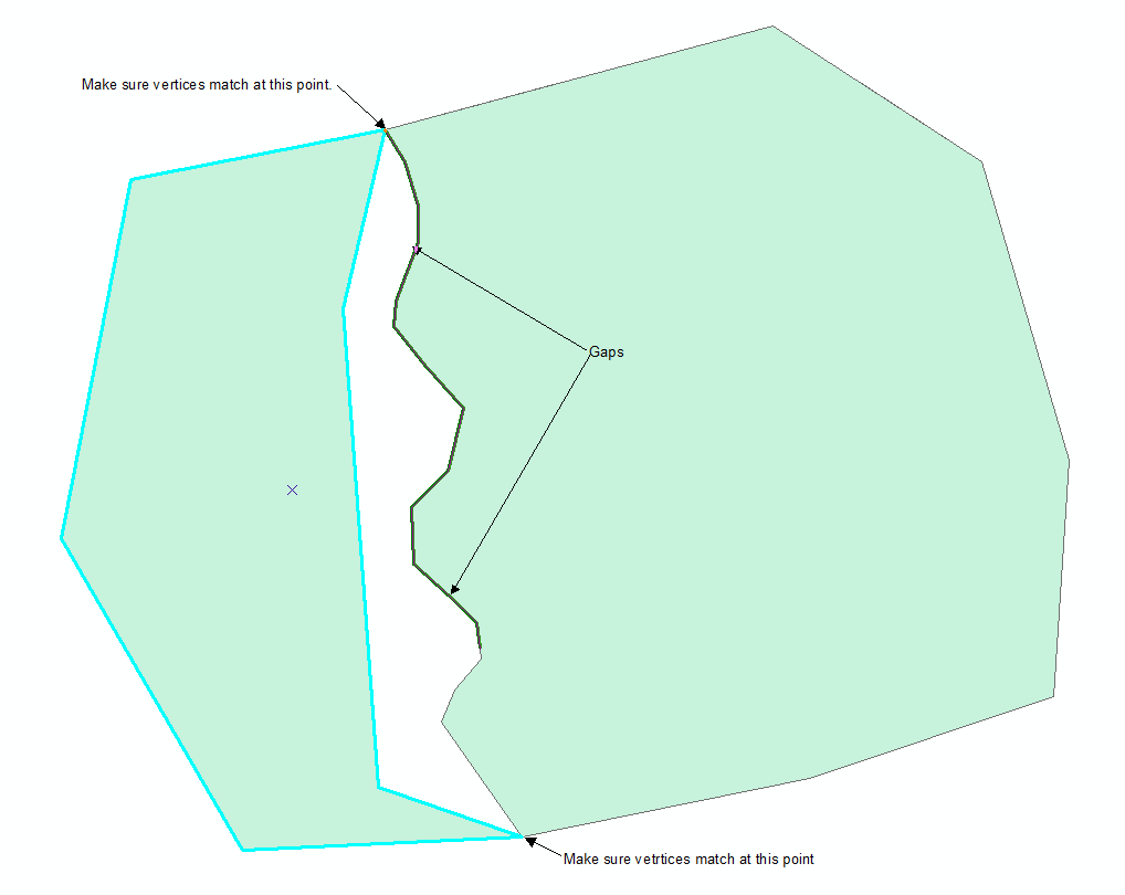
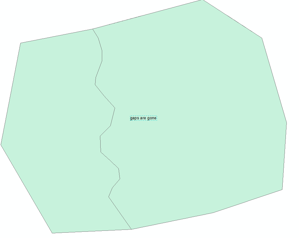
I also would recommend using a different method of fixing the gaps instead of zooming in to each vertex and moving the individual vertices to match the other polygon. I make sure the two polygons match where they begin intersecting, then I reshape one of them to take out the offending border with the other polygon, then I reshape it again using the trace tool to follow the other polygon thus making the boundary the same.
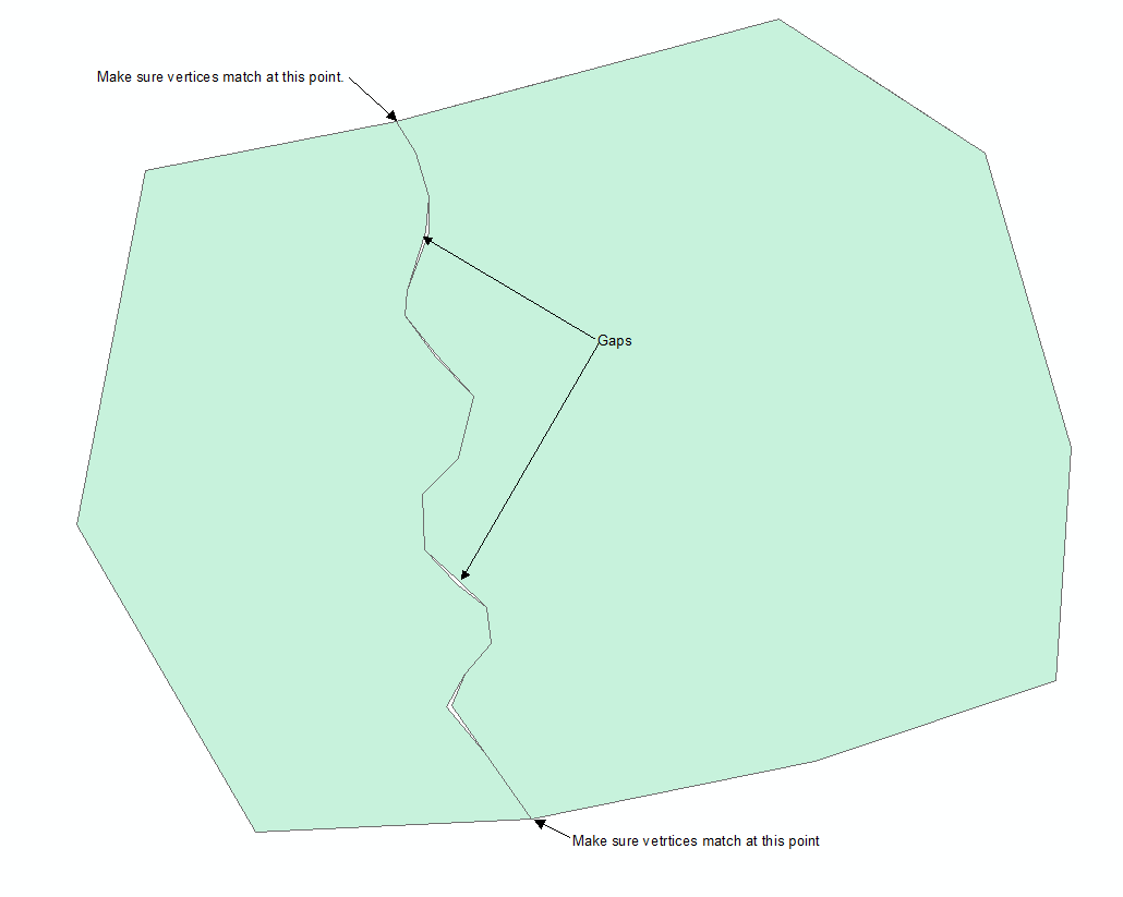
Use the reshape tool to modify one of the polygons:
Use the reshape tool and the trace tool to follow the boundary of the other polygon:
There used to be something called the "zipper tool" that would use a distance tolerance to make the boundary coincident. I don't know if that is still around or not, but I think this method gets a cleaner result.
There is the Align to Shape tool on the advanced editing toolbar - this is the old zipper tool. I haven't used this much, I think it is better if you have a separate feature class to use to trace for the common boundary. I actually just tried this tool with a few scenarios and I found it difficult to make the trace tool follow just one of the boundaries. I find it easier to get one of the boundaries out of the picture altogether by using the method described above.
Hope that helps.
Jeff
Summit County, Utah