- Home
- :
- All Communities
- :
- Products
- :
- ArcGIS Pro
- :
- ArcGIS Pro Questions
- :
- Can .TIF be converted to DTM or DSM
- Subscribe to RSS Feed
- Mark Topic as New
- Mark Topic as Read
- Float this Topic for Current User
- Bookmark
- Subscribe
- Mute
- Printer Friendly Page
Can .TIF be converted to DTM or DSM
- Mark as New
- Bookmark
- Subscribe
- Mute
- Subscribe to RSS Feed
- Permalink
- Report Inappropriate Content
Hi all,
I want to apply this example of Calculating Solar Radiation to my work:
Explore Solar Radiation | ArcGIS for Local Government
In the requirements of Calculate Solar Radiation Rasters task (see image 1), I have to "Enter the surface model you wish to include in the analysis. This can be a bare earth DTM or a DSM" in the Surface Model field. (see image 2).
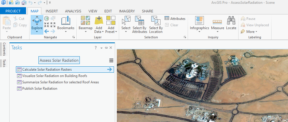
(image 1)
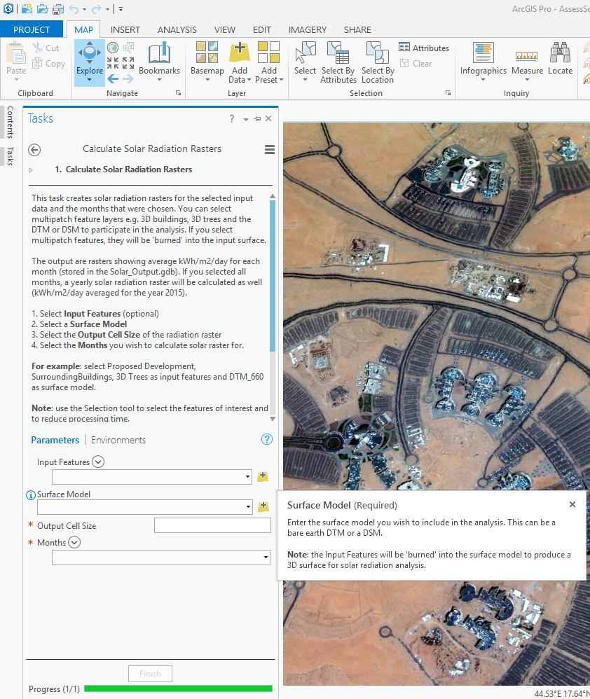
(image 2)
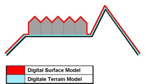
From the internet, DEM is most of the time used as a generic term for DSMs and DTMs. This image on Wikipedia depicts the differences between DSMs and DTMs well:
Now, I ONLY have a (.TIF) image for my project. This image was taken by a satellite with very excellent resolution.
I suffered a lot of problem in running this example to my work as I don't have DSM or DTM for my work's area. I reach to this point after several investigation.
The question:
Is there anyway to either convert my high resolution TIF image to DSM or DTM, or any alternative solution?
Note: There is not Lidar data or image for my work's area.
- Mark as New
- Bookmark
- Subscribe
- Mute
- Subscribe to RSS Feed
- Permalink
- Report Inappropriate Content
If the tif is just a high res picture, it will lack elevations, therefore, it will be of little use. You will notice that they mention multipatch features and 3d trees... these have an elevation associated with them. So short of finding a DEM and producing 3d features to represent your buildings etc, I don't see what else you can do.
- Mark as New
- Bookmark
- Subscribe
- Mute
- Subscribe to RSS Feed
- Permalink
- Report Inappropriate Content
Dear Dan Patterson
Thank you for your reply.
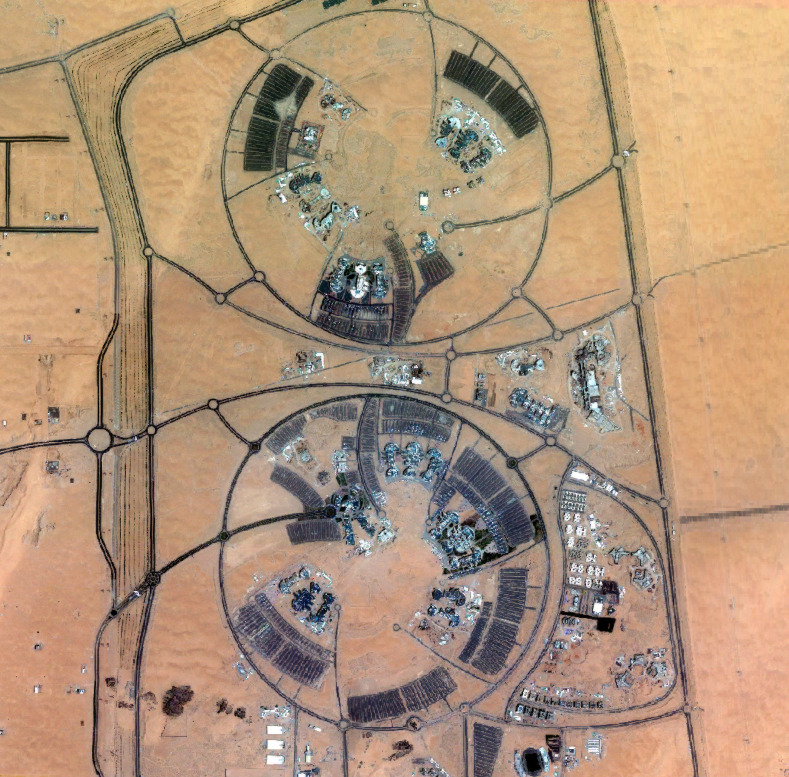
Actually, the TIF image looks like with elevation when I add the TIF layer to the "Scene" 3D. See how is it showing:
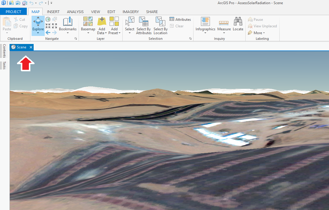
Do you think can I get some how to change the TIF to DSM or DTM?
You can download the TIF layer which is compressed in this folder:
university-najran.7z - Google Drive
Thanks!